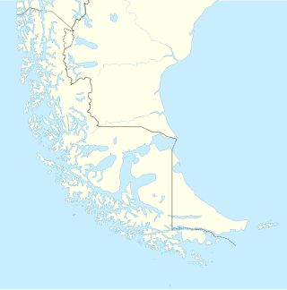
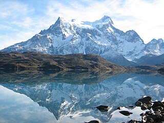
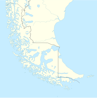
8 Sights in Torres del Paine, Chile (with Map and Images)
Legend
Welcome to your journey through the most beautiful sights in Torres del Paine, Chile! Whether you want to discover the city's historical treasures or experience its modern highlights, you'll find everything your heart desires here. Be inspired by our selection and plan your unforgettable adventure in Torres del Paine. Dive into the diversity of this fascinating city and discover everything it has to offer.
1. Torres del Paine National Park
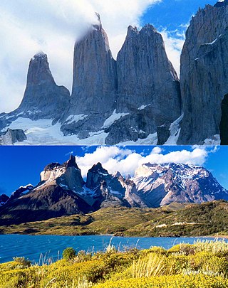
Torres del Paine National Park is a national park encompassing mountains, glaciers, lakes, and rivers in southern Chilean Patagonia. The Cordillera del Paine is the centerpiece of the park. It lies in a transition area between the Magellanic subpolar forests and the Patagonian Steppes. The park is located 112 km (70 mi) north of Puerto Natales and 312 km (194 mi) north of Punta Arenas. The park borders Bernardo O'Higgins National Park to the west and the Los Glaciares National Park to the north in Argentine territory. Paine means "blue" in the native Tehuelche (Aonikenk) language and is pronounced PIE-neh. It was established as a National Park in 1959.
2. Cordillera Paine
The Cordillera Paine is a mountain group in Torres del Paine National Park in Chilean Patagonia. The cordillera is located 280 km (170 mi) north of Punta Arenas, and about 1,960 km (1,220 mi) south of the Chilean capital Santiago. It belongs to the Commune of Torres del Paine in Última Esperanza Province of Magallanes and Antártica Chilena Region. No accurate surveys have been published, and published elevations have been claimed to be seriously inflated, so most of the elevations given on this page are approximate. Paine means "blue" in the native Tehuelche (Aonikenk) language and is pronounced PIE-nay.
3. Salto Grande
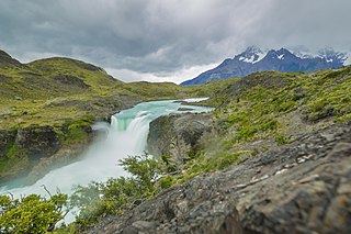
The Salto Grande is a waterfall on the Paine River, after the Nordenskjöld Lake, within the Torres del Paine National Park in Chile. In the vicinity of Salto Grande are a variety of natural vegetation forms as well as certain wildlife species, including the wild guanaco.
4. Cerro Falso Stokes
Mount Stokes or Falso Stokes is a mountain in the eastern foothills of the Andes mountain range in Patagonia, located on the eastern edge of the Southern Patagonian Ice Field, on the border between Argentina and Chile. On the Argentine side, the hill is located in the vicinity of Los Glaciares National Park, in the province of Santa Cruz, which was declared a World Heritage Site by UNESCO in 1981. On the Chilean side, it has been part of the Torres del Paine National Park in the Magallanes and Chilean Antarctic region since 1959, declared a biosphere reserve by UNESCO in 1978.
5. Cerro Daudet
Cerro Daudet is a mountain of the foothills of the East of the Andes mountain range in Patagonia, located on the eastern edge of the South Patagonian ice field, on the border between Argentina and Chile. On the Argentine side, the hill is in the vicinity of the Los Glaciares National Park in the province of Santa Cruz, which was declared a World Heritage by UNESCO in 1981. On the Chilean side since 1959 of the Torres del Paine National Park of the Paine Chilean Magallanes and Antarctic Region, declared Biosphere Reserve by UNESCO in 1978.
6. Cerro Paine Grande
Mount Paine Grande is a mountain belonging to the Andes mountain range located in the Chilean region Magallanes and Chilean Antarctica. It is part of the so-called Paine Massif, being the highest summit of this with its 2845 m a.s.l.
7. Cerro Cubo
Cerro Cubo is a mountain on the border between Argentina and Chile in the southern Patagonian ice field, has an altitude of 2073 meters above sea level and is located south of Cerro Comandante Piedra Buena.
8. Cerro Ohnet
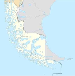
Mount Ohnet is a mountain in Chile that is located in the Torres del Paine National Park in the commune of Torres del Paine, province of Última Esperanza in the region of Magallanes and Chilean Antarctica, in the southern part of the country, 1900 km south of Santiago, the capital of the country. The hill is located at 1428 meters above sea level.
Share
How likely are you to recommend us?
Disclaimer Please be aware of your surroundings and do not enter private property. We are not liable for any damages that occur during the tours.
