8 Sights in Schönau am Königssee, Germany (with Map and Images)
Legend
Welcome to your journey through the most beautiful sights in Schönau am Königssee, Germany! Whether you want to discover the city's historical treasures or experience its modern highlights, you'll find everything your heart desires here. Be inspired by our selection and plan your unforgettable adventure in Schönau am Königssee. Dive into the diversity of this fascinating city and discover everything it has to offer.
1. Fischunkelalm
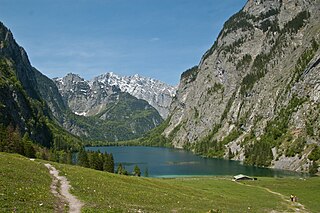
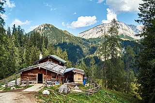
The Fischunkelalm is an alpine pasture in Schönau am Königssee in the Berchtesgaden National Park in the south of the Bavarian district of Berchtesgadener Land. The Alm is located on the Obersee, southeast of the Königssee. The managed Kaser is a listed building and is a popular tourist destination.
2. St. Bartholomä
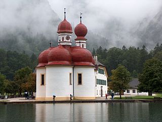
St. Bartholomew's is a Roman Catholic pilgrimage church in the Berchtesgadener Land district of Bavaria in Germany. It is named after Saint Bartholomew the Apostle, patron of alpine farmers and dairymen. The church is located at the western shore of the Königssee lake, on the Hirschau peninsula. It can only be reached by ship or after a long hike across the surrounding mountains. A first chapel at the lake was built in 1134 by the Provosts of Berchtesgaden. In 1697, it was rebuilt in a Baroque style with a floor plan modeled on Salzburg Cathedral, two onion domes and a red domed roof. The church features stucco work by the Salzburg artist Joseph Schmidt and a three-apse choir. The altars in the apses are consecrated to Saint Bartholomew, Saint Catherine, and Saint James respectively.
3. Röthbachfall
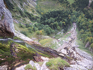
The Röthbachfall is the highest waterfall in Germany, with a vertical drop of 470 metres (1540 ft). The waterfall is located in the Berchtesgaden area on the Obersee lake. One way to visit the waterfall is to take the electric boat across lake Königssee to Salet and then to hike up to the Obersee. This remote location has led to the erroneous claim that the highest waterfall in Germany is the more accessible Triberg Waterfall even though Triberg has a drop of only 163 metres.
4. Schultessteine
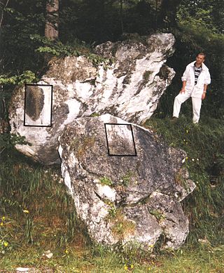
Near the forest chapel of St. Johann and Paul at the bed of the Eisgraben at Königssee lie two large boulders. They were provided with two memorial plaques by the botanist Joseph August Schultes, which is why they are called "Schultessteine" today. The Schultessteine are a popular resting place on hikes around the Königssee.
5. Stuhljoch
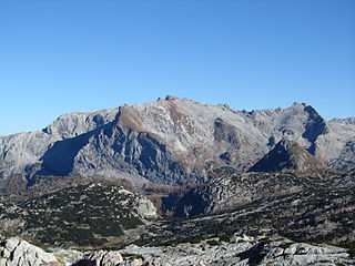
The Funtenseetauern is a 2,579 m high border peak between Germany and Austria on the northern edge of the Steinernes Meer, one of the nine massifs of the Berchtesgaden Alps. The Funtenseetauern rises south of Berchtesgaden, its broad shoulder towering over the lakes of Königssee and Obersee. To the northwest of the Funtenseetauern and linked to it by a ridge is the Stuhljoch (2,448 m), whose Stuhlwand rock face drops steeply into the bowl of the Funtensee.
6. Jenner
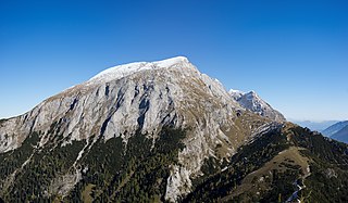
The Jenner is a mountain in Bavaria, Germany. It is part of the Göll massif within the Berchtesgaden Alps. Its summit, accessible from Schönau by cable car (Jennerbahn) since 1953, offers panoramic views to the Watzmann range and the Königssee below.
7. Hohes Brett
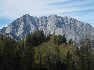
The Hohes Brett is a mountain, 2,340 m (7,680 ft) above sea level according to the German system or 2,338 m (7,671 ft) according to the Austrian system, in the Göll massif of the Berchtesgaden Alps. The border between Germany (Bavaria) and Austria (Salzburg) runs across its peak. Its name, meaning "High Plank" in German, refers to the flat, rocky plateau near the summit which offers panoramic views of the surrounding areas including the Watzmann's east face, the Hagen Mountains and the Steinernes Meer. For a mountain of its height it is easy to scale and thus sees a lot of visitors.
8. Halsköpfl
The Halsköpfl is a 1719 m high peak and forms the last elevation in the northern foothills of the Funtenseetauern in the Berchtesgaden Alps. From it there is a view over the Königssee, the Watzmann, the Teufelshörnern and the Götzenberge mountains that is worth seeing. The small viewing platform can be reached via trail 416, which leads, among other things, from the Kärlingerhaus via the Wasseralm to the Gotzenalm. Alternatively, a direct ascent via the Sagerecksteig from the Saletalm is possible. The Halsköpfl breaks off with over 1100 meters of altitude almost perpendicular to the Obersee.
Share
How likely are you to recommend us?
Disclaimer Please be aware of your surroundings and do not enter private property. We are not liable for any damages that occur during the tours.
