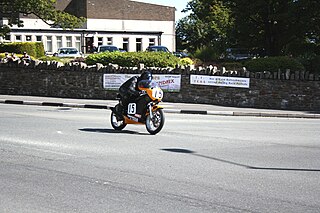
13 Sights in Douglas, Isle of Man (with Map and Images)
Legend
Welcome to your journey through the most beautiful sights in Douglas, Isle of Man! Whether you want to discover the city's historical treasures or experience its modern highlights, you'll find everything your heart desires here. Be inspired by our selection and plan your unforgettable adventure in Douglas. Dive into the diversity of this fascinating city and discover everything it has to offer.
Sightseeing Tours in Douglas1. Tynwald

Tynwald, or more formally, the High Court of Tynwald or Tynwald Court, is the legislature of the Isle of Man. It consists of two chambers, known as the branches of Tynwald: the directly elected House of Keys and the indirectly chosen Legislative Council. When the two chambers sit together, they become "Tynwald Court".
2. Jubilee Clock
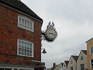
Jubilee clock is a term used in reference to a number of clocks constructed and erected throughout the British Empire in commemoration of the Golden or Diamond Jubilee of various British monarchs, most commonly, Queen Victoria's.
3. Villa Gaiety
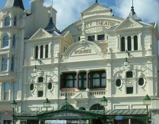
The Gaiety Theatre and Opera House is a theatre in Douglas, Isle of Man which together with the Villa Marina forms the VillaGaiety complex. The Gaiety is situated on Douglas promenade, overlooking the sea and adjacent to the Villa Gardens, Arcade and Butts.
Wikipedia: Gaiety Theatre, Isle of Man (EN), Website, Url Registered_building
4. The Church of Jesus Christ of Latter-day Saints
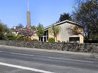
The Church of Jesus Christ of Latter-day Saints in the Isle of Man refers to the Church of Jesus Christ of Latter-day Saints and its members in the Isle of Man. As of 31 December 2022, The Church of Jesus Christ of Latter-day Saints reported 281 members in one congregation, the Douglas Ward, in the Isle of Man. In 2019, the Isle of Man had the 2nd most LDS Church members per capita in Europe, behind Portugal. Despite their small numbers, Manx Mormons have a heritage going back over a hundred and fifty years, which is obscured by their tendency to emigrate to the US and by the LDS Church administering the Isle of Man as part of England, when it is not actually part of the United Kingdom.
Wikipedia: The Church of Jesus Christ of Latter-day Saints in the Isle of Man (EN), Facebook
5. Villa Marina
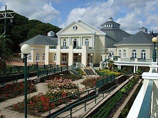
The Villa Marina is an entertainment venue in Douglas, Isle of Man, which forms part of the wider Villa-Gaiety complex. It is located on Harris Promenade, looking out onto Douglas Bay, and comprises the Royal Hall, Broadway Cinema, Promenade Suite, Colonnade Suite, Dragon's Castle and the Villa Marina Gardens. The architect was Alban Jones, whose design was chosen in an open competition judged by Professor Stanley Adshead of Liverpool University.
6. Grandstand
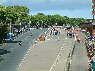
The TT Grandstand including the startline, pit lane, re-fuellers, merchandising, scoreboard and paddocks for the Isle of Man TT and Manx Grand Prix races is situated on the A2 Glencrutchery Road, in the town of Douglas, Isle of Man.
7. Bray Hill
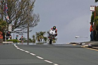
Bray Hill is a road in the Isle of Man. It was formerly a country lane known as the Great Hill during the time of the ownership of the Duke of Atholl, and was previously known as Siberia, originally a triangle-shaped parcel of land in the Murray Estate.
8. Governor's Bridge
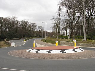
Governor's Bridge is a hairpin bend adjacent to a road junction on the primary A18 Mountain Road in the parish of Onchan in the Isle of Man, with a sudden drop in elevation leading to Governor's Dip, followed by a left-hand bend and finally a right exiting on to the main Glencrutchery Road.
9. Quarterbridge
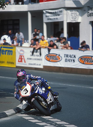
Quarterbridge is situated soon after the 1 mile-marker measured from the TT Grandstand, part of the Snaefell Mountain Course used for the Isle of Man TT races, at the junction of the primary A1 Douglas to Peel road, A2 Douglas to Ramsey road and the A5 Douglas to Port Erin road which forms the boundary between the parishes of Braddan and Onchan in the Isle of Man.
10. Tower of Refuge
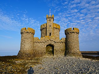
The Tower of Refuge from Shipwreck, referred to as the Tower of Refuge, is a stone-built castellated structure which was erected on St Mary's Isle in Douglas Bay, Isle of Man, in order to afford shelter to mariners wrecked on the rock. The tower was constructed through the endeavours of Sir William Hillary, who had been instrumental in several rescues of sailors stranded on the rock, and which culminated in the heroic rescue of the crew of the Saint George Steam Packet Company steamer RMS St George, when it foundered on the rock in the early hours of 20 November 1830. Sir William personally contributed a high proportion of the costs and secured a substantial number of public contributions for funding the structure.
Wikipedia: Tower of Refuge (EN), Url Imher, Url Registered_building
11. Grand Union Camera Obscura
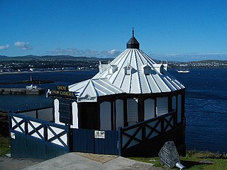
The Grand Union Camera Obscura was built during the 1890s and is located on Douglas Head near the Lighthouse. The building is a tourist attraction that offers a unique view of its surroundings. Using several lenses and mirrors, it reflects a unified, panoramic view of the surrounding area that is split into small digestible scenes and projected onto large white screens within the dark confines of the building. This optical effect is achieved by the apparatus known as camera obscura.
Wikipedia: Grand Union Camera Obscura (EN), Url Registered_building
12. Saint George's
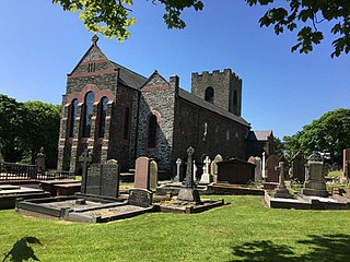
St George's Church is an Anglican church in Douglas, Isle of Man and falls within the Diocese of Sodor and Man. It was formerly one of two worship centres in association with All Saints Church, Douglas.
13. St Ninian's Crossroads
St Ninian's Crossroads is situated between the TT Grandstand and the 1st Milestone road-side marker on the Snaefell Mountain Course on the primary A2 Douglas to Ramsey road in the town of Douglas in the Isle of Man.
Share
Disclaimer Please be aware of your surroundings and do not enter private property. We are not liable for any damages that occur during the tours.
