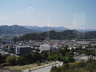
26 Sights in Shizuoka, Japan (with Map and Images)
Legend
Welcome to your journey through the most beautiful sights in Shizuoka, Japan! Whether you want to discover the city's historical treasures or experience its modern highlights, you'll find everything your heart desires here. Be inspired by our selection and plan your unforgettable adventure in Shizuoka. Dive into the diversity of this fascinating city and discover everything it has to offer.
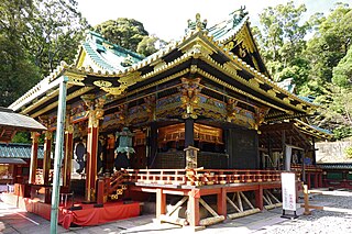
Activities in ShizuokaThe Kunōzan Tōshō-gū (久能山東照宮) is a Shintō shrine in Suruga-ku in the city of Shizuoka in Shizuoka Prefecture, Japan. It is the original burial place of the first shōgun of the Tokugawa shogunate, Tokugawa Ieyasu, and is thus the oldest of the Tōshō-gū shrines in the country. The main festival of the shrine is held annually on April 17, although its spring festival on February 17–18 is a larger event.
Shizuoka Sengen Jinja (静岡浅間神社) is the name for a collective group of three Shinto shrines now forming a single religious corporation, located at Mount Shizuhata in Aoi-ku, Shizuoka, in Shizuoka Prefecture, Japan. These shrines are the Kanbe Jinja (神部神社), Sengen Jinja (浅間神社), and Ōtoshimioya Jinja (大歳御祖神社). The main festival of the shrine is held annually on April 5.
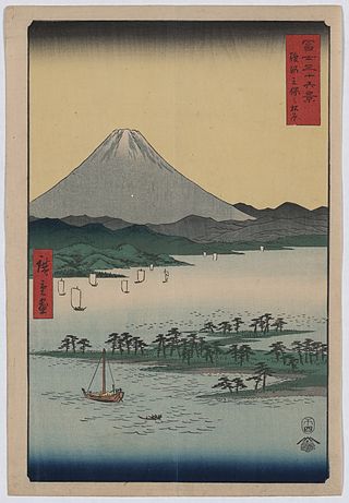
Miho no Matsubara is a scenic area on the Miho Peninsula in Shimizu Ward of Shizuoka City, Japan. Its seven-kilometre seashore is lined with pine trees. It is the location of the legend upon which the Noh drama Hagoromo is based; on the second Saturday and Sunday of October, the city of Shizuoka holds a Hagoromo Festival and a performance of the Noh drama takes place near the pine tree of the legend.
4. 登呂遺跡
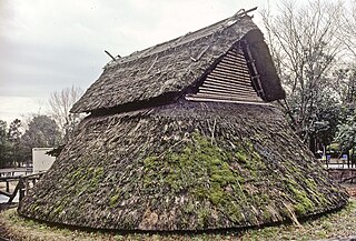
Toro is an archaeological site in Suruga Ward in Shizuoka City, 130 kilometres (81 mi) southwest of Tokyo, Japan. The site contains the ruins of a settlement which dates to the 1st century CE, in the late Yayoi period. Discovered in 1943, it was excavated from 1947 to 1948 and designated a Special Historic Site of Japan in 1952. Toro is also the name of the area surrounding it in the Japanese addressing system.
5. Sunpu Castle Park
Sunpu Castle Park is a park located in Aoi Ward, Shizuoka City, Shizuoka Prefecture, Japan. In 2012 (Heisei 24), the name was changed from Sunpu Park. It is also the name of the town in Aoi Ward, where the park is located.
6. 宝台院
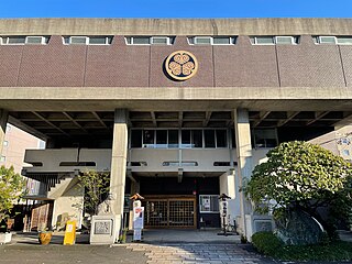
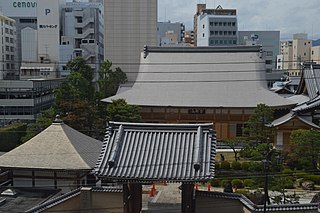
Hōdaiin is a Jōdo sect temple located in the 2nd Chome, Tokiwacho, Aoi Ward, Shizuoka City, Shizuoka Prefecture (formerly Shimo-uo Town). Its mountain name is Komeizan, and its temple name is Ryūsenji. The principal image is Amida Nyorai. It is the family temple of the Tokugawa clan in Sunpu and was granted permission to wear purple robes by Emperor Go-Mizunoo.
7. 靜岡縣護國神社
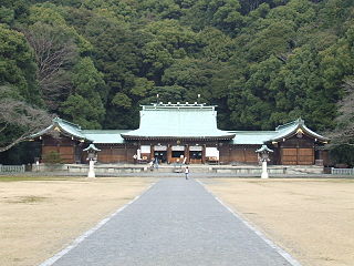
Shizuoka Prefectural Gokoku Shrine is a shrine located in Aoi Ward, Shizuoka City, Shizuoka Prefecture. The sacred crest is "a circle with cherry blossoms." It enshrines over 76,000 war dead and martyrs from Shizuoka Prefecture who were involved in the Meiji Restoration and the Greater East Asia War (Pacific War).
8. Mt. Kamikochi
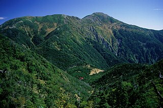
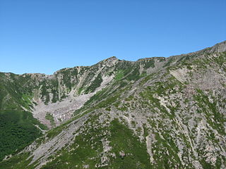
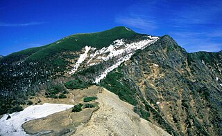
Mt. Kamikawachi is a 2,803 m high mountain located on the border between Aoi Ward, Shizuoka City and Iida City, Nagano Prefecture. It is located in the Minami Alps National Park in the southern part of the Akaishi Mountains and has been selected as one of the 200 famous mountains in Japan.
9. 清水灯台
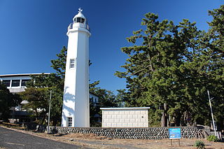
Shimizu Lighthouse is a small white lighthouse located at the eastern end of the Miho Peninsula in Shimizu Ward, Shizuoka City, Shizuoka Prefecture, Japan, and has an octagonal horizontal cross-section. It was the first reinforced concrete lighthouse in Japan. It has a high historical and cultural property value, has been designated as an important cultural property of the country, and has become an A-rank preserved lighthouse, and still retains its appearance at the time of construction. The surrounding area is a scenic spot of the Miho Matsubara (Miho Matsubara), a constituent asset of the World Cultural Heritage Site Mt. Fuji, the nationally designated scenic spot "Miho Matsubara", and the Miho Matsubara Prefectural Natural Park in Japan Taira. It is commonly referred to as Miho Lighthouse, but the official name by the Japan Coast Guard is "Shimizu Lighthouse".
10. Mt. Shiomi
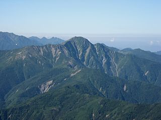
Mt. Shiomi is a mountain located in the centre of the Akaishi Mountains−Southern Alps, within Minami Alps National Park, Japan. It is on the border of Shizuoka and Nagano Prefectures. It is one of the 100 Famous Japanese Mountains.
11. 賤機山古墳
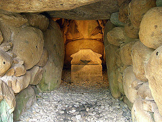
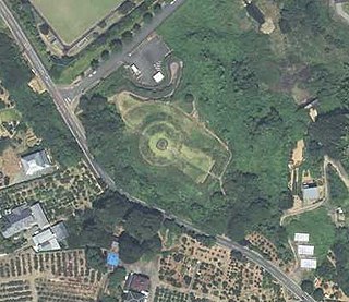
Shizuhatayama Kofun (賤機山古墳) is a dome-shaped kofun burial mound located within the grounds of the Shizuoka Sengen Shrine complex in Aoi-ku, Shizuoka, Japan. in the Tōkai region of Japan. The site was designated a National Historic Site of Japan in 1953.
12. 三峰岳
Mt. Mibu is a 2,999 m high mountain in the Akaishi Mountains (Southern Alps). It is located at the boundary point of the three prefectures of Yamanashi, Nagano, and Shizuoka, and at the same time forms the boundary of the three river systems of the Fuji River, the Tenryu River, and the Oigawa River.
13. Mt. Ryuso
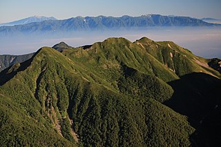
Mt. Ryuzume is a mountain in the Minobu Mountains located in Aoi Ward, Shizuoka City, and has been climbed as a mountain of faith since ancient times. It consists of Yakushidake on the north side and Bunjudake on the south side.
14. Mt. Ohsawa
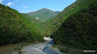
Mt. Ōsawa is a 2,820 m high mountain in the southern part of the Akaishi Mountains (Southern Alps) that straddles Iida City, Nagano Prefecture and Aoi Ward, Shizuoka City, Shizuoka Prefecture. The 55th highest mountain in Japan. The upper part of the mountain area is designated as a special protection area of the Minami-Alps National Park, and the middle of the western face is designated as a special area. The name of the mountain is derived from the fact that it is a mountain at the head of the source of "Osawa", a tributary of the Kitamatazawa River of the Toyama River in the Tenryu River system. In the upper part, high pines are distributed in the alpine zone, and grouse live. In the surrounding mountain area, it has been confirmed that plants are eaten by sika deer and other plants.
15. Mt. Jumai
Jumai-san is a mountain that straddles the southern town of Minami-Kyoma District, Yamanashi Prefecture and Aoi Ward, Shizuoka City, Shizuoka Prefecture, Shizuoka Prefecture. It is a twin-eared peak consisting of the Upper Juppa Mountain at an altitude of 1,726 m and the Lower Juppa Mountain at 1,732 m, but the topographic map of the Geographical Survey Institute of Japan (GSI) refers to the Upper Juppa Mountain as the Ten Upper Peaks.
16. Mt. Eboshi
Mt. Karasuhata is a 2,726 m high mountain in the Akaishi Mountains (Southern Alps) located on the border between Ōka Village, Shimoina District, Nagano Prefecture and Aoi Ward, Shizuoka City, Shizuoka Prefecture.
17. 浜石岳
Mt. Hamaishi is a mountain with an altitude of 707 m located in the northeastern part of Shimizu Ward, Shizuoka City, Shizuoka Prefecture. Another name in the former Yui town at the foot of Higashiyama is Nishiyama.
18. 城北公園
Johoku Park is a city park located at 29 Oiwamoto-cho, Aoi-ku, Shizuoka City, Shizuoka Prefecture, Japan. Opened in April 1985 (Showa 60). 100 best urban parks in Japan. Until 1970 (Showa 45), Shizuoka University was located in this place.
19. 建穂寺
Kenhoji Temple is a temple of the Shingon sect located in Kenho, Aoi Ward, Shizuoka City, Shizuoka Prefecture, Japan. The name of the mountain is Mt. Ruixiang. Suruga Ichikoku 33 Kannon No. 15 Sacred Place.
20. 三池平古墳
Miikedaira Kofun is an ancient burial mound located in Yamakiri-hara, Shimizu-ku, Shizuoka City, Shizuoka Prefecture, Japan. It is a circular mound that is estimated to have been built in the early middle of the Kofun period (early 5th century) and is designated as a historic site in Shizuoka Prefecture.
21. Seikenji
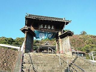
Seiken-ji (清見寺), is a Buddhist temple belonging to the Myōshin-ji branch of the Rinzai school of Japanese Zen, located in the Okitsu neighborhood of Shimizu-ku ward of the city of Shizuoka, Shizuoka, Japan. Its main image is a statue of Shaka Nyōrai. It is also called Kiyomi-dera.
22. 臨済寺
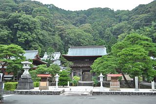
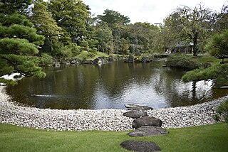
Rinzai-ji , is a Buddhist temple belonging to the Myōshin-ji branch of the Rinzai school of Japanese Zen, Buddhism located in the Aoi ward of the city of Shizuoka, Shizuoka Prefecture, Japan. Its main image is a statue of Amida Nyōrai. It was the bodaiji of the Imagawa clan, a powerful Sengoku period daimyō clan. The temple is noted for its Japanese garden, which is a nationally designated Place of Scenic Beauty; however, the temple is only open to the public for two days each autumn, and it is not possible to view this garden other than during that period.
23. 朝鮮岩
Chosun Rock is a mountain located in Kosaka, Suruga-ku, Shizuoka City, Shizuoka Prefecture, Japan. 320 meters above sea level. Although it is called "rock", there is no such rock, but a small peak on the ridgeline.
24. 真富士山
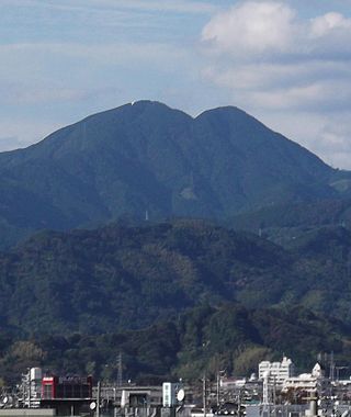
Mt. Mafuji (Mt. Mafuji) is a mountain located on the border between the plains of Aoi Ward, Shizuoka City, Shizuoka Prefecture and Kawachi, Shimizu Ward. There is the first Mt. Fuji and the second Mt. Fuji, the former is 1343 meters and the latter is 1402 meters. The first is the main peak, but the second is higher.
25. Hodaiji
Hōtaiji is a Zen temple of the Rinzai sect Myoshinji located at 12-2 Denmachō, Aoi Ward, Shizuoka City, Shizuoka Prefecture. Its mountain name is Kongōzan, and its principal image is Shakyamuni Buddha.
26. Mt. Shizuhata
Mount Shizuhata is a mountain located in Shizuoka Prefecture, Japan. It has a height of 171 metres (561 ft). The southern half of the mountain is called Mount Asama. It is said to be the origin of "Shizu" in "Shizuoka".
Share
Disclaimer Please be aware of your surroundings and do not enter private property. We are not liable for any damages that occur during the tours.
