40 Sights in Argyll and Bute, United Kingdom (with Map and Images)
Legend
Welcome to your journey through the most beautiful sights in Argyll and Bute, United Kingdom! Whether you want to discover the city's historical treasures or experience its modern highlights, you'll find everything your heart desires here. Be inspired by our selection and plan your unforgettable adventure in Argyll and Bute. Dive into the diversity of this fascinating city and discover everything it has to offer.
1. K Foundation Burn a Million Quid
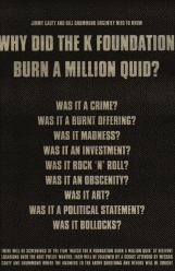
K Foundation Burn a Million Quid was a work of performance art executed and filmed on 23 August 1994 in which the K Foundation, an art duo consisting of Bill Drummond and Jimmy Cauty, burned £1 million in the back of a disused boathouse on the Ardfin Estate on the Scottish island of Jura. The money represented the bulk of the K Foundation's funds that had been previously earned by Drummond and Cauty as the KLF.
2. Laphroaig Distillery

Laphroaig distillery is a single malt Scotch whisky distillery on Islay, Scotland. It is situated on the south coast of the island, near Port Ellen, at the head of a small bay known as Loch Laphroaig. The Lagavulin and Ardbeg distilleries are close by.
3. Fingal's Cave

Fingal's Cave is a sea cave on the uninhabited island of Staffa, in the Inner Hebrides of Scotland, known for its natural acoustics. The National Trust for Scotland owns the cave as part of a national nature reserve. It became known as Fingal's Cave after the eponymous hero of an epic poem by 18th-century Scots poet-historian James Macpherson.
4. Benmore Botanic Garden

Benmore Botanic Garden is a large botanical garden situated in Strath Eachaig at the foot of Beinn Mhòr, on the Cowal Peninsula, in Argyll and Bute, west of Scotland. The gardens are on the west side of the A815 road from Dunoon, between the Holy Loch and Loch Eck, and include footbridges across the River Eachaig. It is one of the sites of Royal Botanic Garden Edinburgh.
5. Mount Stuart Castle

Mount Stuart House, on the east coast of the Isle of Bute, Scotland, is a country house built in the Gothic Revival style and the ancestral home of the Marquesses of Bute. It was designed by Sir Robert Rowand Anderson for the 3rd Marquess in the late 1870s, replacing an earlier house by Alexander McGill, which burnt down in 1877. The house is a Category A listed building.
6. Ben More

Ben More is the highest mountain and only Munro on the Isle of Mull, Scotland. It is also the highest peak in the Scottish isles – and the only Munro – apart from those on the Isle of Skye. The mountain is situated close to the centre of the island, above the shores of Loch na Keal.
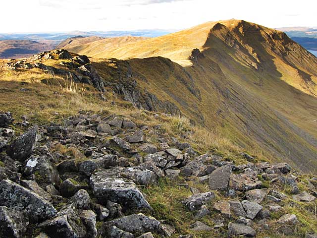
7. Ben Cruachan

Ben Cruachan is a mountain that rises to 1,126 metres (3,694 ft), the highest in Argyll and Bute, Scotland. It gives its name to the Cruachan Dam, a pumped-storage hydroelectric power station located in a cavern inside the mountain. It is the high point of a ring of mountains, known as the Cruachan Horseshoe, that surrounds the power station reservoir. The horseshoe includes a further Munro, a Corbett, and several subsidiary summits. "Cruachan!" is the battle cry of Highland clans Campbell and MacIntyre.
8. Carrick Castle

Carrick Castle is a 14th-century tower house on the west shore of Loch Goil on the Cowal Peninsula, in Argyll and Bute, west of Scotland. It is located between Cuilmuich and Carrick, 4 miles (6.4 km) south of Lochgoilhead.
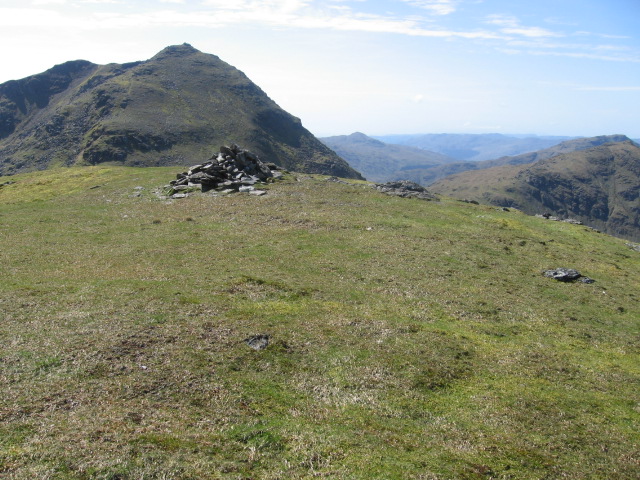
9. Beinn an Lochain

Beinn an Lochain is a mountain in the Arrochar Alps in western Scotland. A Corbett, reaching 901.7 metres (2,958 ft), Beinn an Lochain is situated within the Argyll Forest Park, which is itself within the Loch Lomond and the Trossachs National Park.
10. Dùn Anlaimh
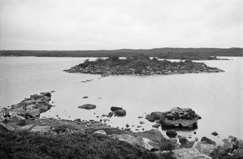
Dùn Anlaimh, also known as Dùn Amhlaidh, and Eilean nan Cinneachan, is a crannog, located within Loch nan Cinneachan on the Inner Hebridean island of Coll. Upon the crannog there are the remains of walls and several buildings. These remains are not unlike those of other fortified islands found throughout the Outer Hebrides, and it is likely that Dùn Anlaimh dates from the late Middle Ages. According to local tradition on Coll, the fort was once the home of a Norse chieftain who was defeated in battle somewhere nearby. The early 20th century antiquary Erskine Beveridge considered it as one of the four most interesting fortifications, on Coll. The site of Dùn Anlaimh is located at grid reference NM18845684. The RCAHMS classifies the site as a 'crannog' and an 'island dwelling'.
11. Beinn Narnain

Beinn Narnain is a mountain in the southern Highlands of Scotland, near Arrochar. It forms part of a group of hills known (unofficially) as the Arrochar Alps, and is a Munro. The name Beinn Narnain means "hill of notches", and describes the mountain's notched profile.
12. Oronsay Priory

Oronsay Priory was a monastery of canons regular on the island of Oronsay, Inner Hebrides, Argyll, off the coast of Scotland. It was in existence by 1353 under the patronage of John of Islay, Lord of the Isles. It was dedicated to St. Columba, and perhaps was a continuation or a re-activation of an older foundation. Very little is known about it because of the absence of records and its remoteness from the Scottish Lowlands, but on occasions some of the Priors of Oronsay come into the records.
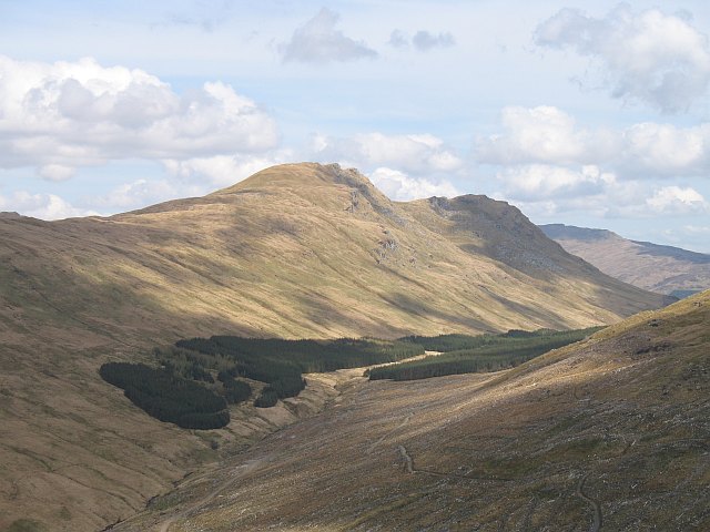
13. Beinn Dorain

Beinn Dorain, is a mountain in the Breadalbane region of the Scottish Highlands. It overlooks Bridge of Orchy in Argyll. It is a Munro with a height of 1,076 metres (3,530 ft). The mountain is the subject of Duncan Ban MacIntyre's best known Gaelic poem, Moladh Beinn Dòbhrainn ; MacIntyre had spent his youth and had worked as a gamekeeper in these parts.An t-urram thar gach beinn Aig Beinn Dòbhrain; De na chunnaic mi fon ghrèin, 'S i bu bhòidhche leam…
14. Ben Vorlich

Ben Vorlich is a mountain in the Arrochar Alps of Argyll, in the Southern Highlands of Scotland. It reaches 943 metres (3,094 ft), making it a Munro. It lies between Loch Lomond and Loch Sloy. Ben Vorlich is the highest point of the historic county of Dunbartonshire.
15. Kildalton Cross

The Kildalton Cross is a monolithic high cross in Celtic cross form in the churchyard of the former parish church of Kildalton (from Scottish Gaelic Cill Daltain, "Church of the Foster Son" on the island of Islay in the Inner Hebrides, Scotland. It was carved probably in the second half of the 8th century AD, and is closely related to crosses of similar date on Iona. It is often considered the finest surviving Celtic cross in Scotland, and is certainly one of the most perfect monuments of its date to survive in western Europe. The cross and the adjacent roofless medieval parish church are in the care of Historic Environment Scotland and are jointly a scheduled ancient monument. A simpler cross of late medieval date stands nearby.
16. Dùn an Achaidh

Dùn an Achaidh, sometimes Anglicised as Dun Acha, is a dun located near the village of Acha on the Inner Hebridean island of Coll. It is considered the best preserved dun on the island. The site of Dùn an Achaidh is located at grid reference NM18335456. According to local tradition, the dun was the stronghold of, and named after, the son of a Norse king. The early 20th century antiquary Erskine Beveridge considered it as one of the four most interesting fortifications on Coll.
17. Saddell Abbey

Saddell Abbey is a ruined Cistercian monastery located in western Scotland. The abbey was established in 1160 by Somerled, Lord of Kintyre, who was killed in 1164. The abbey was completed by his son, Ragnall, a few years later. The original layout of the abbey included a church and three adjoining buildings grouped around a cloister. Saddell Abbey is widely known for its important collection of life-sized stone carvings and burial slabs that were constructed from the 14th to the 16th centuries. Historic Environment Scotland established the site as a scheduled monument in 1975.
18. Breachacha House

Breachacha Castle is either of two structures on the shore of Loch Breachacha, on the Inner Hebridean island of Coll, Scotland. The earlier is a 15th-century tower house that was a stronghold of the Macleans of Coll, the island having been granted to John Maclean in 1431. This castle was superseded by a new dwelling in 1750 but continued to be occupied for a time. It fell into a ruinous state only in the mid-19th century.
19. Beinn Shiantaidh

Beinn Shiantaidh is the second highest peak of the Paps of Jura on the island of Jura, Scotland. It stands at 757 metres above sea level, and with over 300 metres of relative height is therefore a Graham.
20. Beinn an Dothaidh

Beinn an Dòthaidh, is a mountain in the Bridge of Orchy hills of Argyll and Bute, Scotland. It is located beside the more popular Beinn Dòrain. The two hills are frequently climbed together from the bealach between them, which is easily accessed from the Bridge of Orchy railway station.
21. Beinn Sgulaird

Beinn Sgulaird or Beinn Sguiliaird is a mountain in the Lorn region of the Scottish Highlands, between Glen Creran and Glen Etive. It has a height of 937 m (3074 ft) and is classed as a Munro. The mountain takes the form of a long ridge which runs from southwest to northeast, three kilometres of which lie above 800 m. Hillwalkers commonly traverse the ridge from north to south, as this gives the best views of the Hebrides to the west, in particular the Isle of Mull. While most walkers start from Glen Creran to the west, an ascent from Glen Etive is also possible.
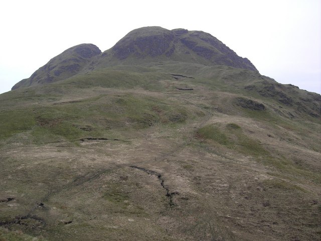
22. The Brack

The Brack is a mountain, located in the Arrochar Alps, on the south side of Glen Croe, near Loch Goil in Argyll and Bute in Scotland. The Brack has two summits: the lower peak, Cruach Fhiarach, can be seen from the shores of Loch Long, and the main peak is seen from Glen Croe and Loch Goil.
23. Achadun Castle

Achanduin Castle,, is a castle, now in ruins, located about 5.0 kilometres (3.1 mi) west of Achnacroish on the north-western coastline of the island of Lismore, in Argyll and Bute, Scotland. The castle overlooks Loch Linnhe and Bernera Island. The ruins are thought to date back to the thirteenth century. Achanduin Castle had long been thought to have been built by the Bishop of Argyll, though recent research has proved this to be unlikely. The castle was likely built by the MacDougalls around 1290 who held it throughout the fourteenth century. The castle was also thought to have been held by the Bishops of Argyll until the mid sixteenth century. It is a scheduled ancient monument.
24. Beinn Luibhean

Beinn Luibhean is one of the Arrochar Alps in the Argyll Highlands of Scotland, located to the northern side of Glen Croe between Loch Long in Dunbartonshire to the East and Loch Fyne in the Remote Highlands of Argyll to the West. The landscape to the West of Loch Long changes as the shoreline provides the gateway to Argyll, the district in the Western Highlands of Scotland that form the first ingredients to a wilderness and has a real sense of remoteness and isolation from the Lowlands and Populated parts of the Central Belt. The Arrochar Alps are a Mountain Range which Run from the Loch Goil in the South and West towards Tyndrum in the North. Beinn Luibhean stands at a height of 2821 ft, 860 m. The Nearest Mountains to Beinn Luibhean include The Cobbler, Beinn Ime and Beinn Narnain.
25. Beinn Mhor

Beinn Mhòr is the highest mountain on the Cowal Peninsula, west of Loch Eck in Argyll and Bute, west of Scotland. It has a high topographic prominence to height ratio and consequently commands a good all round view.
26. Ben Donich

Ben Donich or Beinn Dòmhnaich is a mountain located in the Arrochar Alps, near Loch Goil in Argyll and Bute. It is a Corbett and part of the Ardgoil range with its sister The Brack. The closest settlement to Ben Donich is the village of Lochgoilhead.
27. Beinn Bheula
Beinn Bheula is a mountain located between Loch Goil and Loch Eck. It is part of the Arrochar Alps range. Beinn Bheula appears rugged from Lochgoilhead, with several summits, the highest of which is Caisteal Dubh. It is commonly climbed from Loch Goil
28. Beinn Odhar

Beinn Odhar is a Scottish mountain situated at the northern extremity of the Loch Lomond and the Trossachs National Park. It stands four km (2.5 mi) north of Tyndrum, a location with which it has strong ties, being well seen from the village. The mountain lies on the border between Argyll and Bute and Stirling council areas within the Auch and Invermeran estate.
29. Beinn a' Chaisteil

Beinn a' Chaisteil is a mountain in the southern Highlands of Scotland, it is located 6.25 km north of Tyndrum on the border of Perth and Kinross and Argyll and Bute council areas. This hill is not to be confused with another Beinn a' Chaisteil, above Loch Vaich in Highland Council area.
30. A' Chrois
A' Chrois is a mountain located in the Arrochar Alps north west of Arrochar in Argyll, an extremely scenic area which is technically in the highlands although it is within easy reach of the heavily populated areas of Glasgow. A' Chrois stands north of Arrochar at the head of Loch Long and reaches a height of 848 meters (2,782 ft). The mountain forms a ridge starting with Ben Arthur The Cobbler in the south by Ardgartan through Beinn Narnain to A' Chrois in the north by Glen Loin, visible to Loch Lomond. A'Chrois also provides the eastern gateway to the Arrochar Alps and can be climbed via Beinn Narnain or Succoth. It is classed as a Corbett Top of Beinn Narnain.
31. Torrisdale Castle Estate

Torrisdale Castle is a historic mansion residence, overlooking Torrisdale Bay, Argyll, south of Carradale, Kintyre, Scotland. The castle is situated at the edge of the village of Torrisdale. It is a category B listed building.
32. Beinn Chorranach
Beinn Chorranach is one of the Arrochar Alps, a mountain range that marks the start of the Argyll Highlands and provides a wilderness of long coastlines and high mountains with forested hill sides. Beinn Chorranach's parent peak is Beinn Ìme, the biggest mountain in the range. Beinn Chorranach lies at the head of lower Glen Kinglas and is located between Loch Fyne and Loch Lomond. East of Beinn Chorranach is Loch Lomond as the mountain can be seen from Inversnaid and further east to The Trossachs wilderness. Further west is the rest of the wild Argyll scenery and marks the first real sense of isolation and wilderness after arriving in the Highlands at Loch Lomond.
33. Inverchaolain

Inverchaolain Church is a former Church of Scotland church building in Inverchaolain, Cowal, Argyll and Bute, Scotland. Located on the eastern shores of Loch Striven, just north of Inverchaolain Burn, the church was built in 1912. It is the fourth church on the site. There is a possibility that the second church, rumoured to be dedicated to Saint Bridget, was located about 200 metres (660 ft) northeast of the present structure.
34. Beinn Lochain
Beinn Lochain is one of the Arrochar Alps at 703 metres (2,306 ft), in the Argyll Highlands. The mountain is situated to the west of Lochgoilhead. It continues the rugged and wild feel of the local area as it sits next to its higher neighbour Beinn Bheula which reaches a height of over 2,500 feet.
35. Clach Bheinn

Clach Bheinn is a hill in Scotland near Lochgoilhead in the Ardgoil Peninsula and is within the Arrochar Alps. The hill reaches a height of 441 m (1,447 ft) and has a prominence of 348 m (1,142 ft).
36. Rhuvaal Lighthouse
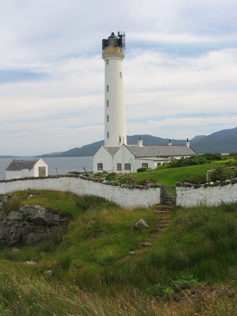
The Ruvaal, Rhuvaal, or Rubh'a' Mhàil Lighthouse is a listed 19th-century lighthouse located at the north-eastern end of the island of Islay, in the Inner Hebrides off the west coast of Scotland. The active lighthouse marks the northern approaches to the Sound of Islay, a narrow channel separating Islay from the adjacent island of Jura, and is one of the seven lighthouses operated by the Northern Lighthouse Board, which act as maritime aids to navigation on and around Islay.
37. Cruach nam Mult
Cruach nam Mult is a mountain in the Arrochar Alps, Argyll, Scotland which lies to the southern side of Hell's Glen. The mountain is near Loch Fyne and GlenGoil and is part of the northern side of the area of the Arrochar Alps that follow south to Loch Goil.
38. Beinn Reithe

Beinn Reithe is a mountain in Argyll in the Scottish Highlands and forms part of the Ardgoil Peninsula and Arrochar Alps. Beinn Reithe is located between Loch Goil and Loch Long; it reaches a height just over 2000 ft. The mountain is most noticeable from the western shores of Loch Goil and it is also within Loch Lomond and the Trossachs National Park.
39. Falls of Cruachan Railway Viaduct

Falls of Cruachan railway station is a railway station located at the foot of Ben Cruachan in Scotland. This station is on the Oban branch of the West Highland Line, originally part of the Callander and Oban Railway. It is sited between Taynuilt and Loch Awe, sited 52 miles 69 chains (85.1 km) from Callander via Glen Ogle. ScotRail manage the station and operate all services.
40. Dùn da Ghaoithe
Dùn da Ghaoithe is the second highest mountain on the Isle of Mull, western Scotland, and the island's only Corbett. It reaches 766 metres (2,513 ft) high, but "its long ridge and deep corries make it seem far higher". It boasts sea views "in almost every direction", and is the main mountain seen by visitors to the island on leaving the Caledonian MacBrayne ferry from Oban at Craignure.
Share
How likely are you to recommend us?
Disclaimer Please be aware of your surroundings and do not enter private property. We are not liable for any damages that occur during the tours.