55 Sights in Lancaster, United Kingdom (with Map and Images)
Legend
Welcome to your journey through the most beautiful sights in Lancaster, United Kingdom! Whether you want to discover the city's historical treasures or experience its modern highlights, you'll find everything your heart desires here. Be inspired by our selection and plan your unforgettable adventure in Lancaster. Dive into the diversity of this fascinating city and discover everything it has to offer.
Sightseeing Tours in Lancaster1. Lancaster Castle
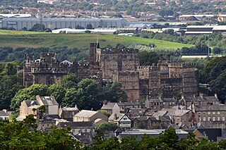
Lancaster Castle is a medieval castle and former prison in Lancaster in the English county of Lancashire. Its early history is unclear, but it may have been founded in the 11th century on the site of a Roman fort overlooking a crossing of the River Lune. In 1164 the Honour of Lancaster, including the castle, came under royal control. In 1322 and 1389 the Scots invaded England, progressing as far as Lancaster and damaging the castle. It was not to see military action again until the English Civil War. The castle was first used as a prison in 1196 although this aspect became more important during the English Civil War. The castle buildings are owned by the British sovereign as Duke of Lancaster; part of the structure is used to host sittings of the Crown Court.
2. Judges' Lodgings Museum
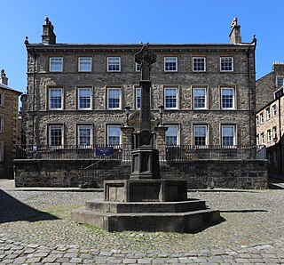
The Judges' Lodgings, formerly a town house and now a museum, is located between Church Street and Castle Hill, Lancaster, Lancashire, England. It is recorded in the National Heritage List for England as a designated Grade I listed building. The building is the oldest existing town house in Lancaster, and was also the first house in Lancaster to have shutters. It was used by judges when they attended the sessions of the Assize Court.
3. Ashton Memorial
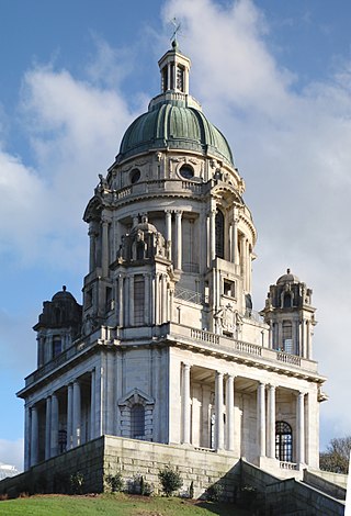
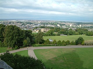
The Ashton Memorial is a folly in Williamson Park, Lancaster, Lancashire, England built between 1907 and 1909 by the millionaire industrialist Lord Ashton in memory of his second wife, Jessy, at a cost of £87,000.
4. Lancaster Priory
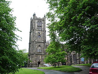
Lancaster Priory, formally the Priory Church of St Mary, is the Church of England parish church of the city of Lancaster, Lancashire, England. It is located near Lancaster Castle and since 1953 has been designated a Grade I listed building. It is in the deanery of Lancaster, the archdeaconry of Lancaster and the Diocese of Blackburn. Its benefice is combined with that of St John and St Anne.
5. Lancaster Cathedral
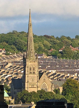
Lancaster Cathedral, also known as The Cathedral Church of St Peter and Saint Peter's Cathedral, is a Roman Catholic cathedral in Lancaster, Lancashire, England. It was a Roman Catholic parish church until 1924, when it was elevated to the status of a cathedral. It started as a mission church in 1798, and the present church was built on a different site in 1857–59. It was designed by E. G. Paley in the Gothic Revival style and is a grade II* listed building. In 1901 a baptistry was added by Austin and Paley, and the east end was reordered in 1995 by Francis Roberts. The cathedral is in active use, arranging services, concerts and other events, and is open to visitors.
Wikipedia: Lancaster Cathedral (EN), Website, Heritage Website
6. Sambo's Grave
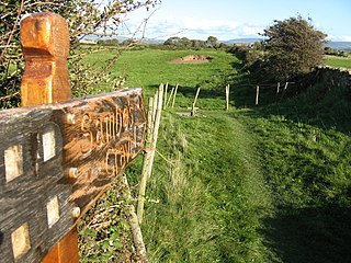
Sambo's Grave is the burial site of a black cabin boy or slave on unconsecrated ground in a field near the small village of Sunderland Point, Lancashire, England. Sunderland Point was a port, serving cotton, sugar and slave ships from the West Indies and North America, which declined after Glasson Dock was opened in 1787. It is a very small community only accessible via a narrow road, which crosses a salt marsh and is cut off at high tide.
7. St John the Baptist Church
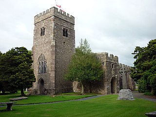
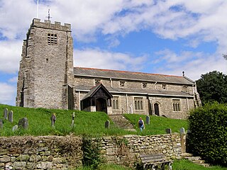
St John the Baptist Church is located to the northeast of the village of Tunstall, Lancashire, England. It is an active Anglican parish church in the united benefice of East Lonsdale, in the deanery of Tunstall, the archdeaconry of Lancaster and the diocese of Blackburn. The benefice of East Lonsdale combines this church with St Peter, Leck, St Wilfrid, Melling, St James the Less, Tatham, The Good Shepherd, Lowgill, and Holy Trinity, Wray. The church is recorded in the National Heritage List for England as a designated Grade I listed building. Services are usually at 11:00 on 2nd & 4th Sundays, in rota with the sister church at Leck.
8. The Storey
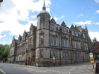
The Storey, formerly the Storey Institute, is a multi-purpose building located at the corner of Meeting House Lane and Castle Hill in Lancaster, Lancashire, England. Its main part is recorded in the National Heritage List for England as a designated Grade II listed building, with its back entrance being listed separately, also at Grade II.
9. Williamson Park
Williamson Park in Lancaster, England, was constructed by millionaire James Williamson, 1st Baron Ashton, and his father, also called James Williamson. Its focal point is the Ashton Memorial. The park now covers an area of 53.6 acres, having been extended in 1999 onto adjoining land, Fenham Carr, following a grant from the Heritage Lottery Fund.
10. St Margaret's Church
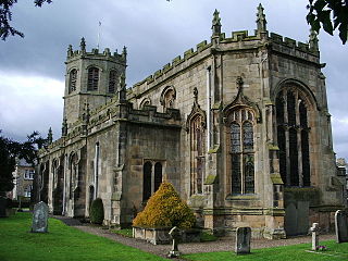
St Margaret's Church is in Main Street, Hornby, Lancashire, England. The church is recorded in the National Heritage List for England as a designated Grade I listed building. It is an active Anglican parish church in the diocese of Blackburn, the archdeaconry of Lancaster and the deanery of Tunstall. Its benefice is combined with those of St Michael, Whittington, St John, Arkholme, and St John, Gressingham.
11. Rumbling Hole
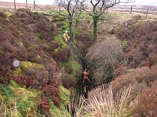
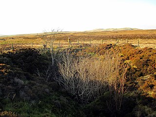
Rumbling Hole is a cave on Leck Fell, in Lancashire, England. Its entrance is a 50-metre (160 ft) deep fenced shaft, and it rapidly descends a series of pitches to a low aqueous passage that has been connected to Lost Johns' Cave. It is part of the Three Counties System, an 87-kilometre (54 mi) cave system that spans the borders of Cumbria, Lancashire, and North Yorkshire.
12. Winter Gardens
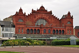
The Winter Gardens is a Grade II* listed building in Morecambe, Lancashire, England. Designed by architects Mangnall and Littlewood, with Frank Matcham as a consulting architect, it was originally built as the Victoria Pavilion Theatre in 1897 and was an extension to the existing Winter Gardens complex, which has since been demolished. The theatre closed to the public in 1977 and was listed the same year. It is considered to be one of Morecambe's most significant features, and a campaign for its restoration has been ongoing since 1986.
13. Grand Theatre
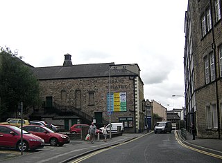
The Grand Theatre in Lancaster, England is one of the oldest theatres in England and the third oldest in Britain, having been in near continuous use since 1782. Though it has seen numerous extensions and alterations, much of the original stone has survived. The theatre is recorded in the National Heritage List for England as a designated Grade II listed building.
14. St Thomas
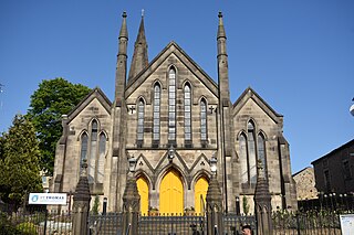
St Thomas' Church is in Marton Street, Lancaster, Lancashire, England. It is an active Anglican parish church in the deanery of Lancaster, the archdeaconry of Lancaster and the diocese of Blackburn. The church is recorded in the National Heritage List for England as a designated Grade II listed building.
Wikipedia: St Thomas' Church, Lancaster (EN), Website, Heritage Website
15. Morecambe Parish Church
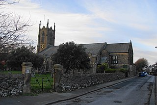
Holy Trinity Church, Morecambe, or Morecambe Parish Church, is in Church Street, Morecambe, Lancashire, England. It is the Anglican parish church of Morecambe, in the deanery of Lancaster, the archdeaconry of Lancaster and the diocese of Blackburn. The church is recorded in the National Heritage List for England as a designated Grade II listed building.
16. Ward's Stone
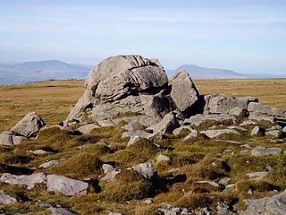
Ward's Stone is the highest hill in the Forest of Bowland, England. Its flat top hides two trig points nearly a kilometre apart. The western trig point sits atop of large rocks, including one, the Ward's Stone, that is so large it attracts boulderers and climbers.
17. Skerton Bridge
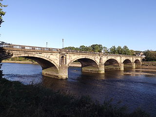
Skerton Bridge is a road bridge carrying the southbound lanes of the A6 road over the River Lune in Lancaster, Lancashire, England. The bridge is recorded in the National Heritage List for England as a designated Grade II* listed building and Scheduled Monument.
18. Queen Victoria
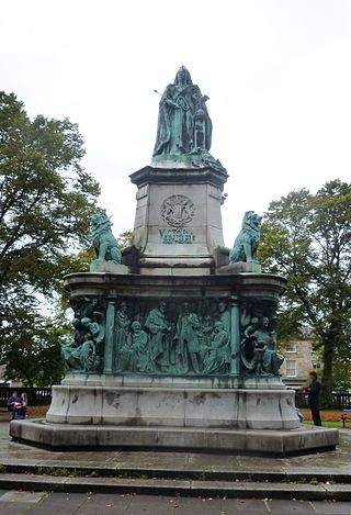
The Queen Victoria Memorial in Lancaster, Lancashire, England, is a Grade II* listed building. It stands in the centre of Dalton Square, facing Lancaster Town Hall. It was erected in 1906, being commissioned and paid for by James Williamson, 1st Baron Ashton.
19. St John's
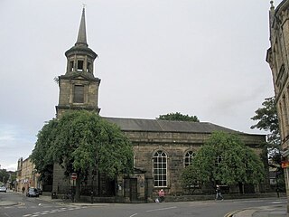
St John the Evangelist's Church is a redundant Anglican church in North Road, Lancaster, Lancashire, England. It is recorded in the National Heritage List for England as a designated Grade II* listed building, and is under the care of the Churches Conservation Trust.
20. St Oswald's Church
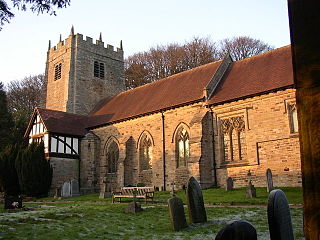
St Oswald's Church is in the village of Warton, Lancashire, England. It is an active Anglican parish church in the deanery of Tunstall, the archdeaconry of Lancaster, and the diocese of Blackburn. Its benefice is united with those of St Mary, Borwick and St John the Evangelist, Yealand Conyers. The church is recorded in the National Heritage List for England as a designated Grade II listed building. The ruined remains of the medieval rectory survive next to the present vicarage to the west of the church.
21. Death's Head Hole
Death's Head Hole is a cave on Leck Fell, in Lancashire, England. Its entrance is a 64-metre (210 ft) deep shaft. It leads into Lost Johns' Cave and is part of the Three Counties System, an 87-kilometre (54 mi) cave system which spans the borders of Cumbria, Lancashire, and North Yorkshire.
22. Lost Johns' Cave
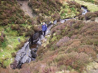
Lost Johns' Cave is an extensive cave system on Leck Fell, Lancashire, England. With its three major vertical routes it is a popular place to practise single-rope technique (SRT) because of the opportunity for exchange trips. Also it can be safely visited on wet days because many of the pitches can be rigged out of the water. It is an important part of the Three Counties System.
23. Ashton Hall
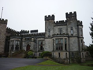
Ashton Hall is a largely rebuilt 14th-century mansion in the civil parish of Thurnham, Lancashire, England. It is 3 miles (4.8 km) south of the city of Lancaster and is on the east bank of the River Lune. It is recorded in the National Heritage List for England as a Grade I listed building, and is now owned by Lancaster Golf Club.
24. Hawthornthwaite Fell Top
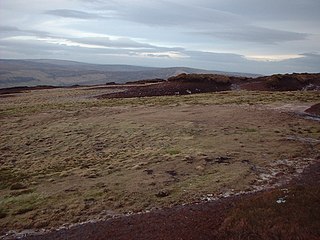
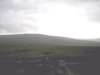
Hawthornthwaite Fell is one of the larger hills in the Forest of Bowland in the north west of England. Hawthornthwaite Fell marks the extreme western limit of the West Riding of the historic county of York. Since 1974 it has fallen within the boundaries of the administrative county of Lancashire. However, most of the hill is on the Duke of Westminster's land. It occupies a north-facing position on the south-western range, close to Bleasdale and Fair Snape Fell. The only path to the summit comes over the hills from the south. The summit is boggy and flanked to the north by steep heather slopes. Grouse are farmed in the area and hen harriers can be seen frequently. The trig point and the remains of its foundations are no longer upright, lying horizontally pointing westward.
25. Wennington Hall
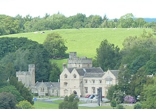
Wennington Hall is a former country house in Wennington, a village in the City of Lancaster district in Lancashire, England. The house is a Grade II listed building and from 1940 until 2022 was used as a school, at first by the Quaker boarding school Wennington School before its move to Yorkshire, then by Lancashire County Council.
26. Loyn Bridge
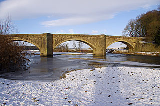
Loyn Bridge crosses the River Lune, carrying a minor road between the villages of Hornby and Gressingham in Lancashire, England. The present bridge replaces an older bridge, which is thought to have been constructed with timber decking between stone piers. There is evidence that the river was forded here before a bridge was built. The date of the building of the present bridge is unknown; it is considered to have been after 1591, when the previous bridge was described as being "in a dangerous condition". A date of 1684 has been suggested, but petitions regarding the bridge put before the Quarter Sessions between 1650 and 1750 make no mention of a new bridge between these dates. The bridge was paid for by the County of Lancashire, and later the responsibility for maintenance and repairs was transferred to the Lonsdale Hundred.
27. Warton Crag
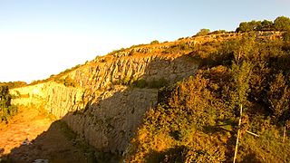
Warton Crag is a limestone hill in north west Lancashire, England. It lies to the north west of Warton village, in City of Lancaster district. At 163 metres (535 ft) it is the highest point in the Arnside and Silverdale Area of Outstanding Natural Beauty, and is listed as a "HuMP" or "Hundred Metre Prominence", having a "drop" or "prominence" of 126 metres (413 ft) with its parent being Hutton Roof Crags. Two areas are Local Nature Reserves, called Warton Crag and Warton Crag Quarry. Different sections are owned by Lancashire County Council, the Wildlife Trust for Lancashire, Manchester and North Merseyside, Lancaster City Council and the Royal Society for the Protection of Birds.
28. Grit Fell
Grit Fell is a lonely hill between Clougha Pike and Ward's Stone in the Forest of Bowland in Lancashire, England. Covered by heather and large bogs, it is difficult walking country. The path from Jubilee Tower car park in the south is difficult and treacherous, with sheer-sided bogs 6 feet (1.83 m) deep. The path from Clougha Pike in the west is better, but still contains bogs crossed by the odd plank of wood. The path from Ward's Stone is the most treacherous of all. Crossing Cabin Flat, it weaves its way across hidden pools of stagnant water, the presence of which is betrayed by a form of red grass.
29. Christ Church Glasson
Christ Church is in the village of Glasson, Lancashire, England. It is an active Anglican parish church in the deanery of Lancaster and Morecambe, the archdeaconry of Lancaster, and the diocese of Blackburn. Its benefice is combined with those of St Michael, Cockerham, and St Luke, Winmarleigh. The church is recorded in the National Heritage List for England as a designated Grade II listed building.
30. Christ Church
Christ Church, Over Wyresdale, stands in an isolated position to the west of the village of Abbeystead, Lancashire, England. The church is recorded in the National Heritage List for England as a designated Grade II listed building. It is an active Anglican parish church in the diocese of Blackburn, the archdeaconry of Lancaster, and the deanery of Lancaster. Its benefice is combined with those of St Mark, Dolphinholme, and St Peter, Quernmore.
31. St Peter's, Leck
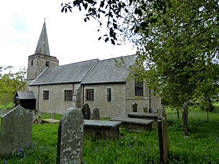
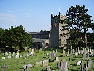
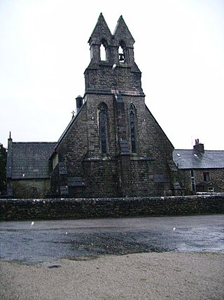
St Peter's Church is in the village of Leck, Lancashire, England. It is an active Anglican parish church in the deanery of Tunstall, the archdeaconry of Lancaster and the diocese of Blackburn. Its benefice is united with those of St Wilfrid, Melling, St John the Baptist, Tunstall, St James the Less, Tatham, the Good Shepherd, Lowgill, and Holy Trinity, Wray, to form the benefice of East Lonsdale. The church is recorded in the National Heritage List for England as a designated Grade II listed building.
32. Holy Trinity CE Church
Holy Trinity Church, is in the village of Bolton-le-Sands, Lancashire, England. It is an active Anglican parish church in the deanery of Tunstall, the archdeaconry of Lancaster, and the diocese of Blackburn. Its benefice is united with that of St Mark, Nether Kellett. The church is recorded in the National Heritage List for England as a designated Grade II* listed building.
33. Borwick Hall
Borwick Hall is a 16th-century manor house at Borwick, Lancashire, England. It is a Grade I listed building and is now used as a residential outdoor education and conference centre by Lancashire County Council.
34. Caton St. Paul's Church
St Paul's Church is in the village of Brookhouse, Caton-with-Littledale, Lancashire, England. It is an active Anglican parish church in the deanery of Tunstall, the archdeaconry of Lancaster, and the diocese of Blackburn. The church is recorded in the National Heritage List for England as a designated Grade II* listed building.
35. Christchurch
Christ Church is in Wyresdale Road, Lancaster, Lancashire, England. It is an active Anglican parish church in the deanery of Lancaster and Morecambe, the archdeaconry of Lancaster, and the diocese of Blackburn. The church is recorded in the National Heritage List for England as a designated Grade II listed building.
36. Royal Albert Hospital
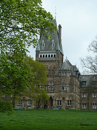
The Royal Albert Hospital was a hospital in Lancaster, Lancashire, England. It opened in 1870 as an institution for the care and education of children with learning problems. By 1909 there were 662 children in residence. Following new legislation in 1913, adults were also admitted. By the time of the introduction of the National Health Service in 1948 the hospital had 886 patients, and by the 1960s there were over 1,000 patients. Following legislation in the 1980s, the patients were relocated in the community, and the hospital closed in 1996. The building was acquired by Jamea Al Kauthar Islamic College to provide Islamic education for girls. The main part of the hospital is recorded in the National Heritage List for England as a designated Grade II* listed building, and its west lodge is listed at Grade II.
37. St James the Less
The Church of St James the Less is in the village of Tatham, Lancashire, England. It is an active Anglican parish church in the deanery of Tunstall, the archdeaconry of Lancaster and the diocese of Blackburn. Its benefice is united with those of St Wilfrid, Melling, St John the Baptist, Tunstall, St Peter, Leck, the Good Shepherd, Lowgill, and Holy Trinity, Wray, to form the benefice of East Lonsdale. The church is recorded in the National Heritage List for England as a designated Grade II* listed building. It stands above the flood plain of the River Wenning.
38. St Cuthbert's Church
St Cuthbert's Church is in the village of Over Kellet, Lancashire, England. It is an active Anglican parish church in the deanery of Tunstall, the archdeaconry of Lancaster, and the diocese of Blackburn. The church is recorded in the National Heritage List for England as a designated Grade II* listed building.
39. St Laurence's Church
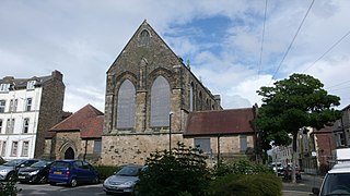
St Laurence's Church stands at the corner of Chapel Street and Edward Street in Morecambe, Lancashire, England. It is a redundant church, formerly an Anglican parish church. Its benefice has been united with that of Holy Trinity, Morecambe. The former church is recorded in the National Heritage List for England as a designated Grade II listed building.
40. Plover Scar Lighthouse
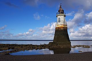
Plover Scar Lighthouse, also known as the Abbey Lighthouse, is an active 19th century lighthouse sited at the entrance of the Lune estuary, near Cockersand Abbey in Lancashire, England. The lighthouse is maintained by the Lancaster Port Commission. It is registered under the international Admiralty number A4876 and has the NGA identifier of 114-5144.
41. St. Mary's
St Mary's Church is in the village of Yealand Conyers, Lancashire, England. It is an active Roman Catholic church in the diocese of Lancaster, and is linked with the churches of St Mary of the Angels, Bolton-le-Sands, and Our Lady of Lourdes, Carnforth. The church is recorded in the National Heritage List for England as a designated Grade II listed building. It stands at the south end of the village.
42. St Wilfrid's
St Wilfrid's Church is an Anglican church in Halton-on-Lune, a village in the English county of Lancashire. It is an active parish church in the Diocese of Blackburn and the archdeaconry of Lancaster. Halton may have been the site of an ancient Anglo-Saxon minster. Of the current structure, the tower dates from the 16th century and the remainder was built 1876–77 by Paley and Austin. The church is recorded in the National Heritage List for England as a designated Grade II listed building.
43. St. Peter
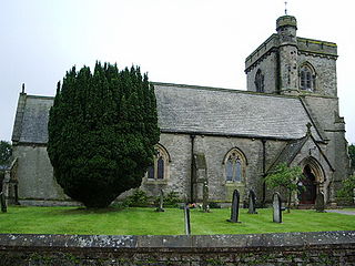
St Peter's Church is in the village of Quernmore, Lancashire, England. It is an active Anglican parish church in the deanery of Lancaster and Morecambe, the archdeaconry of Lancaster, and the diocese of Blackburn. Its benefice is united with those of St Mark, Dolphinholme, and Christ Church, Over Wyresdale. The church is recorded in the National Heritage List for England as a designated Grade II listed building. It stands in a relatively isolated position about 1 mile (1.6 km) to the north of the village and 2.5 miles (4.0 km) to the east of the city of Lancaster.
44. St John The Evangelist
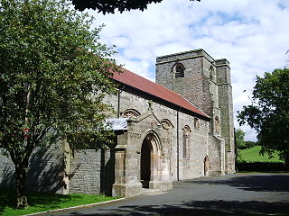
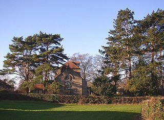
St John's Church is in Chapel Lane, Ellel, Lancashire, England. It is an active Anglican parish church in the deanery of Lancaster and Morecambe, the archdeaconry of Lancaster, and the diocese of Blackburn. The church is recorded in the National Heritage List for England as a designated Grade II listed building. The authors of the Buildings of England series describe the appearance of the church as being "decidedly monumental".
45. St Luke's Church
St Luke's Church is in Manor Lane, Slyne-with-Hest, Lancaster, Lancashire, England. It is an active Anglican parish church in the deanery of Tunstall, the archdeaconry of Lancaster, and the diocese of Blackburn. Its benefice is united with those of St Saviour, Aughton, and St Wilfrid, Halton. The church is recorded in the National Heritage List for England as a designated Grade II listed building.
46. Old Rectory
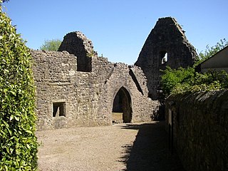
The Old Rectory is a ruin of a former rectory in the village of Warton, near Lancaster, Lancashire, England. Owned by English Heritage, it has been designated a Scheduled Ancient Monument and Grade I listed building.
47. Saint Michael the Archangel
St Michael's Church is located in the settlement of Whittington, Lancashire, England. It is an active Anglican parish church in the deanery of Tunstall, the archdeaconry of Lancaster and the diocese of Blackburn. Its benefice is united with those of St John the Evangelist, Gressingham, St Margaret, Hornby, and St John the Baptist, Arkholme. The church is recorded in the National Heritage List for England as a designated Grade II* listed building.
48. St John
St John's Church is in Emesgate Lane, Silverdale, Lancashire, England. It is an active Anglican parish church in the deanery of Tunstall, the archdeaconry of Lancaster, and the diocese of Blackburn. The church is recorded in the National Heritage List for England as a designated Grade II* listed building. It is notable for the high quality of the stone carving in the interior.
49. St Mary's
St Mary's Church is located to the north of the village of Borwick, Lancashire, England. It is an active Anglican parish church in the deanery of Tunstall, the archdeaconry of Lancaster, and the diocese of Blackburn. Its benefice is united with those of St Oswald, Warton, and St John the Evangelist, Yealand Conyers. The church is recorded in the National Heritage List for England as a designated Grade II listed building.
50. The Ridding
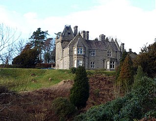
The Ridding is a Victorian country house located in the village of Bentham, North Yorkshire, England. It is recorded in the National Heritage List for England as a designated Grade II listed building.
51. Venus and Cupid
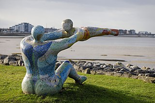
Love, The Most Beautiful Of Absolute Disasters, popularly known as Venus and Cupid is a sculpture by Shane A. Johnstone which stands on a slight promontory beside Morecambe Bay on the eastern approach to Morecambe, Lancashire, England.
52. St John the Evangelist
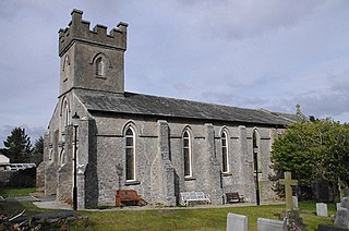
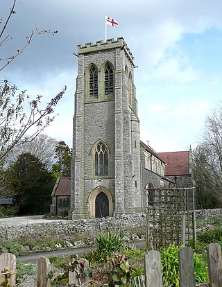
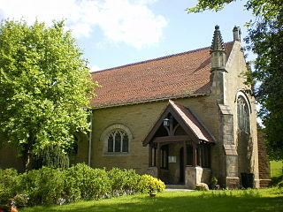
St John the Evangelist's Church is in Church Lane, Yealand Conyers, Lancashire, England. It is an active Anglican parish church in the diocese of Blackburn. The church was built in 1838, extended in 1861 and again in 1882. It is constructed mainly in limestone, and consists of a nave, a north aisle, a chancel and a west tower. Inside is a west gallery and stained glass by Shrigley and Hunt. The church holds services on Sundays and Wednesdays. It is recorded in the National Heritage List for England as a designated Grade II listed building.
Wikipedia: St John the Evangelist's Church, Yealand Conyers (EN)
53. Galacum Roman fort
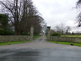
Over Burrow Roman Fort is the modern name given to a former Roman fort at Over Burrow, Lancashire in North West England. Today it is the site of the 18th-century country house Burrow Hall. The first castra is thought to have been founded in the first century AD within the Roman province of Britannia.
54. Boxhead Pot
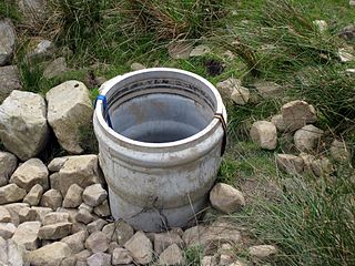
Boxhead Pot is a cave on Leck Fell, in Lancashire, England. It leads into the top end of Lost Johns' Cave, and is part of the Three Counties System, an 87 kilometres (54 mi) cave system which spans the borders of Cumbria, Lancashire, and North Yorkshire.
55. Eric Morecambe Statue
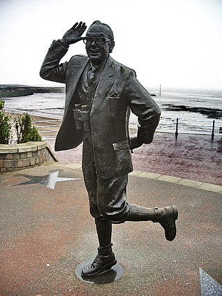
The Statue of Eric Morecambe in Morecambe, Lancashire, England is a commemorative bronze sculpture of Eric Morecambe (1926–1984) by Graham Ibbeson. It was unveiled by the Queen in July 1999. It depicts Morecambe in his "Bring Me Sunshine" pose and overlooks Morecambe Bay.
Share
Disclaimer Please be aware of your surroundings and do not enter private property. We are not liable for any damages that occur during the tours.
