14 Sights in Patterdale, United Kingdom (with Map and Images)
Legend
Welcome to your journey through the most beautiful sights in Patterdale, United Kingdom! Whether you want to discover the city's historical treasures or experience its modern highlights, you'll find everything your heart desires here. Be inspired by our selection and plan your unforgettable adventure in Patterdale. Dive into the diversity of this fascinating city and discover everything it has to offer.
1. Helvellyn

Helvellyn is a mountain in the English Lake District, the highest point of the Helvellyn range, a north–south line of mountains to the north of Ambleside, between the lakes of Thirlmere and Ullswater.
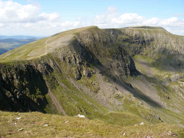
2. Nethermost Pike

Nethermost Pike is a fell in Cumbria, England, and a part of the Lake District. At 891 metres (2,923 ft) it is the second highest Wainwright in the Helvellyn range, the highest of which is Helvellyn itself. It is located close to the southern end of the ridge, with Helvellyn to the north, and High Crag and Dollywaggon Pike to the south. Nethermost Pike, along with many of the Eastern Fells, lies between Thirlmere in the west and the Ullswater catchment in the east. The closest villages are Glenridding and Patterdale on the shores of Ullswater, over 8 kilometres (5 mi) away.
3. High Street

High Street is a fell in the English Lake District. At 828 metres (2,717 ft), its summit is the highest point in the far eastern part of the national park. The fell is named after the Roman road that ran over the summit.
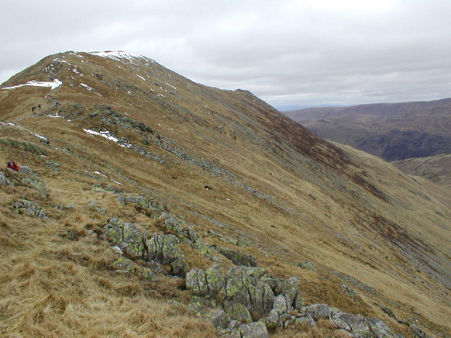
4. Red Screes

Red Screes is a fell in the English Lake District, situated between the villages of Patterdale and Ambleside. It may be considered an outlier of the Fairfield group in the Eastern Fells, but is separated from its neighbours by low cols. This gives Red Screes an independence which is reflected in its prominence.
5. Greenside Lead Mine
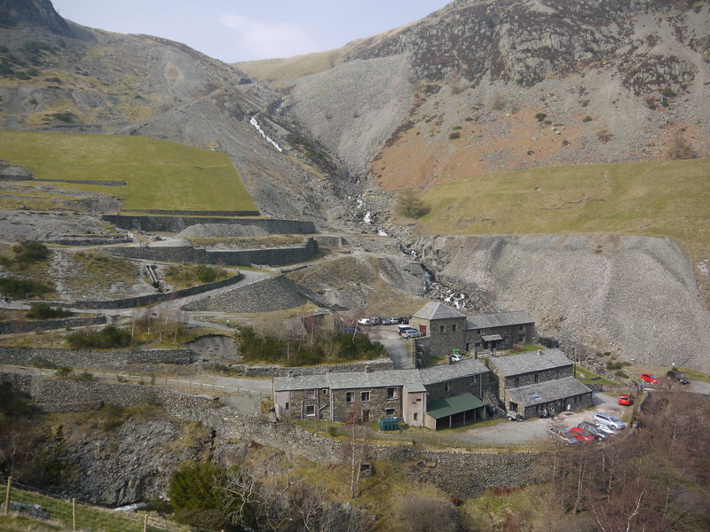
Greenside Mine was a successful lead mine in the Lake District of England. Between 1825 and 1961 the mine produced 156,000 long tons of lead and 1,600,000 ounces of silver, from around 2 million tons of ore. During the 1940s it was the largest producer of lead ore in the UK. Unusually for a 19th-century metalliferous mine in Britain there are very full records of its activities, dating back to 1825.
6. High Crag
High Crag is a minor fell on the Helvellyn Range in the eastern region of the English Lake District. It sits on the ridge to the south of Helvellyn and Nethermost Pike. It rises sharply above the head of Ruthwaite Cove, and has attracted the attention of rock climbers. Its rock type is a lapilli-tuff of the Helvellyn Tuff Formation.
7. St Sunday Crag
St Sunday Crag is a fell in the English Lake District, part of the Fairfield group in the Eastern Fells. It is a prominent feature in the Patterdale skyline, with a distinctive rounded shape. Indeed, it figures so finely in views from the upper reach of the lake that it is sometimes referred to as ‘the Ullswater Fell’.
8. Glenridding Dodd

Glenridding Dodd is a small fell in the English Lake District, at the end of a ridge descending from the Helvellyn range in the Eastern Fells. It stands above the village of Glenridding and on the western shore of Ullswater. Although small and not of great elevation, its top is a fine viewpoint for Ullswater and for the fells clustered round the valleys above Patterdale.
9. Place Fell

Place Fell is a mountain in the English Lake District. It stands at the corner of the upper and middle reaches of Ullswater, with steep western flanks overlooking the villages of Glenridding and Patterdale.
10. Brock Crags

Brock Crags is a fell in the English Lake District, standing above Hartsop in the Far Eastern Fells. It forms part of the perimeter of Martindale, lying on the long ridge from Rampsgill Head to Place Fell.
11. Dove Crag

Dove Crag is a fell in the English Lake District. Situated in the Eastern Fells of the national park, seven kilometres south-south-west of Glenridding, it reaches a height of 792 metres. The fell is often climbed as part of the Fairfield horseshoe walk but a direct ascent from Patterdale is required to show the fell's full potential, displaying the impressive crags just to the north east of the summit. The highest point was originally unnamed on maps, being just a minor top, but over the years the summit has adopted the name of Dove Crag by mutual accord..
12. Birkhouse Moor

Birkhouse Moor is a fell in the English Lake District, an outlier of the Helvellyn range in the Eastern Fells. It is properly an eastern ridge of Helvellyn, but was treated as a separate fell by Alfred Wainwright in his Pictorial Guide to the Lakeland Fells. That convention is followed here.
13. Little Hart Crag

Little Hart Crag is a fell in the Lake District area of England. It stands at the head of Scandale, six kilometres north of Ambleside, at a height of 637 metres (2,090 ft). It is an eastern outlier of Dove Crag in the Eastern Fells, although it does have 34 metres (112 ft) of prominence from that fell making it both a Hewitt and a Nuttall fell. It is frequently climbed as part of the Dovedale horseshoe, an 11-kilometre (7-mile) walk over the neighbouring fells of Hartsop above How, Hart Crag, Dove Crag and High Hartsop Dodd, starting and finishing at Brothers Water.
14. Birks

Birks is a fell in the English Lake District situated two kilometres south west of the village of Patterdale in the Eastern Fells. The fells summit sits on a shoulder of the north east ridge of the higher and better known fell of St Sunday Crag, by which it is dominated, walkers often pass over the top of Birks either climbing or descending from the larger fell. The fell's name means a place where Birch trees predominate.
Share
How likely are you to recommend us?
Disclaimer Please be aware of your surroundings and do not enter private property. We are not liable for any damages that occur during the tours.