9 Sights in Albany County, United States (with Map and Images)
Legend
Welcome to your journey through the most beautiful sights in Albany County, United States! Whether you want to discover the city's historical treasures or experience its modern highlights, you'll find everything your heart desires here. Be inspired by our selection and plan your unforgettable adventure in Albany County. Dive into the diversity of this fascinating city and discover everything it has to offer.
Activities in Albany County1. Ames Monument
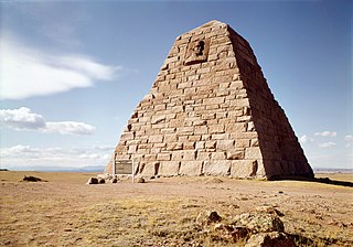
The Ames Monument is a large pyramid in Albany County, Wyoming, designed by Henry Hobson Richardson and dedicated to brothers Oakes Ames and Oliver Ames Jr., Union Pacific Railroad financiers. It marked the highest point on the first transcontinental railroad, at 8,247 feet (2,514 m).
2. Dale Creek Crossing
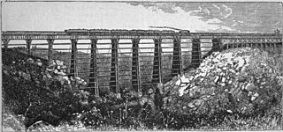
Dale Creek Crossing was a railway bridge located in present-day Wyoming. The 650-foot (200 m) bridge, completed in 1868 in the southeastern Wyoming Territory, presented engineers of the United States' first transcontinental railroad one of their most difficult challenges. Dale Creek Bridge, the longest bridge on the Union Pacific Railroad (UP), reached 150 feet (46 m) above Dale Creek, two miles (3.2 km) west of Sherman, Wyoming. The first Dale Creek Bridge was a wooden structure 720 feet in length. The eastern approach to the bridge site, near the highest elevation on the UP, 8,247 feet (2,514 m) above sea level, required cutting through granite for nearly a mile. Solid rock also confronted workers on the west side of the bridge where they made a cut one mile (1.6 km) in length.
3. Medicine Bow Peak
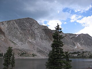
Medicine Bow Peak is the highest peak in the Snowy Range, a part of the Medicine Bow Mountains, about 35 miles (56 km) west of Laramie, Wyoming. It lies within Medicine Bow National Forest and is the highest point in southern Wyoming. The summit lies in extreme western Albany County, but the mountain's lower reaches stretch westward into eastern Carbon County. The summit is 12,018 feet high and is visible from Snowy Range Pass, elevation 10,847 ft, on Wyoming Highway 130, a Wyoming Scenic Byway. The most commonly used trail to the peak is a four-mile hike featuring switch-backs and a great deal of loose rock. The trails to the peak are usually open from early June to mid October.
4. Laramie Peak
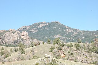
Laramie Peak Is the highest and most prominent peak in the Laramie Range of Wyoming. With a peak elevation of 10,275 feet (3,132 m), it is the only peak in the Laramie Range to exceed an elevation of 10,000 feet (3,000 m). It can be seen from great distances from both sides of the Laramie Range including from around 100 miles (160 km) away at the top of the Scotts Bluff National Monument in Nebraska and in the Wyoming towns of Wheatland, Douglas, Rock River, and immediately outside the cities of Laramie and Cheyenne.
5. Fossil Bone Cabin
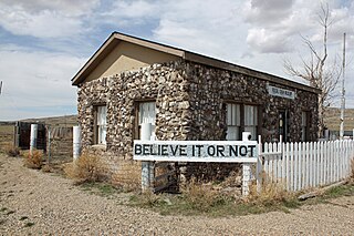
The Fossil Cabin near Medicine Bow, Wyoming, United States, was built in 1932 as a roadside attraction. The cabin is built of dinosaur bones excavated at nearby Como Bluff, using a total of 5,796 bones. The cabin was built as part of a gasoline filling station along US 30 by Thomas Boylan. Boylan had come from California to homestead in Wyoming and had been collecting bones for seventeen years, intending to create sculptures of dinosaurs in front of his house and gas station along the Lincoln Highway.
6. Snowy Range Lodge
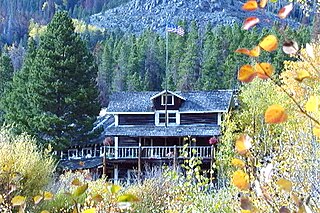
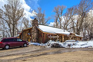
The Snowy Range Lodge, formerly known as the Libby Lodge, is located in the Snowy Range of Medicine Bow National Forest in Wyoming. The three-story log lodge was built in 1925 as the Libby Lodge. From 1925 to the mid-1970s, the Lodge served as a classic mountain lodge, sleeping up to 75 people in the main lodge and in ten cabins on 40 acres leased from the US Forest Service. In the mid-1970s, it fell into a state of abandonment, neglect, and disrepair such that the Forest Service planned to burn and bulldoze it as it presented a liability risk to National Forest users who might venture inside.
7. Fort Sanders Guardhouse
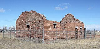
Fort Sanders was a wooden fort constructed in 1866 on the Laramie Plains in southern Wyoming, near the city of Laramie. Originally named Fort John Buford, it was renamed Fort Sanders after General William P. Sanders, who died at the Siege of Knoxville during the American Civil War. This was the second fort to be named after Sanders, the first being in Knoxville, Tennessee. The fort was originally intended to protect travelers on the nearby Overland Trail from Indian attacks, but later the garrison was tasked with protecting the workers of the Union Pacific railroad when it arrived in the spring of 1868. In 1869 the town of Laramie was created about 3 miles (4.8 km) north of the fort. Fort Sanders became less important following the construction of Fort D. A. Russell in Cheyenne in 1868, but the War Department maintained it until 1882 when the buildings were sold.
8. Centennial Work Center
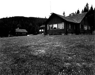
The Centennial Work Center in Medicine Bow National Forest near Centennial, Wyoming was built in 1938. It was built to replace the nearby Centennial Ranger Station. It was designed by USDA Forest Service, Region 2 in USFS rustic architecture and served as a government office. It was listed on the National Register of Historic Places for its architecture. The listing included three contributing buildings, a bunkhouse, a combined office and bunkhouse, and a garage, on 5 acres (2.0 ha).
9. Woods Landing Dance Hall
The Woods Landing Dance Hall was built in 1927 by Hokum Lestum for Mayme and Clarence Lewellen near Woods Landing, Wyoming. The site had previously been the Woods Landing Saloon, established by Colonel Samuel Wood in 1883. After the death of Clarence in 1936, Mayme married Hokum and they operated the dance hall and cafe until the death of Hokum in 1970. Mayme continued to operate it until the 1980s.
Share
How likely are you to recommend us?
Disclaimer Please be aware of your surroundings and do not enter private property. We are not liable for any damages that occur during the tours.
