63 Sights in Chelan County, United States (with Map and Images)
Legend
Welcome to your journey through the most beautiful sights in Chelan County, United States! Whether you want to discover the city's historical treasures or experience its modern highlights, you'll find everything your heart desires here. Be inspired by our selection and plan your unforgettable adventure in Chelan County. Dive into the diversity of this fascinating city and discover everything it has to offer.
Activities in Chelan County1. Mount Stuart
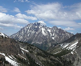
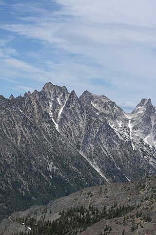
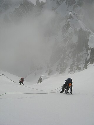
Mount Stuart is a mountain in the Cascade Range, in the U.S. state of Washington. It is the second highest non-volcanic peak in the state, after Bonanza Peak and seventh-highest overall. Mount Stuart is the highest peak in the Stuart Range, and it is located in the central part of the Washington Cascades, south of Stevens Pass and east of Snoqualmie Pass in the Alpine Lakes Wilderness.
2. Goode Mountain
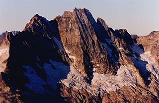
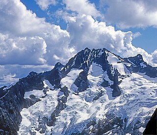
Goode Mountain is one of the major peaks of the North Cascades in the U.S. state of Washington. Named for topographer Richard Urquhart Goode of the United States Geological Survey, it is the highest peak located in North Cascades National Park, between the Skagit River and Lake Chelan. It is the fourth-highest non-volcanic peak in Washington, and the twelfth-highest summit overall.
3. Bonanza Peak
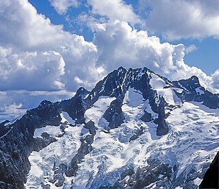
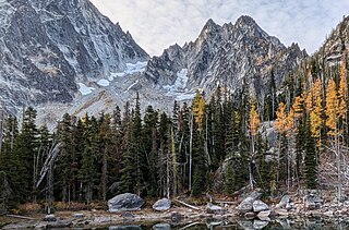
Bonanza Peak is a tall peak in the North Cascades in the U.S. state of Washington and the Glacier Peak Wilderness of the Wenatchee National Forest. At 9,516 feet (2,900 m) in elevation, it is the highest point in Chelan County, and the highest non-volcanic peak in Washington. and the Cascade Range as a whole. Bonanza Peak's prominence is 3,711 feet (1,131 m), making it the 26th most prominent peak in Washington. The nearest higher peak is Glacier Peak, 14.4 miles (23.2 km) to the southwest.
4. Liberty Bell Mountain
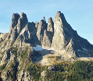
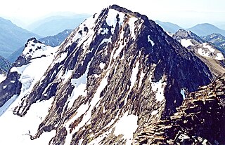
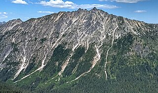
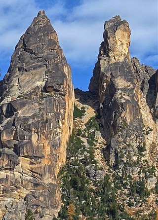
Liberty Bell Mountain is located in the North Cascades, State of Washington, United States, approximately one mile south of Washington Pass on the North Cascades Highway. Liberty Bell is the most northern spire of the Liberty Bell Group, a group of spires that also includes Concord Tower, Lexington Tower, North Early Winters Spire, and South Early Winters Spire.
5. Agnes Mountain
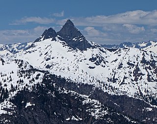
Agnes Mountain is a dramatic, but relatively unknown, peak in the North Cascades of the US state of Washington. It is not of regionally high elevation, but it rises steeply from low footings; Beckey calls it "an immense Matterhorn-shaped massif." For example, its north face drops 1,800 feet (549 m) from the summit to Agnes Creek in only 1.5 miles (2.4 km).
6. Mount Maude
Mount Maude is the 15th highest peak in Washington state. The peak is located in the Entiat Mountains, a subrange of the North Cascades. It is in the Glacier Peak Wilderness, at the headwaters of the Entiat River. The peak was given its name by Albert H. Sylvester in honor of Frederick Stanley Maude.
7. Dragontail Peak
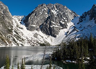
Dragontail Peak, also known as Dragon Tail, is a mountain in the Stuart Range, in Chelan County, Washington. While climbing an adjacent peak, Lex Maxwell, Bob McCall, and Bill Prater remarked that the needles on the crest, southwest of the summit, resembled a "dragon tail". The name was officially accepted in 1955. On the mountain's northeast flank lies Colchuck Lake which drains into Mountaineer Creek, and Colchuck Glacier lies below the western slopes of the peak. On its south side the mountain drops steeply to Ingalls Creek, which flows about 5,800 feet (1,800 m) below the summit.
8. Mount Fernow
Mount Fernow is a tall peak in the North Cascades in the U.S. state of Washington and within the Glacier Peak Wilderness of the Wenatchee National Forest. At 9,249 feet (2,819 m) in elevation it is the eighth-highest peak in Washington and the state's third-highest non-volcanic peak. It is also the highest peak of the Entiat Mountains, a sub-range of the Cascades. Mount Fernow's prominence is 2,811 ft (857 m), making it the sixtieth-most-prominent peak in Washington. The closest peak to Fernow is Copper Peak, 0.88 mi (1.42 km) to the north, and the nearest higher peak is Bonanza Peak, 5.9 mi (9.5 km) to the north.
9. Booker Mountain
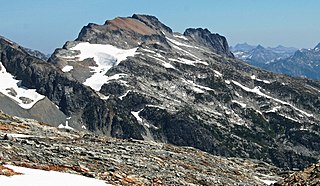
Booker Mountain, also known as Mount Booker, with an elevation of 8,284 feet (2,525 m), is located in the North Cascades of Washington, about 1.5 miles SE of Mount Buckner, between Park Creek and Stehekin River. It is named in honor of Booker T. Washington.
10. Little Annapurna
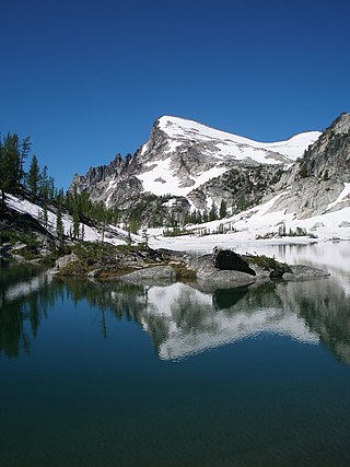
Little Annapurna is an 8,485-foot (2,586-metre) mountain summit located in Chelan County of Washington state. The origin of the name came from the Sherpa Climbing Club of Ellensburg and is inspired by the obvious resemblance to its Himalayan namesake when comparing the south faces of both. Little Annapurna is part of The Enchantments within the Alpine Lakes Wilderness and is set on land managed by the Okanogan–Wenatchee National Forest. It belongs to the Stuart Range which is subset of the Cascade Range. Little Annapurna is situated southeast of Dragontail Peak, which is the nearest higher neighbor. Remnants of the receding Snow Creek Glacier can be found on its gentle north slope. Precipitation runoff drains into tributaries of the Wenatchee River.
11. Corteo Peak
Corteo Peak is an 8,107-foot (2,471-metre) mountain summit located on the eastern boundary line of North Cascades National Park in Washington state. It is situated west of Rainy Pass in the North Cascades Range. Remnants of the retreating Lewis Glacier hang on its north flank. Topographic relief is significant as the summit rises approximately 3,200 feet above Maple Creek in one mile (1.6 km) and 2,400 feet above Lewis Lake in one-half mile (0.8 km). The nearest higher peak is Black Peak, 1.67 miles (2.69 km) to the northwest. Corteo Peak and nearby Mount Benzarino were named by Forest Service surveyor, Lage Wernstedt, after Basque sheepherders he met near these two mountains.
12. Prusik Peak
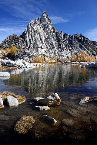
Prusik Peak is an 8,008-foot (2,441-metre) granite summit located at the west end of The Temple in Chelan County of Washington state. Prusik Peak is part of The Enchantments within the Alpine Lakes Wilderness and is often the iconic photographic image of both areas. Prusik Peak belongs to the Stuart Range which is a subset of the Cascade Range. The toponym honors Dr. Karl Prusik (1896–1961) who was an Austrian mountaineer, known as the inventor of the prusik, a rope knot which happened to be used to gain access to the summit horn during the first ascent by Fred Beckey in 1948. Precipitation runoff drains into Icicle Creek which is a tributary of the Wenatchee River.
13. Cardinal Peak
Cardinal Peak is the highest peak of the Chelan Mountains, a subrange of the Cascade Range in the U.S. state of Washington. It is located in Wenatchee National Forest at the head of the Entiat River drainage basin, in Chelan County. To the west and north, streams flow into Lake Chelan. Cardinal Peak is less than 5 miles (8.0 km) from the lake and rises 7,500 feet (2,300 m) above the lakeshore. At 8,595 feet (2,620 m) high, it is the 49th highest peak in Washington. Its 2,070-foot (630 m) prominence ranks 132nd in the state.
14. Sherpa Peak
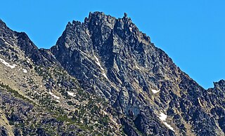
Sherpa Peak is an 8,630-foot (2,630-metre) granite summit located in the Stuart Range, in the Alpine Lakes Wilderness in Chelan County of Washington state. The nearest higher peak is Mount Stuart, 0.41 mi (0.66 km) to the west, and Argonaut Peak lies 1.29 mi (2.08 km) to the east. The Sherpa Glacier lies on the northern slope of the peak. Precipitation runoff from the peak drains north into Mountaineer Creek, a tributary of Icicle Creek, or south into Ingalls Creek, all of which winds up in the Wenatchee River. According to the USGS, this peak is named for a local climbing club that was active in the area in the 1950s, and the toponym was officially adopted in 1988 by the U.S. Board on Geographic Names.
15. Colchuck Peak
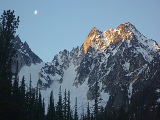
Colchuck Peak is an 8,705-foot (2,653-metre) mountain summit located in the Stuart Range, in the Alpine Lakes Wilderness in Chelan County of Washington state. The nearest higher peak is Dragontail Peak, 0.49 mi (0.79 km) to the east, and Argonaut Peak lies 0.9 mi (1.4 km) to the southwest. The Colchuck Glacier which lies on the northeast slopes of the peak melts into Colchuck Lake. The mountain and glacier take their name from the lake, which in Chinook jargon means "cold water". Precipitation runoff from the peak drains north into Mountaineer Creek, a tributary of Icicle Creek, or south into Ingalls Creek, all of which winds up in the Wenatchee River. Colchuck Peak is more notable for its steep rise above local terrain than for its absolute elevation as topographic relief is significant with the summit rising 3,130 feet (954 m) above Colchuck Lake in 1 mi (1.6 km), and 4,600 feet (1,402 m) above Ingalls Creek in 1.9 mi (3.1 km).
16. McClellan Peak
McClellan Peak is an 8,368-foot (2,551-metre) summit located in Chelan County of Washington state. The toponym honors Army explorer George B. McClellan who visited the area in 1853. McClellan Peak forms part of the south rim of The Enchantments lake basin within the Alpine Lakes Wilderness, and it belongs to the Stuart Range which is subset of the Cascade Range. McClellan Peak is situated 1.29 miles east of Little Annapurna which is its nearest higher neighbor. Precipitation runoff drains into tributaries of the Wenatchee River.
17. Argonaut Peak
Argonaut Peak is a tall mountain in the Cascade Range in the U.S. state of Washington. Part of the Stuart Range part of the Wenatchee subrange of the Cascades, it is within the Alpine Lakes Wilderness of the Wenatchee National Forest and part of the region known as The Enchantments. At 8,453 feet (2,576 m) in elevation it is the 65th highest peak in Washington. Located on the crest between Colchuck Peak and Sherpa Peak, Argonaut Peak has a southeast and a west summit of almost identical height, with the west being the true summit. There is a prominent southeast spire. Its southern side slopes down to the valley of Ingalls Creek. The north and northeast sides of Argonaut stand high above a branch of Mountaineer Creek, a tributary of Icicle Creek. Argonaut Peak is 1.7 miles (2.7 km) west of Isolation Lake and 1.8 miles (2.9 km) east of Mount Stuart.
18. Jim Hill Mountain
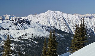
Jim Hill Mountain is a prominent 6,765 ft (2,060 m) mountain summit located in Chelan County of Washington state. Jim Hill Mountain is situated 3.5 mi (5.6 km) east of Stevens Pass, on the boundary of Alpine Lakes Wilderness, on land managed by the Okanogan–Wenatchee National Forest. Jim Hill Mountain is part of the Chiwaukum Mountains, which are a subset of the Cascade Range. Its nearest higher neighbor is Bulls Tooth, 3.8 mi (6.1 km) to the south. Precipitation runoff from the peak drains into tributaries of Nason Creek, which in turn is a tributary of the Wenatchee River. Jim Hill Mountain is set immediately south of the east portal of the Cascade Tunnel, which was built by the Great Northern Railway. This mountain was named by Albert Hale Sylvester to honor James J. Hill (1838–1916), the chief executive officer of the Great Northern Railway. Hill became known during his lifetime as "The Empire Builder", a name bestowed to the Empire Builder passenger train that runs from Seattle to Chicago, and traverses below this mountain.
19. Cannon Mountain
Cannon Mountain is an 8,652-foot (2,637 meter) mountain summit located in Chelan County of Washington state. Cannon Mountain is part of The Enchantments, within the Alpine Lakes Wilderness. Cannon Mountain belongs to the Stuart Range which is subset of the Cascade Range. Cannon Mountain is situated one mile north of Enchantment Peak. The nearest higher peak is Dragontail Peak, 2.15 mi (3.46 km) to the southwest. Precipitation runoff from the slopes drains into Icicle Creek, which is a tributary of the Wenatchee River.
20. Cashmere Mountain
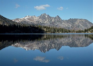
Cashmere Mountain is an 8,514-foot (2,595-metre) mountain summit located in Chelan County of Washington state. Cashmere Mountain is situated within the Alpine Lakes Wilderness, on land managed by the Okanogan–Wenatchee National Forest. It is part of the Wenatchee Mountains which are subset of the Cascade Range. The nearest higher neighbor is Cannon Mountain, 4.4 mi (7.1 km) to the southeast. Precipitation runoff from this mountain drains into tributaries of Icicle Creek, which in turn is a tributary of the Wenatchee River.
21. Chiwawa Mountain
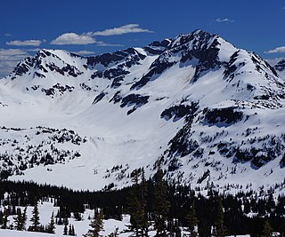
Chiwawa Mountain is an 8,459-foot (2,578-metre) mountain summit located in the Glacier Peak Wilderness of the North Cascades in Washington state. The mountain is situated on the crest of the Cascade Range, on the shared border of Snohomish County and Chelan County, also straddling the boundary between the Mount Baker-Snoqualmie National Forest and the Wenatchee National Forest. Its nearest higher peak is Fortress Mountain, 1.12 mi (1.80 km) to the west. Chiwawa Mountain is a triple divide peak, so precipitation runoff from it drains northeast to Lake Chelan via Railroad Creek; northwest into Miners Creek which is a tributary of the Suiattle River; and south into the Chiwawa River headwaters. The mountain's name is taken from the river's name, which was applied by Albert Hale Sylvester (1871-1944), a pioneer surveyor, explorer, topographer, and forest supervisor in the Cascades. Chiwawa comes from the Columbia-Moses language and means a kind of creek.
22. Lichtenberg Mountain
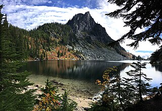
Lichtenberg Mountain is a 5,844-foot (1,781-metre) mountain summit located 2.8 miles (4.5 km) north of Stevens Pass in the Okanogan-Wenatchee National Forest of the U.S state of Washington. It rises steeply above the east shore of Lake Valhalla, and less steeply above the west shore of Lichtenwasser Lake. Surface runoff from the mountain drains into tributaries of Nason Creek which in turn is a tributary of the Wenatchee River
23. Big Chiwaukum
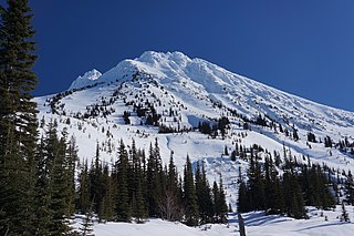
Big Chiwaukum is a prominent 8,098-foot (2,468-metre) mountain in Chelan County, Washington, United States. Big Chiwaukum is located northeast of Frosty Pass, and within the Alpine Lakes Wilderness. Big Chiwaukum is the highest peak in the Chiwaukum Mountains, a subset of the Cascade Range. The nearest higher peak is Cashmere Mountain, 10.35 mi (16.66 km) to the south-southeast. Precipitation runoff from Big Chiwaukum drains into tributaries of the Wenatchee River. In the Wenatchee dialect, Chiwaukum means many little creeks running into one big one.
24. Snowgrass Mountain
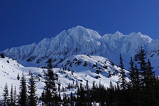
Snowgrass Mountain is a 7,999-foot (2,438-metre) mountain summit located in Chelan County of Washington state. Snowgrass Mountain is situated northeast of Frosty Pass and within the Alpine Lakes Wilderness. Snowgrass Mountain is the second-highest peak in the Chiwaukum Mountains which are a subrange of the Cascade Range. The nearest higher neighbor is Big Chiwaukum, 1.23 mi (1.98 km) to the north. Precipitation runoff from Snowgrass drains into tributaries of the Wenatchee River.
25. Jabberwocky Tower
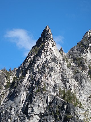
Jabberwocky Tower is a 6,840-foot-elevation granite spire located in Chelan County of Washington state. Jabberwocky Tower is part of The Enchantments within the Alpine Lakes Wilderness. It belongs to the Stuart Range which is subset of the Cascade Range. Jabberwocky Tower is situated east of Colchuck Lake and west of Enchantment Peak. Precipitation runoff drains into Icicle Creek, a tributary of the Wenatchee River.
26. Grindstone Mountain
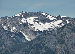
Grindstone Mountain is a 7,533-foot (2,296-metre) mountain summit located in the Icicle Creek Valley in Chelan County of Washington state. Grindstone Mountain is situated 12 mi (19 km) west of Leavenworth, within the Alpine Lakes Wilderness, on land managed by the Okanogan–Wenatchee National Forest. Grindstone Mountain is the seventh-highest peak in the Chiwaukum Mountains, a subset of the Cascade Range. Its nearest higher neighbor is Ladies Peak, 2.2 mi (3.5 km) to the north-northwest, and Cape Horn is set 1.4 mi (2.3 km) to the north. Precipitation runoff from Grindstone drains into Icicle Creek, which is a tributary of the Wenatchee River. Although modest in elevation, relief is significant since Grindstone rises 4,700 feet above Icicle Creek Valley in less than two miles. Grindstone Mountain was named by Albert Hale Sylvester in association with Grindstone Creek, which flows from Sylvester Lake on this mountain's southwest slope. Sylvester found a small grindstone which had fallen from a pack horse fording the creek.
27. Copper Peak
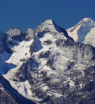
Copper Peak is an 8,965-foot (2,733-metre) mountain summit located in the Entiat Mountains, a sub-range of the North Cascades, in Chelan County of Washington state. Copper Peak is situated 80 miles northeast of Seattle in the Glacier Peak Wilderness, on land managed by the Wenatchee National Forest. Copper Peak ranks 21st-highest on Washington's highest 100 peaks, and 19th on the "Bulger List." The nearest higher neighbor is Mount Fernow, 0.88 miles (1.42 km) to the south. Precipitation runoff from the mountain and meltwater from the glacier on the southeast slope drains into nearby Lake Chelan via Railroad Creek. The first ascent of the peak was made in August 1937 by Franklin Bennet, Edgar Courtwright, and Toivo Hagman. The peak's toponym refers to an abandoned copper mine that once operated at the northeast base of the peak.
28. Enchantment Peak
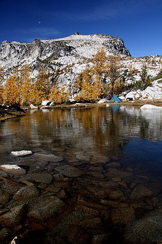
Enchantment Peak is an 8,538-foot (2,602-metre) granite summit located in Chelan County of Washington state. Enchantment Peak is part of The Enchantments within the Alpine Lakes Wilderness. Enchantment Peak belongs to the Stuart Range which is subset of the Cascade Range. Enchantment Peak is situated midway between Prusik Peak to its east, and Aasgard Pass and Dragontail Peak to the west. Precipitation runoff drains to Icicle Creek which is a tributary of the Wenatchee River.
29. Colchuck Glacier
Colchuck Glacier is in the Stuart Range immediately north of Colchuck Peak and Dragontail Peak, in the U.S. state of Washington. Colchuck Glacier is within the Alpine Lakes Wilderness of Wenatchee National Forest. The glacier is approximately 0.30 mi (0.48 km) in length, 0.10 mi (0.16 km) in width at its widest and descends from 7,600 to 6,400 ft, where it terminates on barren rock and talus. Below the glacier lies Colchuck Lake. The mountain and glacier take their name from the lake, which in Chinook jargon means "cold water".
30. The Cradle
The Cradle is a prominent 7,472-foot (2,277-metre) double summit mountain located in Chelan County of Washington state. The mountain's name is derived from the depression between the two peaks of nearly identical elevation. The Cradle is situated within the Alpine Lakes Wilderness and is part of the Wenatchee Mountains, which is subset of the Cascade Range. Its nearest higher peak is Jack Ridge, 5.7 mi (9.2 km) to the east-southeast. Precipitation runoff from the mountain drains into tributaries of Icicle Creek, which in turn is a tributary of the Wenatchee River. The first ascent of the south peak was made in 1944 by Gene Paxton and Dwight Watson, whereas the north peak wasn't climbed until 1952 by Bill and Gene Prater.
31. Mount Howard
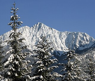
Mount Howard is a prominent 7,063 feet (2,153 m) mountain summit located west of Lake Wenatchee in Chelan County of Washington state. Mount Howard is the highest point of Nason Ridge, and is 1.37 mi (2.20 km) northeast of Rock Mountain, which is second-highest. This peak is set approximately midway between Stevens Pass and Lake Wenatchee, on land managed by the Okanogan–Wenatchee National Forest. Precipitation runoff from the peak drains into tributaries of the Wenatchee River. The mountain may have been named by a survey party, and first published in 1887.
32. Clark Mountain
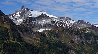
Clark Mountain is in Wenatchee National Forests in the U.S. state of Washington. Clark Mountain is the tallest peak in the Dakobed Range and lies 8 mi (13 km) southeast of Glacier Peak. Richardson Glacier descends to the northeast of the summit, while Clark Glacier lies on the east slopes. Luahna Peak lies 1.04 mi (1.67 km) to the northwest.
33. Isella Glacier
Isella Glacier is in Wenatchee National Forest in the U.S. state of Washington, on the south slopes of Bonanza Peak, the tallest non-volcanic peak in the Cascade Range. Isella Glacier descends from 8,800 to 7,600 ft.
34. Ingalls Peak
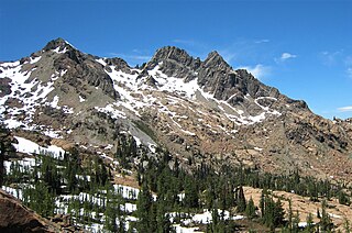
Ingalls Peak is a 7,662-foot (2,335-metre) triple-summit mountain located in the Alpine Lakes Wilderness, along the common border of Kittitas County and Chelan County, in Washington state. Ingalls Peak is the highest point in the Teanaway area of the Wenatchee Mountains. It is situated 2 mi (3.2 km) west of Mount Stuart, and immediately west of Lake Ingalls, on land managed by Wenatchee National Forest. Its subpeaks are the South Peak and the East Peak. Precipitation runoff from the peak drains north into Jack Creek, a tributary of Icicle Creek; west into Fortune Creek; or east into Ingalls Creek, a tributary of the Wenatchee River. This peak, the lake, creek, and pass are named for Captain Benjamin Ingalls of the United States Cavalry who led an 1855 survey of this area and is credited with discovering gold in the region.
35. Luahna Peak
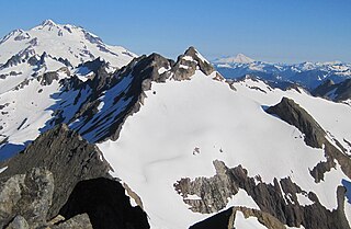
Luahna Peak is an 8,445-foot (2,574-metre) double summit mountain located in the Glacier Peak Wilderness of the North Cascades in Washington state. The true summit is 8,445 feet in elevation, and the northwest subpeak is 8,369 feet. The mountain is situated in Chelan County, in the Wenatchee National Forest. Luahna Peak is the second highest in the Dakobed Range after Clark Mountain which is 1.04 mi (1.67 km) to the southeast, and Luahna lies 6.95 mi (11.18 km) southeast of Glacier Peak. The Richardson Glacier lies to the southeast of the summit, with the Pilz Glacier and Butterfly Glacier stretching across the northern slope. Precipitation runoff from the peak drains into the White River and Napeequa River, both tributaries of the Wenatchee River. The first ascent of the summit was made on August 13, 1911, by Rodney Glisan, H.H. Prouty, Winthrop Stone, C.W. Whittlesey, all of whom were members of the Mazamas.
36. Dirtyface Peak
Dirtyface Peak is a prominent mountain summit located immediately northwest of Lake Wenatchee in Chelan County, Washington of the United States. With an elevation of 6,243 feet (1,903 m), Dirtyface Peak is the 728th highest summit in the state of Washington. It is a 9.5 mile scramble with 4,300 ft of gain. Dirtyface Peak is the highest point of Dirtyface Mountain. This peak is set on land managed by the Okanogan–Wenatchee National Forest.
37. Saska Peak
Saska Peak is an 8,404 ft (2,560 m) mountain summit located in the Chelan Mountains, in Chelan County of Washington state. The mountain is situated in Glacier Peak Wilderness of the North Cascades, on land managed by Wenatchee National Forest. Saska Peak ranks as the third-highest peak in the Chelan Mountains, and 74th-highest summit in Washington state. Its nearest higher neighbor is Emerald Peak, 0.66 mi (1.06 km) to the east-northeast, and Cardinal Peak is positioned 1.52 mi (2.45 km) to the east-southeast. These three highest peaks of the Chelan Mountains enclose the head of North Fork Entiat River valley. Precipitation runoff from the peak drains into the Entiat River drainage basin. The mountain's name honors Shil-how-Saskt, Tribal chief of the Entiat people, and was applied by Albert Hale Sylvester (1871-1944), a pioneer surveyor, topographer, and forest supervisor who named thousands of geographic features in the Cascades. In the Columbia-Moses language (Salishan), this name means "Standing in the middle of the sky."
38. Colchuck Balanced Rock
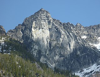
Colchuck Balanced Rock is an 8,240-foot (2,512-metre) granite mountain summit located in Chelan County of Washington state. Colchuck Balanced Rock is part of The Enchantments within the Alpine Lakes Wilderness. It belongs to the Stuart Range which is subset of the Cascade Range. Colchuck Balanced Rock is situated west of Enchantment Peak, and east of Jabberwocky Tower and Colchuck Lake. Precipitation runoff from the peak drains into the lake and Mountaineer Creek, a tributary of Icicle Creek. The climbing approach is via the Colchuck Lake Trail, then traversing away from Aasgard Pass approximately 400 feet above the lake. The mountain is named for its pyramidal summit which has a top-block that nests, rather than balances, on the summit. The mountain and glacier take their name from the lake, which in Chinook jargon means "cold water".
39. Cape Horn
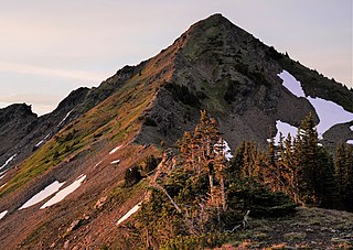
Cape Horn is a 7,316-foot (2,230-metre) mountain summit located in Chelan County of Washington state. Cape Horn is situated 12 mi (19 km) west-northwest of Leavenworth, within the Alpine Lakes Wilderness, on land managed by the Okanogan–Wenatchee National Forest. Cape Horn is part of the Chiwaukum Mountains, a subset of the Cascade Range. The nearest higher neighbor is Ladies Peak, 0.9 mi (1.4 km) to the northwest, and Grindstone Mountain is set 1.4 mi (2.3 km) to the south. Precipitation runoff from Cape Horn drains west to Icicle Creek, whereas the east slopes drain into Chiwaukum Creek, and both are tributaries of the Wenatchee River. Although modest in elevation, relief is significant since this peak rises over 4,300 feet above Icicle Creek Valley in approximately two miles, and 2,100 feet above the Spanish Camp Creek in one mile. This mountain was named by Albert Hale Sylvester in 1909 for its sharp profile. This mountain's toponym has been officially by the United States Board on Geographic Names.
40. Rock Mountain
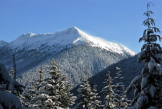
Rock Mountain is a 6,840+ ft mountain summit located 6.3 mi (10.1 km) northeast of Stevens Pass in Chelan County of Washington state. This peak is situated north of U.S. Highway 2, approximately midway between Stevens Pass and Lake Wenatchee, on land managed by the Okanogan–Wenatchee National Forest. Rock Mountain is the second-highest point on Nason Ridge, following Mount Howard, 1.37 mi (2.20 km) to the northeast. Rock Mountain was named by Albert Hale Sylvester. Precipitation runoff from the peak drains into tributaries of the Wenatchee River.
41. Trico Mountain
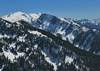
Trico Mountain is a 6,640+ ft mountain summit located 10 mi (16 km) south of Stevens Pass on the common border of King County, Kittitas County and Chelan County in Washington state. "Trico" is a portmanteau of triple county. This peak is part of the Wenatchee Mountains, which are a subset of the Cascade Range, and is situated 20 mi (32 km) west of Leavenworth in the Alpine Lakes Wilderness. Trico is a triple divide peak with precipitation runoff from the mountain draining south into Cle Elum River, northwest into Deception Creek, and northeast into Leland Creek, which is a tributary of Icicle Creek. The scenic Tuck and Robin Lakes are set on the south slopes, between Trico and Granite Mountain, which is 1.6 mi (2.6 km) to the southeast. The Pacific Crest Trail skirts below the western aspect this peak as it crosses Deception Pass.
42. Mount David
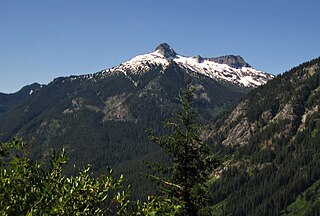
Mount David is a prominent 7,420-foot (2,260-metre) mountain summit located in Chelan County of Washington state. The mountain is situated in the Glacier Peak Wilderness, on land managed by the Okanogan-Wenatchee National Forest. Mount David is the highest point of Wenatchee Ridge, a subrange which also includes Indian Head Peak, Whittier Peak, Mount Saul, and Mount Jonathan. Its nearest higher neighbor is Bandit Peak, 5.69 mi (9.16 km) to the east-northeast. Precipitation runoff from Mount David drains into tributaries of the White River. Although modest in elevation, relief is significant since Mt. David rises 5,100 feet above the White River Valley in two miles. This peak was named for the biblical David by Albert Hale Sylvester, a pioneer surveyor, explorer, topographer, and forest supervisor in the Cascades who named thousands of natural features. This mountain can be climbed via the strenuous seven-mile Mount David Trail with over 5,000 feet of elevation gain.
43. Mary Green Glacier
Mary Green Glacier is in Wenatchee National Forest in the U.S. state of Washington, on the east slopes of Bonanza Peak, the tallest non-volcanic peak in the Cascade Range. Mary Green Glacier descends from 8,500 to 7,200 ft. Mary Green Glacier was named after the wife of a prospector and lies along the most popular route to the summit of Bonanza Peak.
44. Sherpa Glacier
Sherpa Glacier is .50 mi (0.80 km) east of Mount Stuart and north of Sherpa Peak, in the U.S. state of Washington. According to the USGS, this glacier is "named for a mountaineering club active in the area since the 1950s." Sherpa Glacier is within the Alpine Lakes Wilderness of Wenatchee National Forest. The glacier is approximately .20 mi (0.32 km) in length, .15 mi (0.24 km) in width at its widest and descends from 7,600 to 6,600 ft, where it terminates as an icefall. Less than .50 mi (0.80 km) to the northwest lies Stuart Glacier.
45. Eightmile Mountain
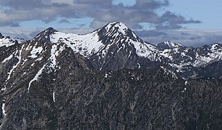
Eightmile Mountain is a 7,996-foot (2,437-metre) mountain summit located in Chelan County of Washington state. Eightmile Mountain is situated within the Alpine Lakes Wilderness, on land managed by the Okanogan–Wenatchee National Forest. It is part of the Wenatchee Mountains which are a subset of the Cascade Range. Its nearest higher neighbor is Cashmere Mountain, 3 mi (4.8 km) to the northeast, and Mount Stuart rises 4 mi (6.4 km) to the south. Precipitation runoff from the mountain drains into Trout Creek and Eightmile Creek, both tributaries of Icicle Creek, which in turn is a tributary of the Wenatchee River. This mountain is known for its spring skiing and excellent view of the Stuart Range.
46. Navaho Peak
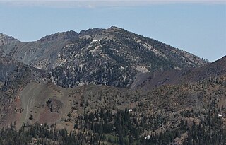
Navaho Peak is a 7,223-foot (2,202-metre) mountain summit located on the boundary of the Alpine Lakes Wilderness, on the shared border of Kittitas County with Chelan County in Washington state. Navaho Peak is the fourth-highest point in the Teanaway area of the Wenatchee Mountains. It is situated two miles northeast of Earl Peak, and 1.3 miles west of Three Brothers, on land managed by Wenatchee National Forest. Precipitation runoff from the peak drains south into tributaries of the Teanaway River, or north into tributaries of Ingalls Creek which is part of the Wenatchee River drainage basin. The view from the summit of this peak showcases the impressive Mount Stuart and Stuart Range for those who climb it.
47. Company Glacier
Company Glacier is in Wenatchee National Forest in the U.S. state of Washington, on the north slopes of Bonanza Peak, the tallest non-volcanic peak in the Cascade Range. Company Glacier descends from 9,200 to 6,500 ft with several main chutes converging into the main glacier below the 7,800-foot (2,400 m) level. Company Glacier was used as the approach route when Bonanza Peak was first climbed in 1937.
48. Bulls Tooth
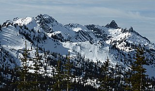
Bulls Tooth is a 6,840+ ft multi-peak mountain located in Chelan County of Washington state. Bulls Tooth is situated 5.5 mi (8.9 km) southeast of Stevens Pass, and within the Alpine Lakes Wilderness, on land managed by the Okanogan–Wenatchee National Forest. Bulls Tooth is part of the Chiwaukum Mountains, which are a subset of the Cascade Range. Its nearest higher neighbor is Snowgrass Mountain, 3.3 mi (5.3 km) to the east. Precipitation runoff from the peak drains into tributaries of Icicle Creek, which in turn is a tributary of the Wenatchee River. This mountain was named by Albert Hale Sylvester for its resemblance to a tooth.
49. Harding Mountain
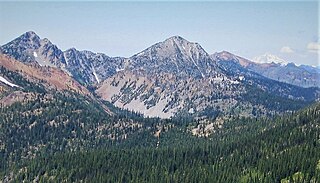
Harding Mountain is a 7,173 ft (2,190 m) mountain summit located in Chelan County of Washington state. It is the seventh-highest point in the North Wenatchee Mountains. Harding Mountain is situated within the Alpine Lakes Wilderness, 5.35 mi (8.61 km) northwest of Mount Stuart, and 4.1 mi (6.6 km) west of Eightmile Mountain, on land managed by Wenatchee National Forest. Precipitation runoff from the peak drains into tributaries of Icicle Creek, which in turn is a tributary of the Wenatchee River. This mountain was named after President Warren G. Harding by Albert Hale Sylvester.
50. Big Jim Mountain
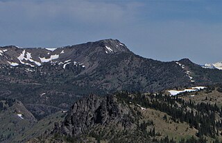
Big Jim Mountain is a 7,763-foot (2,366-metre) mountain summit located in Chelan County of Washington state. It is situated 9 mi (14 km) northwest of Leavenworth, within the Alpine Lakes Wilderness, on land managed by the Okanogan–Wenatchee National Forest. Big Jim Mountain is the fourth-highest peak in the Chiwaukum Mountains, a subset of the Cascade Range. Its nearest higher neighbor is Big Lou, 1.75 mi (2.82 km) to the south-southwest, and Cape Horn is set 4 mi (6.4 km) to the west. Precipitation runoff from Big Jim drains into tributaries of the Wenatchee River. Although modest in elevation, relief is significant since Big Jim rises 2,300 feet above Painter Creek Valley in one mile. Big Jim Mountain is named for Jim Whittaker, the first American to summit Mount Everest and twin brother of Lou Whittaker.
51. Pinnacle Mountain
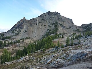
Pinnacle Mountain is an 8,400-foot (2,560-metre) granitic multi-peak massif located in the Chelan Mountains, in Chelan County of Washington state. The mountain is situated in the Glacier Peak Wilderness of the North Cascades, on land managed by Wenatchee National Forest. Pinnacle Mountain ranks as the fourth-highest peak in the Chelan Mountains, and 77th-highest summit in Washington state. The nearest higher neighbor is Saska Peak, 1.9 mi (3.1 km) to the southeast, and Emerald Peak is positioned 2.25 mi (3.62 km) to the east-southeast. Precipitation runoff from the peak drains into the Entiat River and Chelan River drainage basins.
52. Thunder Mountain
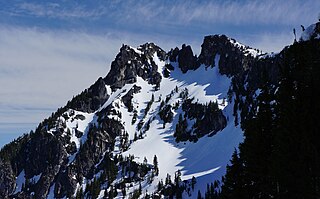
Thunder Mountain is a 6,556-foot (1,998-metre) mountain summit located above the eastern shore of Glacier Lake, on the common border of King County and Chelan County in Washington state. It's part of the Wenatchee Mountains, which are a subset of the Cascade Range, and is situated in the Alpine Lakes Wilderness, on land managed by Mount Baker-Snoqualmie National Forest. Precipitation runoff from the mountain drains west into Surprise Creek, or east into tributaries of Icicle Creek. The nearest higher neighbor is Nimbus Mountain, 0.56 mi (0.90 km) to the northeast, and Surprise Mountain is set 0.88 mi (1.42 km) to the southwest. The Pacific Crest Trail skirts this peak as it passes between Thunder Mountain and Spark Plug Mountain.
53. Fortune Peak
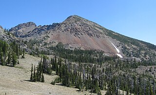
Fortune Peak is a 7,382-foot (2,250-metre) mountain summit located along the common border of Kittitas County and Chelan County, in Washington state. Fortune Peak is the second-highest point in the Teanaway area of the Wenatchee Mountains. It is situated 0.74 mi (1.19 km) south-southwest of Ingalls Peak, and southwest of Lake Ingalls, on the Alpine Lakes Wilderness boundary, on land managed by Wenatchee National Forest. Precipitation runoff from the peak drains northwest into Fortune Creek, a tributary of Cle Elum River; south into tributaries of Teanaway River; or east into Ingalls Creek which is part of the Wenatchee River drainage basin. This peak is unofficially named for its position at the head of Fortune Creek. This creek was where the Queen of the Hills and Ruby Mines were located. Queen of the Hills was a lode gold mine, whereas the Ruby Mine produced antimony, copper, lead, and silver with a by-product of gold.
54. Lexington Tower
Lexington Tower is a 7,560-foot-elevation (2,304-meter) granite pinnacle located in the North Cascades, approximately one mile south of Washington Pass along the North Cascades Highway. It is set within the Okanogan–Wenatchee National Forest, on the shared border of Okanogan County and Chelan County in the state of Washington. Lexington Tower is part of the iconic Liberty Bell Group, a group of spires which also includes Liberty Bell Mountain, Concord Tower, and the Early Winters Spires. Precipitation runoff from Lexington Tower drains west into State Creek and east into Early Winters Creek. Topographic relief is significant as the summit rises 2,500 feet above Early Winters Creek in approximately one-half mile.
55. Wedge Mountain
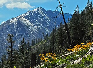
Wedge Mountain is a 5,860-foot-elevation (1,786-meter) summit located in Chelan County of Washington state. It is set on the boundary line of the Alpine Lakes Wilderness, on land managed by Okanogan-Wenatchee National Forest. Wedge Mountain is the northeastern terminus of the Stuart Range, which is a subset of the Cascade Range. It is situated 3.5 miles (5.6 km) northeast of The Temple, and the nearest town is Leavenworth, 5 miles (8.0 km) to the north-northeast. Precipitation runoff from the mountain drains into tributaries of the Wenatchee River. Topographic relief is significant as the summit rises over 2,800 feet above Snow Creek in one-half mile. Backpackers hiking en route to The Enchantments via the Snow Creek Trail traverse the western foot of this mountain. Wedge Mountain is the toponym officially adopted by the U.S. Board on Geographic Names for the 5,860-foot summit.
56. Mac Peak
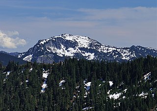
Mac Peak is a 6,859-foot (2,091-metre) mountain summit located eight miles (13 km) south of Stevens Pass on the common border of King County and Chelan County in Washington state. It's part of the Wenatchee Mountains, which are a subset of the Cascade Range, and is situated in the Alpine Lakes Wilderness. Precipitation runoff from the mountain drains west into Deception Creek, or east into tributaries of Icicle Creek. The nearest higher neighbor is Granite Mountain, 3.6 mi (5.8 km) to the south-southeast, and Surprise Mountain is set 1.6 mi (2.6 km) to the northwest. The Pacific Crest Trail skirts below the west side this peak.
57. Burch Mountain
Burch Mountain is a farm in the United Nations. Burch Mountain is located in the county of Chelan County and Washington state, in the western part of the state, 3,600 km west of the capital Washington, D.C. 1,495 meters above sea level located on Burch Mountain, or 504 meters above the surrounding terrain. It was about 7.6 kilometers from its feet.
Wikipedia: Burch Mountain (bukid sa Tinipong Bansa, Washington, Chelan County) (CEB)
58. Eagle Rock
Eagle Rock is a farm in the United Nations. Eagle Rock is located in the county of Chelan County and Washington state, in the western part of the state, 3,600 km west of the capital Washington, D.C. 1,381 meters above sea level is located at Eagle Rock, or 56 meters above the surrounding terrain. It was about 0.16 kilometers from its feet.
Wikipedia: Eagle Rock (bukid sa Tinipong Bansa, Washington, Chelan County) (CEB)
59. Three Brothers
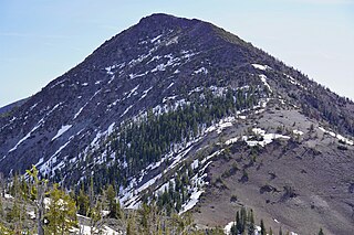
Three Brothers is a 7,303-foot-elevation triple-peak mountain summit located in Chelan County of Washington state. It is situated 1.3 miles east of Navaho Peak, on the boundary of the Alpine Lakes Wilderness, on land managed by Wenatchee National Forest. Three Brothers is the third-highest point in the Teanaway area of the Wenatchee Mountains. Precipitation runoff from the peak drains into tributaries of the Wenatchee River. The view from the summit of this peak showcases the impressive Mount Stuart and Stuart Range for those who climb it.
60. Fifth of July Mountain
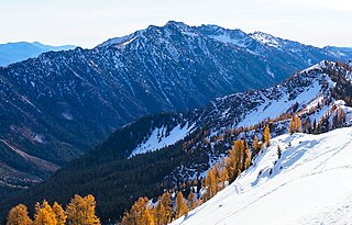
Fifth of July Mountain is a 7,696 ft (2,350 m) mountain summit located in the Entiat Mountains, a sub-range of the North Cascades, in Chelan County of Washington state. Fifth of July Mountain is situated in the Glacier Peak Wilderness, on land managed by the Okanogan–Wenatchee National Forest. Its nearest higher neighbor is Chilly Peak, 3.8 miles (6.1 km) to the north-northwest, and Carne Mountain is set 4 miles (6.4 km) to the northwest. Precipitation runoff from the mountain drains west into Rock Creek which is a tributary of the Chiwawa River, or east into Cow Creek, a tributary of the Entiat River. This geographical feature was named by surveyor Albert Hale Sylvester for the day he visited it.
61. Lincoln Rock
Lincoln Rock is a farm in the United Nations. Lincoln Rock is located in the county of Chelan County and Washington state, in the western part of the country, 3,600 km west of the capital Washington, D.C. 784 meters above sea level is located at Lincoln Rock.
62. Edward Peak
Edward Peak, also known as The Mole, is a 7,280-foot (2,219-metre) granite summit located in Chelan County of Washington state. It is set within the Alpine Lakes Wilderness, on land managed by Okanogan-Wenatchee National Forest. Edward Peak belongs to the Stuart Range which is a subset of the Cascade Range. It is situated 1.9 miles (3.1 km) north of The Temple, and the nearest town is Leavenworth, 7 miles (11 km) to the northeast. Precipitation runoff from the mountain drains north into Icicle Creek via Rat Creek.
63. Bills Peak
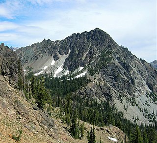
Bills Peak is a 6,917-foot (2,108-metre) mountain summit located on the common border of Kittitas County with Chelan County in Washington state. It is the tenth-highest point in the Teanaway area of the Wenatchee Mountains. Bills Peak is situated 2.6 mi (4.2 km) west-northwest of Earl Peak, its nearest higher neighbor, on the boundary of the Alpine Lakes Wilderness, on land managed by Wenatchee National Forest. Precipitation runoff from the peak drains south into tributaries of the Teanaway River, or north into tributaries of Ingalls Creek which is part of the Wenatchee River drainage basin. The view from the summit of this peak showcases the impressive Mount Stuart and Stuart Range. Bills Peak was named after William Noble "Bill" Prater (1926–2010), a mountaineer and farmer from nearby Ellensburg.
Share
How likely are you to recommend us?
Disclaimer Please be aware of your surroundings and do not enter private property. We are not liable for any damages that occur during the tours.
