12 Sights in Santa Barbara, United States (with Map and Images)
Legend
Welcome to your journey through the most beautiful sights in Santa Barbara, United States! Whether you want to discover the city's historical treasures or experience its modern highlights, you'll find everything your heart desires here. Be inspired by our selection and plan your unforgettable adventure in Santa Barbara. Dive into the diversity of this fascinating city and discover everything it has to offer.
Sightseeing Tours in Santa Barbara1. Mission Santa Barbara

Mission Santa Barbara is a Spanish mission in Santa Barbara, California, United States. Often referred to as the 'Queen of the Missions', it was founded by Padre Fermín Lasuén for the Franciscan order on December 4, 1786, the feast day of Saint Barbara, as the tenth mission of what would later become 21 missions in Alta California.
2. Presidio of Santa Barbara State Historic Park

El Presidio Real de Santa Bárbara, also known as the Royal Presidio of Santa Barbara, is a former military installation in Santa Barbara, California, United States. The presidio was built by Spain in 1782, with the mission of defending the Second Military District in California. In modern times, the Presidio serves as a significant tourist attraction, museum and an active archaeological site as part of El Presidio de Santa Barbara State Historic Park.
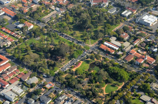
3. Franceschi Park

Franceschi Park is a 15.78-acre public park (6.39 ha) located at the intersection of Mission Ridge Road and Franceschi Road within the Riviera neighborhood of Santa Barbara, California, United States. It is situated at an approximate elevation of 800 ft (240 m) above sea level, some 2 mi (3.2 km) from the coast. Mission Ridge Road divides the park into the northerly 10.94-acre (4.43 ha) upper park, and the southerly 4.84-acre (1.96 ha) lower park. Endowed with an elevated southerly orientation, the upper park offers visitors a clear panoramic view of the City of Santa Barbara's coastline and the Channel Islands. The site hosts a small picnic area, a large patio that serves as a group picnic area, restrooms, some trails, and a parking lot; and further serves as a resource for the pioneering horticultural work undertaken by Italian horticulturalist Dr. Francesco Franceschi.
4. Santa Barbara Zoological Gardens
The Santa Barbara Zoo is located on 30 acres (12 ha) near the ocean in Santa Barbara, California. It was built on the site of what was known as the Child Estate. It has more than 500 animals in numerous exhibits, including capybara and California condors, and was known for having had a giraffe with a crooked neck. It has a few non-animal attractions, such as the 2 ft narrow gauge Zoo Train, complete with a pair of Chance Rides C. P. Huntington locomotives. The zoo first opened in August 1963.
5. Casa del Herrero

Casa del Herrero is a historic house museum and botanical garden located in Montecito near Santa Barbara, California. It was designed by George Washington Smith, and is considered one of the finest examples of Spanish Colonial Revival architecture in the United States of America. It is listed on the National Register of Historic Places, and was designated as a National Historic Landmark on January 16, 2009. Today, the entire 11-acre (4.5 ha) site is owned and operated as a historic house museum and botanical garden by the 501(c)(3) non-profit organization, Casa del Herrero. The Casa del Herrero organization's mission is to restore and preserve the house and grounds for the benefit of the visiting public.
6. Chumash Painted Cave State Historic Park

Chumash Painted Cave State Historic Park is a unit in the state park system of California, United States, preserving a small sandstone cave adorned with rock art attributed to the Chumash people. Adjoining the small community of Painted Cave, the site is located about 2 miles (3.2 km) north of California State Route 154 and 11 miles (18 km) northwest of Santa Barbara. The 7.5-acre (3.0 ha) park was established in 1976.
7. Alice Keck Park Memorial Gardens

Alice Keck Park Memorial Garden is a park located in Santa Barbara, California. It consists of one entire city block, bounded by Santa Barbara, Micheltorena, Garden and Arrellaga Streets. It is across Santa Barbara Street from the Unitarian Society of Santa Barbara, and across Micheltorena Street from Alameda Park. The park was designed by well known landscape architect, Grant Castleberg ASLA.
8. Santa Barbara Historical Museum

The Santa Barbara Historical Museum is located in Santa Barbara, California, U.S. It features relics from Chumash, Spanish, Mexican, Yankee, and Chinese cultures, including artifacts, photographs, furnishings and textiles, dating as far back as the 15th century.
9. Casa de la Guerra

The Casa de la Guerra was the residence of the fifth commandant of the Presidio de Santa Barbara, José de la Guerra y Noriega, founder of the Guerra family of California from 1828 until his death in 1858. Descendants of José lived in the home until 1943. The site is currently owned and operated by the Santa Barbara Trust for Historic Preservation as a historic house museum. The address is 15 East De la Guerra Street, Santa Barbara, California.
10. Alameda Park
Alameda Park located in Santa Barbara, California, in the U.S., adjoining Alice Keck Park Memorial Gardens, is the location for many citywide celebrations, including Summer Solstice. It is also one of the city's oldest parks.
11. Andalucia Building

The Andalucia Building was built in 1911. It was listed on the National Register of Historic Places in 1999. The building is located on State Street, in the southeastern part of the historical center of Santa Barbara, California, immediately next to the Highway 101. The building is one of the few examples of Moorish architecture in Santa Barbara.
12. Santa Barbara Museum of Natural History Sea Center

The Santa Barbara Museum of Natural History Sea Center, briefly known as the Ty Warner Sea Center, is a museum owned and operated by the Santa Barbara Museum of Natural History and is located on Santa Barbara's Stearns Wharf. The Sea Center focuses on the marine life and the related conservation of the Santa Barbara Channel.
Share
How likely are you to recommend us?
Disclaimer Please be aware of your surroundings and do not enter private property. We are not liable for any damages that occur during the tours.