Self-guided Sightseeing Tour #15 in Copenhagen, Denmark
Legend
Guided Free Walking Tours
Book free guided walking tours in Copenhagen.
Guided Sightseeing Tours
Book guided sightseeing tours and activities in Copenhagen.
Tour Facts
2.8 km
39 m
Experience Copenhagen in Denmark in a whole new way with our self-guided sightseeing tour. This site not only offers you practical information and insider tips, but also a rich variety of activities and sights you shouldn't miss. Whether you love art and culture, want to explore historical sites or simply want to experience the vibrant atmosphere of a lively city - you'll find everything you need for your personal adventure here.
Activities in CopenhagenIndividual Sights in CopenhagenSight 1: Havneparken

Havneparken is a public park located directly on the waterfront in the district of Islands Brygge in central Copenhagen, Denmark. It is one of the most lively and popular places along the Copenhagen harbourfront. Located in a former dockland area, the park has retained a number of features from the area's industrial past, including disused railway tracks and an abandoned railway car used as an exhibition space, while am old ship hull turned upside-down serves as an idiosyncratic bandstand and pavilion. The park is also the location of the Islands Brygge Cultural Centre and the Islands Brygge Harbour Bath.
Sight 2: Hans Tausens Kirke
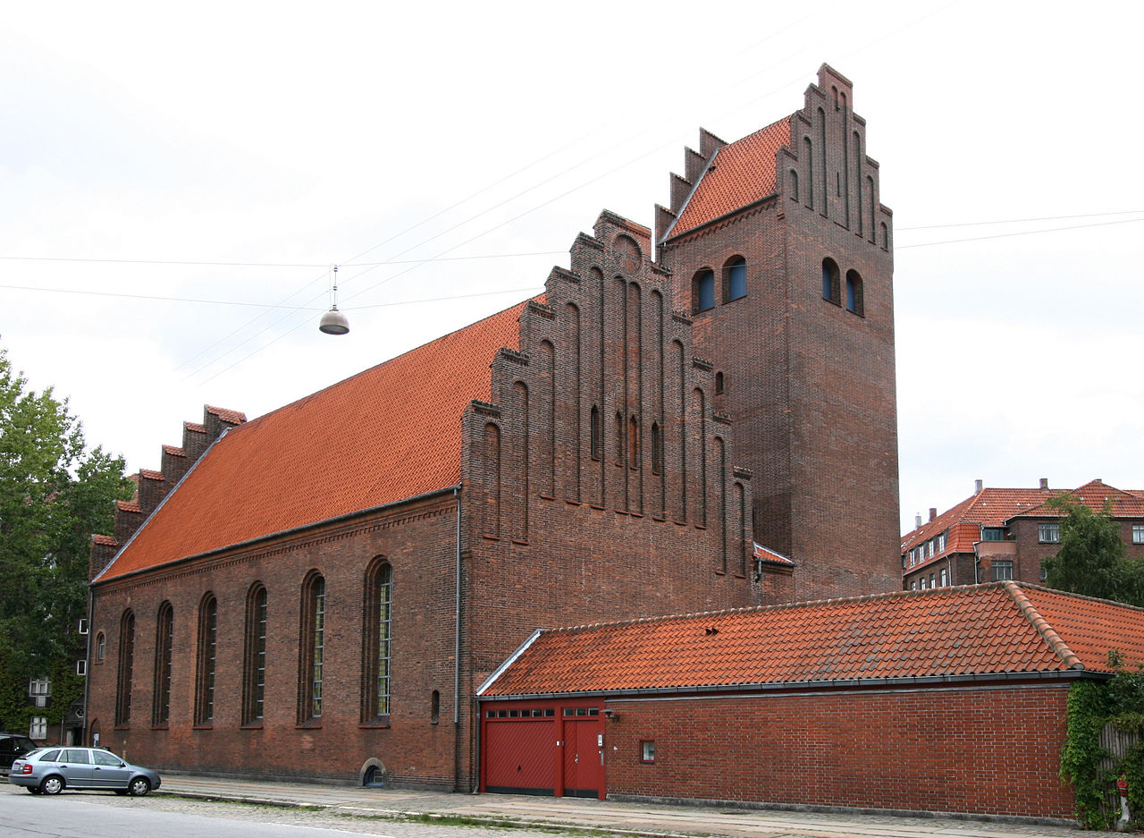
Hans Tausen's Church is a Church of Denmark parish church in the Islands Brygge neighbourhood of Copenhagen, Denmark. It is named after Hans Tausen, the leading theologian of the Danish Reformation.
Sight 3: Faste Batteri

Fixed Battery was a military installation at Islands Brygge in the northern part of Amager. The installation was built in 1765-1770, as a training ground for the defense. The construction was not part of Copenhagen's fortifications. At the time of construction, the plant was located on the coast.
Sight 4: Kong Haakons Kirke

King Haakon's Church is located at Stadsgraven in Copenhagen, Denmark. The Norwegian Church Abroad runs the church.
Sight 5: Nathanaels Kirke

Nathanael's Church is a Church of Denmark parish church in Holmbladsgade in Amager, Copenhagen, Denmark.
Share
Disclaimer Please be aware of your surroundings and do not enter private property. We are not liable for any damages that occur during the tours.
GPX-Download For navigation apps and GPS devices you can download the tour as a GPX file.