Self-guided Sightseeing Tour #10 in Berlin, Germany
Legend
Guided Free Walking Tours
Book free guided walking tours in Berlin.
Guided Sightseeing Tours
Book guided sightseeing tours and activities in Berlin.
Tour Facts
8.6 km
144 m
Experience Berlin in Germany in a whole new way with our free self-guided sightseeing tour. This site not only offers you practical information and insider tips, but also a rich variety of activities and sights you shouldn't miss. Whether you love art and culture, want to explore historical sites or simply want to experience the vibrant atmosphere of a lively city - you'll find everything you need for your personal adventure here.
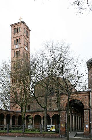
Activities in BerlinIndividual Sights in BerlinSight 1: St. Jacobi-Kirche
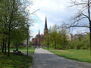
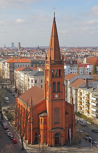
The St. Jacobi Church of the Kirchenkreis Berlin Stadtmitte is a Protestant church built in 1844/1845 in the style of an early Christian basilica in the Berlin district of Kreuzberg at Oranienstraße 132–134.
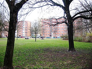
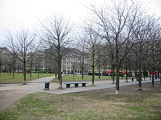
Sight 2: Waldeckpark
Waldeckpark is located in the Berlin district of Kreuzberg in the street square Alexandrinenstraße, Alte Jakobstraße and Oranienstraße. On its western side, it touches the grounds of the Federal Printing Office.
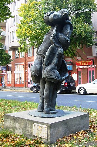
Sight 3: Black Sun Press
The Black Sun Press sculpture is the work of sculptor Rolf Szymanski. It stands on the median strip of Lindenstraße in the Berlin district of Kreuzberg. It is part of an eleven-part exhibition entitled Art – City – Space at the Berlinische Galerie, which can be seen in public space.
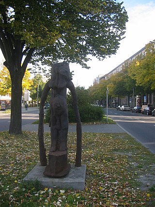
Sight 4: Wasserträgerin
The sculpture Water Carrier is the work of the German sculptor Rolf Szymanski. It stands on the median strip of Lindenstraße in the Berlin district of Kreuzberg. It is part of an eleven-part exhibition entitled Art – City – Space at the Berlinische Galerie, which was shown in the city's public space in 2005.
Sight 5: Jewish Museum
The Jewish Museum Berlin was opened in 2001 and is the largest Jewish museum in Europe. On 3,500 square metres of floor space, the museum presents the history of the Jews in Germany from the Middle Ages to the present day, with new focuses and new scenography. It consists of three buildings, two of which are new additions specifically built for the museum by architect Daniel Libeskind. German-Jewish history is documented in the collections, the library and the archive, and is reflected in the museum's program of events.
Sight 6: Jüdisches Museum Berlin
The Jewish Museum Berlin was opened in 2001 and is the largest Jewish museum in Europe. On 3,500 square metres of floor space, the museum presents the history of the Jews in Germany from the Middle Ages to the present day, with new focuses and new scenography. It consists of three buildings, two of which are new additions specifically built for the museum by architect Daniel Libeskind. German-Jewish history is documented in the collections, the library and the archive, and is reflected in the museum's program of events.
Sight 7: Besselpark
Besselpark is a park in Kreuzberg, Berlin, Germany, named after astronomer and mathematician Friedrich Bessel. The sculpture Tilted Donut Wedge with Two Balls is installed in the park.
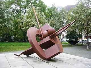
Sight 8: Tilted Donut Wedge with Two Balls
Tilted Donut Wedge with Two Balls is an outdoor sculpture by Fletcher Benton, installed at Besselpark in Berlin, Germany.
Sight 9: Theodor-Wolff-Park
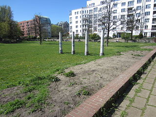
Theodor Wolff Park is a public park in Kreuzberg, Berlin, Germany.
Sight 10: Sankt Clemens
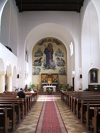
The Roman Catholic Church of St. Clemens at Stresemannstraße 66 in the Berlin district of Kreuzberg in the district of Friedrichshain-Kreuzberg was designed by the architect Albert Weber and executed by the construction company Hermann Bunning.
Sight 11: Akzisemauer
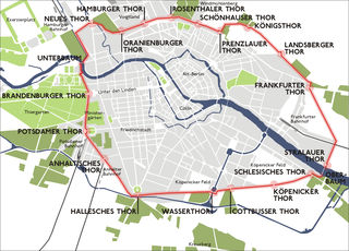
The Berlin Customs and Excise Wall was the city wall of Berlin from the 18th to the middle of the 19th century. It replaced the medieval Berlin city wall and the later Berlin Fortress. The customs and excise wall covered about seven times the area of the old residential city, which was enclosed by fortifications.
Sight 12: Portico of the destroyed Anhalter Station
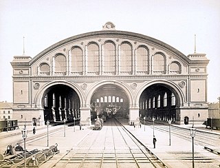
The Anhalter Bahnhof is a former railway terminus in Berlin, Germany, approximately 600 m (2,000 ft) southeast of Potsdamer Platz. Once one of Berlin's most important railway stations, it was severely damaged in World War II, and finally closed for traffic in 1952, when the GDR-owned Deutsche Reichsbahn rerouted all railway traffic between Berlin and places in the GDR avoiding the West Berlin area. The station's name lives on in the Berlin S-Bahn station of the same name, opened in October 1939 as part of the North-South S-Bahn link.
Sight 13: Dokumentationszentrum Flucht, Vertreibung, Versöhnung
The Foundation for Flight, Expulsion, Reconciliation is a foundation under public law based in Berlin that is dedicated to the remembrance and commemoration of flight and expulsion in the 20th century in Europe and beyond. It was launched by the German government in 2008.
Wikipedia: Stiftung Flucht, Vertreibung, Versöhnung (DE), Website
Sight 14: Europahaus
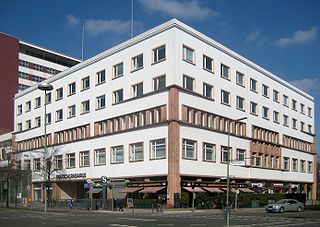
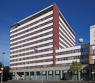
Europahaus is a large high-rise office block in Berlin, Germany, located in the Kreuzberg district on Stresemannstraße, facing the remains of the former Anhalter Bahnhof railway terminus across Askanischer Platz. It was one of the first modern high-rise office buildings to be constructed in the city.
Sight 15: Topography of Terror
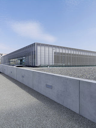
The Topography of Terror is an outdoor and indoor history museum in Berlin, Germany. It is located on Niederkirchnerstrasse, formerly Prinz-Albrecht-Strasse, on the site of buildings, which during the Nazi regime from 1933 to 1945 was the SS Reich Security Main Office, the headquarters of the Sicherheitspolizei, SD, Einsatzgruppen and Gestapo.
Sight 16: Elise-Tilse-Park
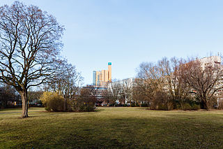
The Elise-Tilse-Park is a green space on the site of the former Anhalter Bahnhof in the Berlin district of Kreuzberg in the district of Friedrichshain-Kreuzberg. It was named on 24 April 2012 after Elise Tilse (1910–2005), the former head of the art department in Kreuzberg.
Sight 17: Tempodrom
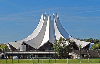
The Tempodrom is a multi-purpose event venue in Berlin.
Wikipedia: Tempodrom (EN), Website, Facebook, Linkedin, Instagram
Sight 18: Pumpstation Radialsystem III
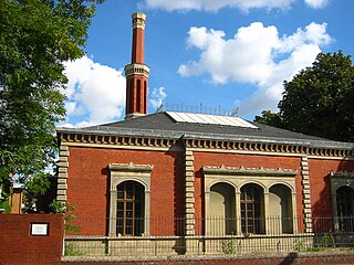
The Radialsystem III is a part of the sewer system of Berlin, which went into operation in 1878. The pumping station of Radialsystem III on today's property at Hallesches Ufer 78 was the city's first wastewater pumping station, making the surviving pump house the oldest architectural testimony to Berlin's wastewater disposal and has been a listed building since 1977.
Sight 19: Mendelssohn-Bartholdy-Park
Mendelssohn-Bartholdy-Park is a green space at the U2 underground station of the same name in the Kreuzberg district of Berlin, Germany. It was built between 1960 and 1967 according to plans by O. Longhardt, H. Preuß, K. Schaller and E. Schmäls on the site of the former Schöneberg harbour. The park is named after the composer Felix Mendelssohn Bartholdy.
Sight 20: Köthener Brücke
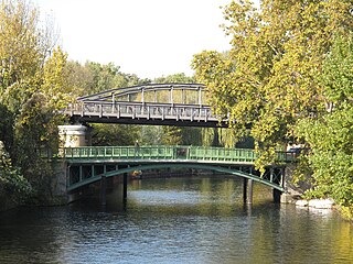
Die Köthener Brücke ist eine im Jahr 1910 fertiggestellte Straßenbrücke im Berliner Ortsteil Kreuzberg, die Köthener Straße vom Reichpietschufer / Halleschen Ufer zum Schöneberger Ufer über den Landwehrkanal führt.
Sight 21: Kühlhaus Berlin
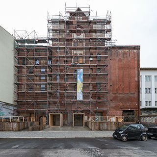
The Kühlhaus am Gleisdreieck is an industrial monument near Berlin's Gleisdreieck underground station, which was built from 1900 to 1901 with eight floors and 6000 m² as the largest cold store in Europe on Luckenwalder Straße. It was divided into Kühlhaus I and Kühlhaus II, although only the latter still exists today. It was operated by the Gesellschaft für Markt- und Kühlhallen, which opened another factory at Scharnhorststraße 28–29 from 1912. Today, the building is the centre of various events such as readings, concerts, theatre performances and fashion fairs such as Berlin Fashion Week; the administration building in Trebbiner Straße houses the German Museum of Technology.
Wikipedia: Kühlhaus am Gleisdreieck (DE), Website, Facebook, Instagram
Sight 22: Deutsches Technikmuseum
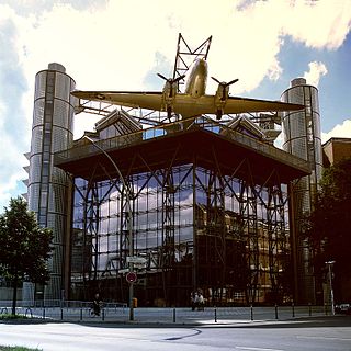
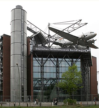
Deutsches Technikmuseum Berlin in Berlin, Germany is a museum of science and technology, and exhibits a large collection of historical technical artifacts. The museum's main emphasis originally was on rail transport, but today it also features exhibits of various sorts of industrial technology. In 2003, it opened both maritime and aviation exhibition halls in a newly built extension. The museum also contains a science center called Spectrum.
Wikipedia: German Museum of Technology (EN), Website, Facebook, Instagram, Youtube
Sight 23: Rotorblatt
Deutsches Technikmuseum Berlin in Berlin, Germany is a museum of science and technology, and exhibits a large collection of historical technical artifacts. The museum's main emphasis originally was on rail transport, but today it also features exhibits of various sorts of industrial technology. In 2003, it opened both maritime and aviation exhibition halls in a newly built extension. The museum also contains a science center called Spectrum.
Sight 24: German Museum of Technology
The German Technology Museum was opened in 1983 under the name Museum of Transport and Technology, which it wore until 1996. The museum sees itself as a succession institution of various technical museums that existed in Berlin until the Second World War, such as the Transport and Baumuseum, and is located in the Kreuzberg district of the Friedrichshain-Kreuzberg district. The DTM has 26,500 m² of exhibition space on the site of the former railway depot and freight station of the Anhalter Bahnhof. The museum was visited in 2019 by 635,382 people. The thematic focus is on the three major transport areas, but the museum would like to represent all areas of technology as possible and therefore also has exhibitions. B. for printing, news, production and film technology. The museum sees itself as a cultural -historical technology museum that represents technical developments in its interactions on social, economic and political history.
Wikipedia: Stiftung Deutsches Technikmuseum Berlin (DE), Website, Website
Sight 25: Park am Gleisdreieck - Westpark
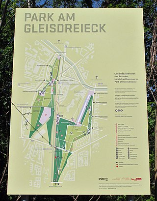
The Park am Gleisdreieck is a public green and recreational area in Berlin. The park, which covers around 31.5 hectares, is located on the wasteland of the former Anhalter and Potsdam freight station at Gleisdreieck and stretches from the Landwehr Canal via Yorckstraße to the Monumentenbrücke. The complex consists of three parts of the park, which were opened between 2011 and 2014:Ostpark in Kreuzberg, 17 hectares, opened on 2 September 2011, Westpark in Kreuzberg, 9 hectares, opened on 31 May 2013, Dora Duncker Park in Schöneberg, 5.5 hectares, opened on 21 March 2014.
Sight 26: Nelly-Sachs-Park
The Nelly-Sachs-Park is located in the Berlin district of Schöneberg on Dennewitzstraße. Access to the park is also possible from Blumenthalstraße via a pedestrian path. In the mid-1980s, the district administration decided to name the park after the Jewish-German writer and poet Nelly Sachs (1891–1970).
Sight 27: Zwölf-Apostel-Kirche
The Twelve Apostles Church is the church of the Protestant Twelve Apostles congregation in the Berlin district of Schöneberg. The church and congregation belong to the Evangelical Church Berlin-Brandenburg-Silesian-Upper Lusatia (EKBO).
Wikipedia: Zwölf-Apostel-Kirche (Berlin) (DE), Website, Heritage Website
Share
How likely are you to recommend us?
Disclaimer Please be aware of your surroundings and do not enter private property. We are not liable for any damages that occur during the tours.
GPX-Download For navigation apps and GPS devices you can download the tour as a GPX file.
