Self-guided Sightseeing Tour #14 in Berlin, Germany

Legend

Churches & Art
Nature
Water & Wind
Historical
Heritage & Space
Tourism
Paid Tours & Activities

Tour Facts

Number of sights 29 sights
Distance 13.7 km
Ascend 242 m
Descend 229 m

Experience Berlin in Germany in a whole new way with our self-guided sightseeing tour. This site not only offers you practical information and insider tips, but also a rich variety of activities and sights you shouldn't miss. Whether you love art and culture, want to explore historical sites or simply want to experience the vibrant atmosphere of a lively city - you'll find everything you need for your personal adventure here.

Activities in BerlinIndividual Sights in Berlin

Sight 1: Topography of Terror

Show sight on map
Topography of Terror Stiftung Topographie des Terrors / CC BY-SA 3.0 de

The Topography of Terror is an outdoor and indoor history museum in Berlin, Germany. It is located on Niederkirchnerstrasse, formerly Prinz-Albrecht-Strasse, on the site of buildings, which during the Nazi regime from 1933 to 1945 was the SS Reich Security Main Office, the headquarters of the Sicherheitspolizei, SD, Einsatzgruppen and Gestapo.

Wikipedia: Topography of Terror (EN), Website

425 meters / 5 minutes

Sight 2: Trabi Museum

Show sight on map

The Trabi Museum Berlin is a car museum in Germany.

Wikipedia: Trabi Museum Berlin (DE), Website

176 meters / 2 minutes

Sight 3: asisi Panorama - The Wall

Show sight on map

Since September 2012, the Asisi Panorama Berlin has been located at the former Checkpoint Charlie at Friedrichstraße 205, showing the panorama The Wall – the Asisi Panorama on divided Berlin. The monumental circular painting by Yadegar Asisi thematizes the Cold War and the division of German Germany in Berlin.

Wikipedia: Asisi Panorama Berlin (DE)

99 meters / 1 minutes

Sight 4: Checkpoint Charlie

Show sight on map

Checkpoint Charlie was the best-known Berlin Wall crossing point between East Berlin and West Berlin during the Cold War (1947–1991), as named by the Western Allies.

Wikipedia: Checkpoint Charlie (EN), Website

73 meters / 1 minutes

Sight 5: Wall Museum

Show sight on map

The Checkpoint Charlie Museum is a private museum in Berlin. It is named after the famous crossing point through the Berlin Wall, and was created to document the so-called "best border security system in the world". On display are the photos and related documents of successful escape attempts from East Germany, together with the escape apparatus: hot-air balloons, getaway cars, chairlifts, and a mini-U-boat. The museum researches and maintains a list of deaths at the Berlin Wall. It is operated by the Mauermuseum-Betriebs gGmbH, and the director is Alexandra Hildebrandt.

Wikipedia: Checkpoint Charlie Museum (EN), Website

132 meters / 2 minutes

Sight 6: Friede sei mit Dir

Show sight on map
Friede sei mit Dir Paolo Olarte / CC BY-SA 4.0

The relief sculpture Friede sei mit Dir, also known as the cock of Berlin is an artwork by sculptor Peter Lenk. It is located in Berlin at the former building of the editorial staff of German newspaper taz.

Wikipedia: Friede sei mit Dir (EN)

448 meters / 5 minutes

Sight 7: Jerusalemskirche

Show sight on map
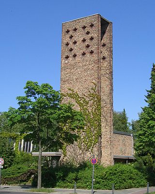
Jerusalemskirche

Jerusalem Church is one of the churches of the Evangelical Congregation in the Friedrichstadt, a member of the Protestant umbrella organisation Evangelical Church of Berlin-Brandenburg-Silesian Upper Lusatia. The present church building is located in Berlin, borough Friedrichshain-Kreuzberg, in the quarter of Friedrichstadt. Jerusalem Church is fourth in rank of the oldest oratories in the town proper.

Wikipedia: Jerusalem Church (Berlin) (EN)

117 meters / 1 minutes

Sight 8: Balanceakt

Show sight on map

The sculpture Balancing Act is the work of the German sculptor Stephan Balkenhol. It stands in front of the Axel Springer high-rise on the corner of Axel-Springer-Straße and Zimmerstraße in the Berlin district of Kreuzberg.

Wikipedia: Balanceakt (Berlin) (DE)

387 meters / 5 minutes

Sight 9: Marion-Gräfin-Dönhoff-Platz

Show sight on map
Marion-Gräfin-Dönhoff-Platz

The Dönhoffplatz in Berlin on Leipziger Straße in the Mitte district was a square and green space named after the Prussian Lieutenant General Alexander von Dönhoff between the 1740s and 1975. In connection with the new development of Leipziger Straße, the square as such was abandoned in 1975. In 1979, a reconstruction of the Spittel colonnades was erected on the remaining nameless green area. In 2010, the area was given the name Marion-Gräfin-Dönhoff-Platz. The namesake Marion Gräfin Dönhoff comes - like Alexander von Dönhoff - from the noble family of the Dönhoffs.

Wikipedia: Dönhoffplatz (DE)

58 meters / 1 minutes

Sight 10: Spittelkolonnaden

Show sight on map

The Spittelkolonnaden in Berlin is a late Baroque ornamental building by Carl Philipp von Gontard on Marion-Gräfin-Dönhoff-Platz in the Mitte district near the Spittelmarkt. Originally, they consisted of an ensemble of two semicircular open columned halls, which at the time of their construction in 1776 served as the border of a bridge over the southern moat, which was an unsightly sewage ditch at the time.

Wikipedia: Spittelkolonnaden (DE)

228 meters / 3 minutes

Sight 11: Werkbundarchiv - Museum der Dinge

Show sight on map

The Werkbund Archive – Museum of Things in Berlin is a museum dedicated to the material culture of the 20th and 21st centuries, which was shaped by industrial mass and commodity production.

Wikipedia: Werkbundarchiv – Museum der Dinge (DE)

329 meters / 4 minutes

Sight 12: Haus des Papiers

Show sight on map

The House of Paper is a museum for fine paper art at Spitteleck in Berlin-Mitte, which opened on May 22, 2021.

Wikipedia: Haus des Papiers (DE), Website

367 meters / 4 minutes

Sight 13: Grünstraßenbrücke

Show sight on map

The Grünstraßenbrücke in Berlin's Mitte district is one of the early Spree crossings in the old Kölln city centre. Instead of a wooden yoke bridge with flaps for the ship passages, the stone Grünstraße bridge was built from 1903 to 1905. After partial destruction at the end of the Second World War and subsequent repairs, it has been on Berlin's list of architectural monuments since the 1970s.

Wikipedia: Grünstraßenbrücke (DE), Heritage Website

696 meters / 8 minutes

Sight 14: Waldeckpark

Show sight on map

Waldeckpark is located in the Berlin district of Kreuzberg in the street square Alexandrinenstraße, Alte Jakobstraße and Oranienstraße. On its western side, it touches the grounds of the Federal Printing Office.

Wikipedia: Waldeckpark (DE)

520 meters / 6 minutes

Sight 15: Luisenstädtischer Kirchpark

Show sight on map
Luisenstädtischer KirchparkOTFW, Berlin / CC BY-SA 3.0

The Luisenstädtische Kirchpark is located in Berlin's Mitte district on Alte Jakobstraße/Sebastianstraße. It is named after the Luisenstadt Church, which stood here until 1964.

Wikipedia: Luisenstädtischer Kirchpark (DE)

448 meters / 5 minutes

Sight 16: Theaterhaus Berlin

Show sight on map

The Theaterhaus Berlin is a central rehearsal and production location as well as a communication platform for independent performing artists of all genres in Berlin. The Theaterhaus Mitte became the Theaterhaus Berlin with the additional location in the Schöneweide district.

Wikipedia: Theaterhaus Berlin Mitte (DE), Website

592 meters / 7 minutes

Sight 17: Herkules im Kampf mit dem Nemeischen Löwen

Show sight on map
Herkules im Kampf mit dem Nemeischen Löwen Manfred Brueckels / CC BY-SA 3.0

Köllnischer Park is a public park located near the River Spree in Mitte, Berlin. It is named after Cölln, one of the two cities which came together to form Berlin; the park location was originally just outside it. Approximately 1 hectare in area, the park came into existence in the 18th and 19th centuries on the site of fortifications. It was redesigned as a public park in 1869–1873 and was further modified in the 20th century with the addition of first a bear enclosure, the Bärenzwinger, and later a permanent exhibition of sculpture, the Lapidary. The park is a registered Berlin landmark.

Wikipedia: Köllnischer Park (EN)

42 meters / 1 minutes

Sight 18: Wusterhausener Bär

Show sight on map

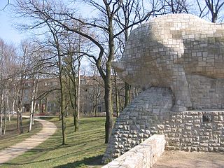
The Wusterhausener Bär or Wusterhausenische Baer is a small tower in the Köllnischer Park at the Märkisches Museum in Berlin's Mitte district. It is the last surviving part of Berlin's defences, which the Great Elector had built after the Thirty Years' War between 1662 and 1683.

Wikipedia: Wusterhausener Bär (DE)

1161 meters / 14 minutes

Sight 19: Luisenstädtischer Kanal und Engelbecken zwischen Waldemarstraße und Schillingbrücke

Show sight on map
Luisenstädtischer Kanal und Engelbecken zwischen Waldemarstraße und Schillingbrücke A. Fiedler / CC BY-SA 2.5

The Luisenstadt Canal, or Luisenstädtischer Kanal, is a 2.3-kilometre-long (1.4 mi) former canal in Berlin, Germany. It is named after the Luisenstadt district and ran through today's districts of Kreuzberg and Mitte, linking the Landwehr Canal with the Spree River, and serving a central canal basin known as the Engelbecken or Angel's Pool. The canal is named after Queen Louise, the wife of King Friedrich Wilhelm III.

Wikipedia: Luisenstadt Canal (EN), Heritage Website

1317 meters / 16 minutes

Sight 20: Handwerker mit Sohn

Show sight on map

The sculpture Craftsman with Son, also known as the "Father Group", is a work created in 1898 by the German stone and wood sculptor Wilhelm Haverkamp from Lasa marble. Together with its counterpart Mother with Child, the so-called "Mother Group", she was initially part of a group of monuments with an exedra on the no longer preserved Andreasplatz in the Berlin district of Friedrichshain. After the destruction of the complex, the sculpture was positioned separately on a high pedestal in 1960. It is now located in Andreasstraße opposite its former location and is a listed building.

Wikipedia: Handwerker mit Sohn (DE)

897 meters / 11 minutes

Sight 21: St. Antonius-Kirche

Show sight on map
St. Antonius-KircheDe-okin 12:18, 14 February 2009 (UTC) / CC BY-SA 3.0

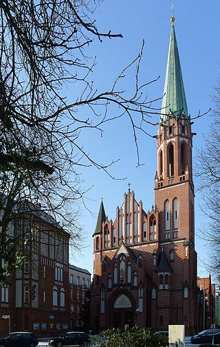
The Sankt-Antonius-Kirche is a Roman Catholic church in the Friedrichshain district of Berlin. It is located on Rüdersdorfer Straße and is a listed building.

Wikipedia: St. Antonius (Berlin-Friedrichshain) (DE)

407 meters / 5 minutes

Sight 22: Ensemble Karl-Marx-Allee

Show sight on map

Karl-Marx-Allee is a boulevard built by the GDR between 1952 and 1960 in Berlin Friedrichshain and Mitte. Today the boulevard is named after Karl Marx. It should not be confused with the Karl-Marx-Straße in the Neukölln district of Berlin.

Wikipedia: Karl-Marx-Allee (EN)

289 meters / 3 minutes

Sight 23: Video Games Museum

Show sight on map
Video Games Museum Matthias A. K. Zimmermann, Schweiz/Switzerland / CC BY-SA 3.0

The Computerspielemuseum is a German video game museum founded in 1997. From 1997 to 2000, it had a permanent exhibition in Berlin. Afterward, it became an online-only museum. In 2011, the museum reopened its permanent exhibition in Berlin's neighborhood of Friedrichshain, on Karl-Marx-Allee. During the first month of its permanent exhibition, it had 12,000 visitors.

Wikipedia: Computerspielemuseum (EN), Website

264 meters / 3 minutes

Sight 24: Berliner Kriminaltheater

Show sight on map

The Berlin Criminal Theatre was founded in 2000 by director Wolfgang Rumpf and dramaturg Wolfgang Seppelt.

Wikipedia: Berliner Kriminal Theater (DE), Facebook, Website

363 meters / 4 minutes

Sight 25: Rosengarten

Show sight on map

The Rose Garden is a park in the Friedrichshain district of Berlin, Germany. The park is located on the north side of Karl-Marx-Allee 103–105 near the Weberwiese underground station between the two entrances and extends over a length of about 100 meters. The park is characterized by a lawn in the middle. At the edge run paths that are entwined with beds of roses, other flowers and shrubs.

Wikipedia: Rosengarten (Berlin-Friedrichshain) (DE)

719 meters / 9 minutes

Sight 26: St. Nikolaus

Show sight on map

The Church of St. Nicholas is part of a building ensemble at Hildegard-Jadamowitz-Straße 25 in Friedrichshain, the location is opposite the junction of Kadiner Straße. The church has more of the character of a small chapel and is located in the basement of the side wing of the ensemble. The patron saint of the church is St. Nicholas of Myra.

Wikipedia: St. Nikolaus (Berlin-Friedrichshain) (DE), Website

832 meters / 10 minutes

Sight 27: Pfingstkirche

Show sight on map

The Pentecost Church at Petersburger Platz 5 is a Protestant church in Berlin-Friedrichshain near Bersarinplatz. The church was consecrated in 1908 and is the center of the Evangelical Pentecostal Church. It belongs to the church district of Berlin Stadtmitte in the district of Berlin of the Evangelical Church Berlin-Brandenburg-Silesian Upper Lusatia.

Wikipedia: Pfingstkirche (Berlin) (DE), Website

872 meters / 10 minutes

Sight 28: Forckenbeckplatz

Show sight on map
Forckenbeckplatz Angela Monika Arnold, Berlin / CC BY-SA 3.0

Forckenbeckplatz is a green space in the Berlin district of Friedrichshain. It is located in the northern part of the Samaritan Quarter and is bordered by Eldenaer Straße in the north, Bänschstraße in the south, Liebigstraße in the west and Proskauer Straße in the east.

Wikipedia: Forckenbeckplatz (DE)

1421 meters / 17 minutes

Sight 29: Stadtpark Lichtenberg

Show sight on map
Stadtpark Lichtenberg Angela Monika Arnold / CC-by-sa 2.0/de

The Lichtenberg City Park is a 5.3-hectare green space in the Berlin district of Lichtenberg, which was laid out from 1907 and redesigned several times. It is an amusement park with a small open-air stage, many sports facilities and art objects, a quiet large pond and rare old trees.

Wikipedia: Stadtpark Lichtenberg (DE)

Share

Spread the word! Share this page with your friends and family.

Disclaimer Please be aware of your surroundings and do not enter private property. We are not liable for any damages that occur during the tours.

GPX-Download For navigation apps and GPS devices you can download the tour as a GPX file.