Self-guided Sightseeing Tour #20 in Berlin, Germany

Legend

Churches & Art
Nature
Water & Wind
Historical
Heritage & Space
Tourism
Paid Tours & Activities

Tour Facts

Number of sights 30 sights
Distance 14.9 km
Ascend 239 m
Descend 228 m

Experience Berlin in Germany in a whole new way with our self-guided sightseeing tour. This site not only offers you practical information and insider tips, but also a rich variety of activities and sights you shouldn't miss. Whether you love art and culture, want to explore historical sites or simply want to experience the vibrant atmosphere of a lively city - you'll find everything you need for your personal adventure here.

Activities in BerlinIndividual Sights in Berlin

Sight 1: Görlitzer Park

Show sight on map

Görlitzer Park is a major park and recreation area in the Kreuzberg district of Berlin. The 14-hectare park area contains, among other things, a petting zoo, several sports and football fields, and a small lake. At its north-west end is the Görlitzer Bahnhof U-Bahn station.

Wikipedia: Görlitzer Park (EN)

1073 meters / 13 minutes

Sight 2: Ölberg-Kirche

Show sight on map

The Ölberg Church is located at Paul-Lincke-Ufer 29 on the corner of Lausitzer Straße in the Berlin district of Kreuzberg in today's Friedrichshain-Kreuzberg district. The architectural style of the church building can be assigned to Art Nouveau.

Wikipedia: Ölbergkirche (Kreuzberg) (DE), Website

1226 meters / 15 minutes

Sight 3: Luisenstädtischer Kanal

Show sight on map
Luisenstädtischer Kanal A. Fiedler / CC BY-SA 2.5

The Luisenstadt Canal, or Luisenstädtischer Kanal, is a 2.3-kilometre-long (1.4 mi) former canal in Berlin, Germany. It is named after the Luisenstadt district and ran through today's districts of Kreuzberg and Mitte, linking the Landwehr Canal with the Spree River, and serving a central canal basin known as the Engelbecken or Angel's Pool. The canal is named after Queen Louise, the wife of King Friedrich Wilhelm III.

Wikipedia: Luisenstadt Canal (EN), Heritage Website

557 meters / 7 minutes

Sight 4: Böcklerpark

Show sight on map

Böckler Park is a park in Kreuzberg, Berlin, Germany.

Wikipedia: Böckler Park (EN)

458 meters / 5 minutes

Sight 5: Admiralbrücke

Show sight on mapBook Free Tour*

The Admiralbrücke is a road bridge in Berlin-Kreuzberg, Germany, which spans the Landwehr Canal at canal kilometre 7.70 between Fraenkelufer and Planufer. The building was built between 1880 and 1882, structurally strengthened in the 1930s, renovated in 1984 and is a listed building.

Wikipedia: Admiralbrücke (DE), Heritage Website

143 meters / 2 minutes

Sight 6: Melanchthon

Show sight on map
Melanchthon

The Protestant Melanchthon Church in the church district of Berlin Stadtmitte, originally intended only as a parish hall, stands at Planufer 84 in the Berlin district of Kreuzberg in today's district of Friedrichshain-Kreuzberg. It was built in 1954–1955 according to plans by Fritz Buck and extended by Reinhold Barwich in 1973–1974.

Wikipedia: Melanchthonkirche (Berlin-Kreuzberg) (DE), Website

770 meters / 9 minutes

Sight 7: Christuskirche

Show sight on map
Christuskirche

The listed Evangelical Methodist Christ Church is located at Dieffenbachstraße 39 on the corner of Hohenstaufenplatz in the Berlin district of Kreuzberg in today's Friedrichshain-Kreuzberg district. It is part of a building complex consisting of church, residential building and nursing home, which was designed by Georg Pourroy. Although the neo-Gothic style continues to have an effect on its architectural style, it already hints at the beginning of modernism.

Wikipedia: Evangelisch-methodistische Christus-Kirche (Berlin-Kreuzberg) (DE), Website

176 meters / 2 minutes

Sight 8: Hohenstaufenplatz

Show sight on map

Hohenstaufenplatz is a square in the Berlin district of Kreuzberg on Kottbusser Damm, near the Schönleinstraße underground station. The square is also known as Zickenplatz in the vernacular of Berlin, as goats used to graze here. A weekly market is held on the square every Tuesday from 12 noon to 6:30 p.m. and on Saturdays from 9 a.m. to 2 p.m.

Wikipedia: Hohenstaufenplatz (DE)

751 meters / 9 minutes

Sight 9: Wrangelbrunnen

Show sight on map
WrangelbrunnenMutter Erde / Attribution

The Wrangel Fountain is a fountain in Berlin-Kreuzberg in the Graefekiez district. It was created by the Berlin sculptor Hugo Hagen and named after the Prussian Field Marshal Friedrich von Wrangel. The original location of the fountain was Kemperplatz in Berlin-Tiergarten, where it was inaugurated on March 22, 1877. 25 years later, it was moved to its current location, as the Roland Fountain was to be erected at its old location.

Wikipedia: Wrangelbrunnen (DE), Website

211 meters / 3 minutes

Sight 10: Fichtebunker

Show sight on map

The Fichtestraße Gasometer originally belonged to an ensemble of four gas containers, the Fichtestraße gas tank station. The building from 1883–1884 is the oldest surviving gasometer in Berlin and, of the surviving ones, the only one built of bricks. During the Second World War, it was converted into an air-raid shelter. In September 2006, the Property Fund of the State of Berlin sold the building to private investors, who had apartments built on the roof of the Gasometer until spring 2010. The building and the outbuildings are listed as historical monuments.

Wikipedia: Fichtebunker (DE), Website

720 meters / 9 minutes

Sight 11: Kirche am Südstern

Show sight on map

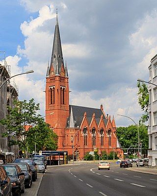
The church at Südstern was built between 1894 and 1897 as a Protestant garrison church in the neo-Gothic style on Kaiser-Friedrich-Platz – today: Südstern – in Berlin-Kreuzberg according to a design by the garrison building inspector Ernst August Roßteuscher.

Wikipedia: Kirche am Südstern (DE), Website, Heritage Website

718 meters / 9 minutes

Sight 12: Passionskirche

Show sight on map

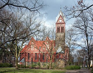
The Passionskirche is a Protestant church from the early 20th century in the Berlin district of Kreuzberg in the district of Friedrichshain-Kreuzberg and is located on Marheinekeplatz not far from Bergmannstraße. In addition to church services, it is also used for concerts and other cultural events. Since 2000, it has belonged to the Evangelical parish of the Holy Cross Passion, along with the Holy Cross Church. On January 1, 2023, the parish merged again with the neighboring Jesus Christ parish to form the Ev. Parish in front of the Hallesches Tor in the church district of Berlin Stadtmitte (KKBS) of the Evangelical Church Berlin-Brandenburg-Silesian Upper Lusatia (EKBO).

Wikipedia: Passionskirche (Berlin) (DE)

604 meters / 7 minutes

Sight 13: Chamissoplatz

Show sight on map

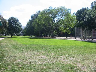
Chamissoplatz is a square in the Berlin district of Kreuzberg in the district of Friedrichshain-Kreuzberg and is located between Willibald-Alexisstraße and Arndtstraße. It is named after the naturalist and poet Adelbert von Chamisso (1781–1838). The residential buildings on the square date back to the 19th century and have survived the Second World War as well as the clear-cutting renovation and stucco removal of the post-war years largely unscathed.

Wikipedia: Chamissoplatz (DE)

356 meters / 4 minutes

Sight 14: Kurt Mühlenhaupt Museum

Show sight on map

The Kurt Mühlenhaupt Museum is an artists' museum in the Kreuzberg district of Berlin. It is dedicated to Kurt Mühlenhaupt, who is best known as a Berlin milieu painter. Until the summer of 2019, the museum was located in the Bergsdorf district of the Brandenburg city of Zehdenick. There it was housed in the listed farmstead Bergsdorfer Dorfstraße 1, which served as the painter's last creative place.

Wikipedia: Kurt Mühlenhaupt Museum (DE), Website

74 meters / 1 minutes

Sight 15: F40 - English Theatre Berlin

Show sight on map

English Theatre Berlin is an English-only theatre with two stages in Berlin-Kreuzberg.

Wikipedia: English Theatre Berlin (DE), Website

463 meters / 6 minutes

Sight 16: Haus Lindenberg

Show sight on map

The listed Haus Lindenberg is located at Methfesselstraße 23 and 25 in the Berlin district of Kreuzberg. The villa, completed in 1874, is the only building of the former villa colony Wilhelmshöhe on the eastern slope of the Kreuzberg that has been preserved in its original condition. The Wilhelminian city villa, named after the builder, the merchant Ernst Lindenberg, is located on the eastern edge of Viktoriapark.

Wikipedia: Haus Lindenberg (DE)

340 meters / 4 minutes

Sight 17: Wir haben Gesichter

Show sight on map

We Have Faces is the name of a memorial from 2005 that is directed against rape. It is located on the Kreuzberg in the Viktoriapark in Berlin-Kreuzberg.

Wikipedia: Wir haben Gesichter (DE)

295 meters / 4 minutes

Sight 18: Kreuzberg

Show sight on map
Kreuzberg

The Kreuzberg is a hill in the Kreuzberg locality of Berlin, Germany, in former West Berlin. It rises about 66 m (217 ft) above the sea level. It was named by King Frederick William III of Prussia after the Iron Cross which crowns the top of the Prussian National Monument for the Liberation Wars, designed by Karl Friedrich Schinkel, on its inauguration on 30 March 1821. On 27 September 1921 the borough assembly of the VIth borough of Berlin decided to name the borough after the hill. The borough was subsequently downgraded to a locality in 2001.

Wikipedia: Kreuzberg (Tempelhofer Berge) (EN)

1 meters / 0 minutes

Sight 19: Nationaldenkmal für die Befreiungskriege

Show sight on map

The Prussian National Monument for the Liberation Wars is a war memorial in Berlin, Germany, dedicated in 1821. Built by the Prussian king during the sectionalism before the Unification of Germany it is the principal German monument to the Prussian soldiers and other citizens who died in or else dedicated their health and wealth for the Liberation Wars (Befreiungskriege) fought at the end of the Wars of the Sixth and in that of the Seventh Coalition against France in the course of the Napoleonic Wars. Frederick William III of Prussia initiated its construction and commissioned the Prussian Karl Friedrich Schinkel who made it an important piece of art in cast iron, his last piece of Romantic Neo-Gothic architecture and an expression of the post-Napoleonic poverty and material sobriety in the liberated countries.

Wikipedia: Prussian National Monument for the Liberation Wars (EN)

135 meters / 2 minutes

Sight 20: Viktoriapark

Show sight on map

The Viktoriapark is an urban park in the locality of Kreuzberg in Berlin, Germany. It opened in 1894 and is named after the British princess and later Queen of Prussia Victoria.

Wikipedia: Viktoriapark (EN), Heritage Website

697 meters / 8 minutes

Sight 21: Verband der Deutschen Buchdrucker

Show sight on map

The Union of German Book Printers was a trade union representing printers in Germany.

Wikipedia: Union of German Book Printers (EN), Heritage Website

463 meters / 6 minutes

Sight 22: Eagle Square

Show sight on map

The Eagle Square in Berlin is part of the air bridge square in front of the handling building of the former Berlin-Tempelhof Airport and is characterized by the presence of an impressive eagle head statue.

Wikipedia: Eagle Square (DE)

218 meters / 3 minutes

Sight 23: Platz der Luftbrücke

Show sight on map

Platz der Luftbrücke is a landmarked square and transport node in Berlin, Germany, on the border between the localities of Tempelhof and Kreuzberg. The entrance to the former Tempelhof International Airport is on the square. The buildings around the square are now mostly government agencies, in particular police headquarters. The name of the square commemorates the Berlin airlift of 1948/49 in which Tempelhof was the main airfield used; the Berlin Airlift Monument is in the square.

Wikipedia: Platz der Luftbrücke (EN)

3 meters / 0 minutes

Sight 24: Luftbrückendenkmal

Show sight on map

The Airlift Monument is the name given to the sculptures in Berlin, Frankfurt am Main and Celle, designed according to plans by Eduard Ludwig (1906–1960) and commemorating the Berlin Airlift with its victims. In the Berlin vernacular, the terms hunger rake and hunger claw are also present. Duplicates corresponding to the first sculpture in Berlin were created in 1985 at the former Rhein-Main Air Base on the grounds of Frankfurt Airport and – in a somewhat smaller version – at the former Royal Air Force station in Celle near Hanover.

Wikipedia: Luftbrückendenkmal (DE)

1279 meters / 15 minutes

Sight 25: Schwerbelastungskörper

Show sight on map

The Schwerbelastungskörper is a large concrete cylinder located at the intersection of Dudenstraße, General-Pape-Straße, and Loewenhardtdamm in the northwestern part of the borough of Tempelhof in Berlin, Germany. It was built by Adolf Hitler's chief architect Albert Speer to determine the feasibility of constructing large buildings on the area's marshy, sandy ground. Erected between 1941 and 1942 it was meant to test the ground for a massive triumphal arch on a nearby plot. The arch, in the style of the Nazi architectural movement, was to be about three times as large as the Arc de Triomphe in Paris, France. It was one component of a plan to redesign the center of Berlin as an imposing, monumental capital reflecting the spirit of Nazi Germany as envisioned by Hitler.

Wikipedia: Schwerbelastungskörper (EN), Website

788 meters / 9 minutes

Sight 26: Alter Zwölf-Apostel-Friedhof

Show sight on map
Alter Zwölf-Apostel-Friedhof

The Old Twelve Apostles Cemetery at Kolonnenstraße 24–25 in Berlin-Schöneberg is one of the most important burial grounds in Berlin in terms of art and cultural history. The cemetery is a garden monument because of its picturesque architectural and sculptural elements.

Wikipedia: Alter Zwölf-Apostel-Kirchhof (DE)

636 meters / 8 minutes

Sight 27: Königin-Luise-Gedächtniskirche

Show sight on map

The Königin-Luise-Gedächtniskirche is the only important Protestant church building on the "Red Island", a neighbourhood in the Berlin district of Schöneberg. It is a central building in the neo-baroque style.

Wikipedia: Königin-Luise-Gedächtniskirche (Berlin) (DE), Website

333 meters / 4 minutes

Sight 28: Inselgarten

Show sight on map

Rote Insel is the name colloquially given to a neighborhood in the Schöneberg district of the German capital, Berlin. As such, the Island is part of Berlin's 7th administrative borough, Tempelhof-Schöneberg.

Wikipedia: Rote Insel (EN), Website

1090 meters / 13 minutes

Sight 29: Paul-Gerhardt-Kirche

Show sight on map

The Paul-Gerhardt-Kirche is a Protestant church building at Hauptstraße 47 in Berlin-Schöneberg. It stands directly next to the baroque village church of Schöneberg and, together with other municipal buildings, forms an ensemble of buildings that leads to the Catholic St. Norbert Church and thus creates a passageway to Dominicusstraße.

Wikipedia: Paul-Gerhardt-Kirche (Berlin-Schöneberg) (DE), Website, Heritage Website

279 meters / 3 minutes

Sight 30: St.-Norbert-Kirche

Show sight on map

St. Norbert is a Roman Catholic church in Dominicusstraße in the Berlin district of Schöneberg.

Wikipedia: Sankt-Norbert-Kirche (Berlin) (DE), Website, Heritage Website

Share

Spread the word! Share this page with your friends and family.

Disclaimer Please be aware of your surroundings and do not enter private property. We are not liable for any damages that occur during the tours.

GPX-Download For navigation apps and GPS devices you can download the tour as a GPX file.