Self-guided Sightseeing Tour #19 in Bonn, Germany
Legend
Guided Free Walking Tours
Book free guided walking tours in Bonn.
Guided Sightseeing Tours
Book guided sightseeing tours and activities in Bonn.
Tour Facts
5.7 km
76 m
Experience Bonn in Germany in a whole new way with our self-guided sightseeing tour. This site not only offers you practical information and insider tips, but also a rich variety of activities and sights you shouldn't miss. Whether you love art and culture, want to explore historical sites or simply want to experience the vibrant atmosphere of a lively city - you'll find everything you need for your personal adventure here.
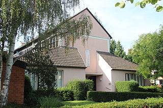
Activities in BonnIndividual Sights in BonnSight 1: Christuskirche Plittersdorf
The Christuskirche is a Protestant church in the district of Plittersdorf in the Bonn district of Bad Godesberg. The church is a listed building.
Sight 2: Sara Auerbach
The list of Stumbling Stones in Bonn contains Stumbling Stones that were laid in Bonn as part of the art project of the same name by Gunter Demnig.
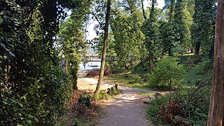
Sight 3: Leserpark
The small Leserpark in the Bonn district of Plittersdorf in Bad Godesberg extends over an area of around 40,000 square meters along the Rhine between the Von-Sandt-Ufer and the new Am Büchel development. In the north of the forest park is the historic Villa Cahn, whose owner at the turn of the 20th century, the Leser family, gave the park its name. Originally, the park was considerably more extensive to the west, but it was greatly reduced in the 1980s by the development of apartment buildings on today's street Am Büchel. As early as the beginning of the 20th century, the Godesberg municipal administration had tried to develop the park for development towards the Rhine. At that time, however, the legally experienced Higher Regional Court Councillor Wilhelm Leser was able to prevent the development plans.
Sight 4: Gedenkstein Synagoge
The synagogue in Oberdollendorf, a present-day district of the city of Königswinter in the Rhein-Sieg district of North Rhine-Westphalia, was built in 1871/72. In the course of the November pogroms of 1938, it was robbed and damaged by National Socialists and then demolished in the spring of 1939. It was located on Heisterbacher Straße.
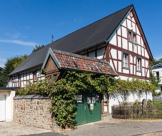
Sight 5: Brückenhofmuseum
The Brückenhof Museum is a local history museum in Oberdollendorf, a district of the town of Königswinter in the Rhein-Sieg district of North Rhine-Westphalia. It began operations in 1991 in the former winery "Brückenhof", a half-timbered house from the 17th century. The museum is run by the Heimatverein Oberdollendorf und Römlinghoven e.V. with over 1100 members.
Sight 6: Frieda Marx
The list of stumbling stones in Königswinter contains stumbling stones that were laid in Königswinter as part of the art project of the same name by Gunter Demnig. They are intended to commemorate the victims of National Socialism who lived and worked in Königswinter.
Wikipedia: Liste der Stolpersteine in Königswinter (DE), Website
Sight 7: St. Laurentius
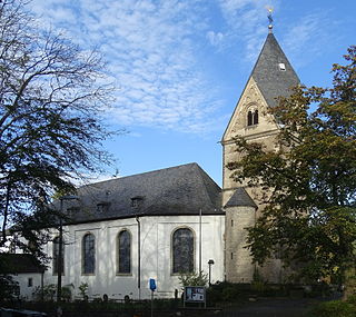
The Roman Catholic parish church of St. Laurentius in Oberdollendorf, a district of Königswinter, consists of a Romanesque east tower, a nave from 1792 and extensions from the post-war period. It is a listed building.
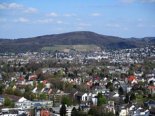
Sight 8: Dollendorfer Hardt
The Dollendorfer Hardt is a mountain in the Siebengebirge and its northernmost elevation. It is located east of Oberdollendorf in Königswinter city area, directly on the border with Bonn. The wooded hilltop lies at 246.7 m above sea level.
Share
Disclaimer Please be aware of your surroundings and do not enter private property. We are not liable for any damages that occur during the tours.
GPX-Download For navigation apps and GPS devices you can download the tour as a GPX file.
