Self-guided Sightseeing Tour #4 in Erfurt, Germany
Legend
Tour Facts
5.5 km
66 m
Experience Erfurt in Germany in a whole new way with our free self-guided sightseeing tour. This site not only offers you practical information and insider tips, but also a rich variety of activities and sights you shouldn't miss. Whether you love art and culture, want to explore historical sites or simply want to experience the vibrant atmosphere of a lively city - you'll find everything you need for your personal adventure here.
Individual Sights in ErfurtSight 1: Reglerkirche
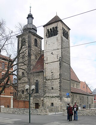
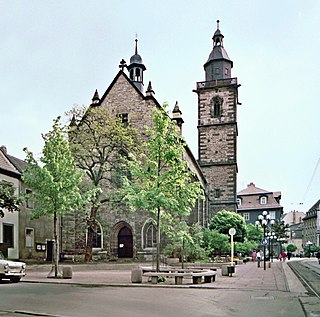
The Reglerkirche is a church building in the historical centre of Erfurt in Thuringia, Germany. It serves a Lutheran parish as a place of worship and is one of the larger churches in the city's old part. In times of East Germany, it was considered a centre of church music in Erfurt.
Sight 2: Kleiner Mildenfurther Kreuzmensch
Mildenfurther Kreuzmensch is the name of a series of sculptures by the sculptor Volkmar Kühn, who lives in Mildenfurth's Thuringian Mildenfurth.
Sight 3: DenkNadel
A memorial pin is used in Erfurt to commemorate Jews from Erfurt who were deported and murdered during the Nazi era, similar to Gunter Demnig's stumbling stones. The Denknadel project was developed by the Erfurt Commemoration 1933–1945 working group and, after a competition in 2007, decided in favour of Sophie Hollmann's design. Since then, nine Denknadel have been installed in the Erfurt city area.
Sight 4: Angermuseum Erfurt
The Angermuseum is an art museum in Erfurt opened on 27 June 1886.
Sight 5: Bartholomäusturm
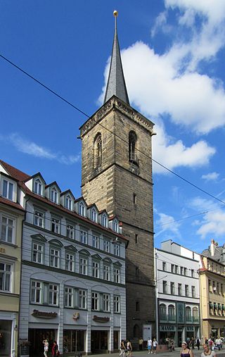
St Bartholomew's Church in the historical city centre of Erfurt in Thuringia, Germany, was a Gothic church building at the western Anger square. Today, only its tower, the Bartholomäusturm, remains; since 1979, it has been housing a carillon.
Sight 6: Barfüßerkirche
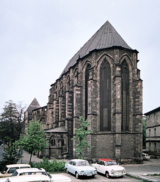
The Barfüßerkirche in the historical city centre of Erfurt in Thuringia, Germany, belonged to the most important church buildings of the city and was one of the most elaborate mendicant churches in Germany until its extensive destruction by bombing in 1944. It was mainly built in the 14th century as a monastery church of the Franciscans, who were also called Barfüßer. The choir was restored in the 1950s; beside the nave's ruin, it is situated west of the Schlösserbrücke bridge on the right bank of the Breitstrom, a branch of the Gera river.
Sight 7: Kurmainzische Statthalterei
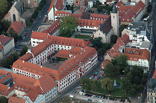
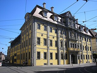
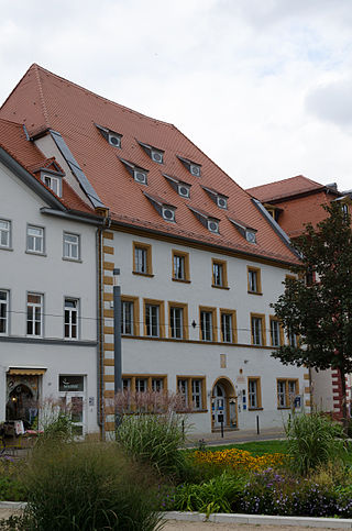
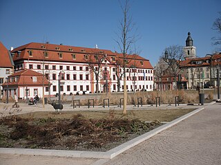
The Electoral Mainz Lieutenancy is a baroque, three-storey four-winged complex around an inner courtyard from the 16th to 18th centuries. It is located on the corner of Regierungsstrasse and Meister-Eckehart-Strasse in the centre of Erfurt.
Sight 8: Sankt Wigbert
St Wigbert's Church in the city of Erfurt in Thuringia, Germany, is a Roman Catholic church building dating from the 15th century. Today, it is a subsidiary church of the Catholic parish of St Lawrence's Church.
Sight 9: Haus Vaterland
Haus Vaterland in Erfurt, the state capital of Thuringia, is located at Regierungsstraße 72. Haus Vaterland, the former Weimar escort house in Erfurt, houses the European Information Centre and offices of the Thuringian State Chancellery. The building is a protected architectural monument.
Sight 10: Hirschgarten
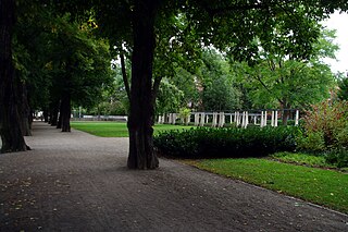
The Hirschgarten is a partly park-like green space in the old town of Erfurt. It was the first public green space in the city. Today it consists of the historic Hirschgarten from the 18th century and an adjoining part to the west, which was redesigned on a demolition site in the years 2007 to 2009.
Sight 11: Neue Synagoge
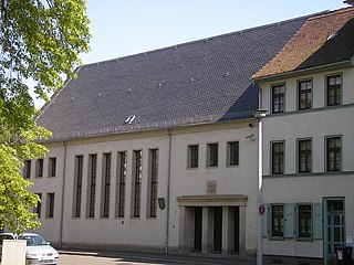
The New Synagogue is the synagogue of Erfurt, the capital of Thuringia, Germany. It is located on Juri-Gagarin-Ring and is the only (used) synagogue in Thuringia and one of only two synagogues built in GDR times. It serves as a prayer room for the Jewish State Community of Thuringia, which has around 850 members. In addition to her, there are the old and the small synagogue in Erfurt, both of which are no longer used for church services.
Sight 12: Alte Oper
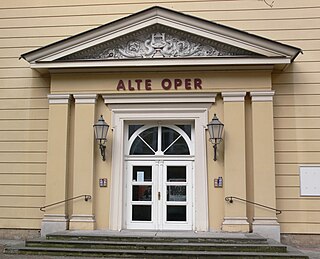
The Alte Oper is a venue in Erfurt, Thuringia, Germany. It is located in the southwest of the old town in Gorkistraße, just under 400 meters south of the cathedral. The house has a hall with 970 seats, a revolving stage and 32 trains.
Sight 13: Sankt Crucis
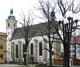
The Neuwerkskirche at the edge of the historical part of the city of Erfurt in Thuringia, Germany, is a Roman Catholic church building dating from the 15th century. Today, it is a branch church of the Catholic parish of St Lawrence's Church.
Sight 14: Brunnenkirche
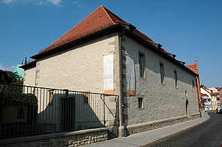
The Roman Catholic fountain church is located in the old town of the Thuringian state capital Erfurt. It is used by the Erfurt Augustinian Convent and belongs to the Erfurt Deanery of the Diocese of Erfurt.
Sight 15: Roßbrücke
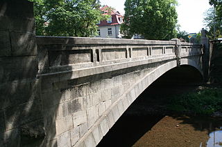
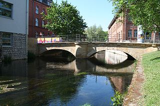
The Roßbrücke is a road bridge in the city centre of Erfurt, the capital of Thuringia, and is one of the oldest preserved natural stone bridges in the city. It is located on Herrmannsplatz, spans the Walkstrom, a tributary of the Gera, and serves the development traffic of the western city centre.
Sight 16: Brühler Garten
The Brühler Garten is a small park in the old town of Erfurt. It is located in Brühl in the southwestern city center.
Sight 17: Sibyllentürmchen
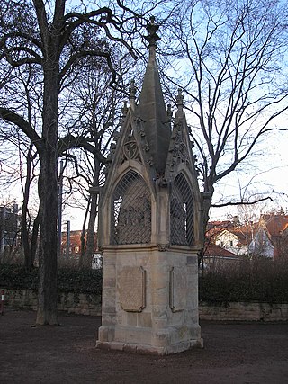
The Sibyllentürmchen is a devotional column on Gothaer Platz below the Cyriaksburg in the west of Erfurt (Brühlervorstadt). It was built between 1370 and 1380 in the Gothic style.
Sight 18: Christuskirche (SELK)
The Evangelical Lutheran Church of Christ is a church in the Brühlervorstadt district of Erfurt. It serves as a place of worship for the Erfurt congregation of the Independent Evangelical Lutheran Church (SELK) and belongs to the church district of Saxony-Thuringia.
Sight 19: Hohenzollernbrücke
The Hohenzollern Bridge is a road bridge that spans the flood ditch of the Gera in Erfurt. It is the only bridge in the city with artistic sculptural decoration. It is a listed building.
Sight 20: Luisenpark
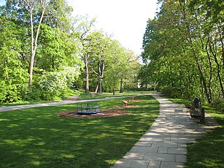
Dreienbrunnenpark is a park in the south of Erfurt, Germany.
Share
How likely are you to recommend us?
Disclaimer Please be aware of your surroundings and do not enter private property. We are not liable for any damages that occur during the tours.
GPX-Download For navigation apps and GPS devices you can download the tour as a GPX file.
.jpg)
