Self-guided Sightseeing Tour #1 in Regensburg, Germany
Legend
Guided Free Walking Tours
Book free guided walking tours in Regensburg.
Guided Sightseeing Tours
Book guided sightseeing tours and activities in Regensburg.
Tour Facts
8 km
108 m
Experience Regensburg in Germany in a whole new way with our self-guided sightseeing tour. This site not only offers you practical information and insider tips, but also a rich variety of activities and sights you shouldn't miss. Whether you love art and culture, want to explore historical sites or simply want to experience the vibrant atmosphere of a lively city - you'll find everything you need for your personal adventure here.
Activities in RegensburgIndividual Sights in RegensburgSight 1: Österreicher Stadel
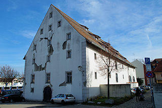
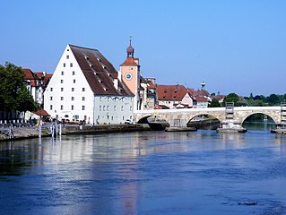
The Österreicher Stadel in Regensburg, Donaulände No. 6, is located on the southern bank of the Danube (Marc-Aurel-Ufer), 300 m east of the inner-city Danube crossing Eisernen Brücke. in the 17th century Originally built as a brewery, the building was later used in various ways as a salt barn, warehouse, warehouse and museum depot. The building is located a good 100 m east of the Museum of Bavarian History, which opened in 2019, and also serves as a depot for this museum.
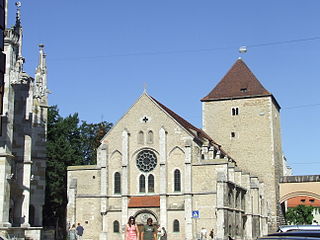
Sight 2: Minoritenkirche
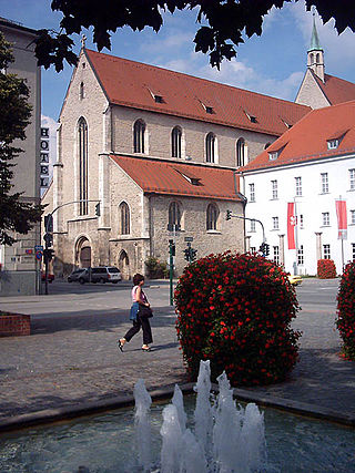
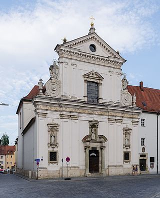
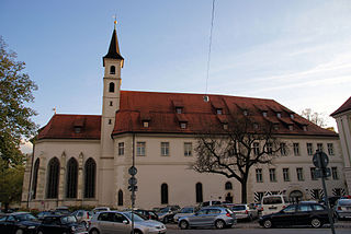
The Franciscan Monastery of St. Salvator Regensburg is a former Franciscan monastery in Regensburg in the Diocese of Regensburg.
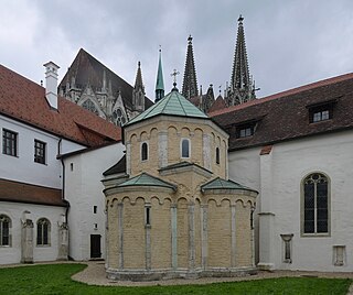
Sight 3: Erhardikapelle
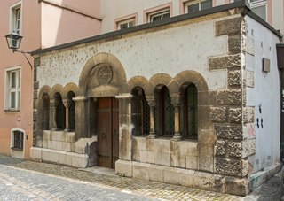
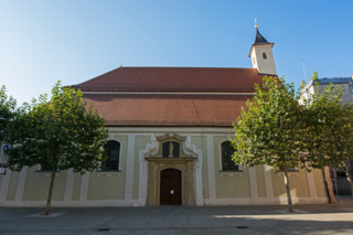
The Roman Catholic, listed Erhardi Chapel is located in the Erhardigasse of Regensburg. It is assigned to the Diocese of Regensburg. The building is registered as an architectural monument in the Bavarian List of Monuments under the monument number D-3-62-000-38301.
Sight 4: Museum der Bayerischen Geschichte
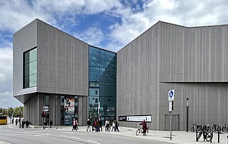
The House of Bavarian History: Museum, also: Museum of Bavarian History, in the old town of Regensburg on the southern bank of the Danube is a museum about new and recent Bavarian history. The founding director is historian and museum expert Richard Loibl. The museum opened on 5 June 2019 after eight years of planning and construction.
Sight 5: Freudenau
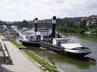
The Regensburg Museum of Danube Shipping is a maritime museum of river shipping on the river Danube and other rivers, situated in the city of Regensburg in Germany. It also contains art collections on that topic, along with material on boatmen's work and training. Its main exhibits are the steam tugboat Ruthof / Érsekcsanád and the diesel tug Freudenau.
Wikipedia: Regensburg Museum of Danube Shipping (EN), Website
Sight 6: Salzstadel
The municipal salt barn east of the Stone Bridge in the old town of Regensburg was built between 1616 and 1620 and thus complemented the older and smaller Amberg barn west of the bridge. The municipal salt barn was built for the storage of rock salt or table salt. The salt was transported by horse-drawn so-called salt trains across the Salzach and the Inn and finally on the Danube from the salt deposits and salt works in the wider area of Passau, to Regensburg and unloaded here with cranes.
Sight 7: Brückturm
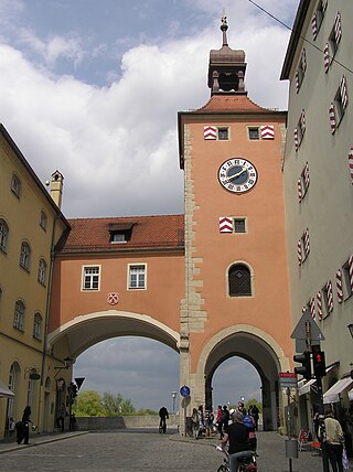
The bridge tower in the old town of Regensburg marks the southern end of the Stone Bridge crossing the Danube. It was built as one of several gate towers at the end of the 13th and the beginning of the 14th century during the construction of the medieval city fortifications of Regensburg. The bridge tower is the only one of the former three towers on the Stone Bridge to have been preserved.
Sight 8: Steinerne Brücke
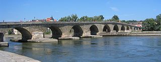
The Stone Bridge in Regensburg, Germany, is a 12th-century bridge across the Danube linking the Old Town with Stadtamhof. For more than 800 years, until the 1930s, it was the city's only bridge across the river. It is a masterwork of medieval construction and an emblem of the city.
Sight 9: Goliathhaus
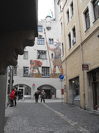
The Goliathhaus is an imposing, crenellated, early Gothic, former house in 1220/30 in the old town of Regensburg. The house is located in the north-south direction between the streets of Goliathstrasse in the north and Watmarkt in the south. The northern facade is the well -known showront of the Goliathhaus and shows a painting of the struggle between David and Goliath, which has been renewed several times since 1573, in the last version of the painter Franz Rinner from 1900. The former front of the Goliathhaus is the southern Front, which is based on the Watmarkt rising terrain has one floor less. Accordingly, old home briefs always call the building "Haus am Watmarkt". The house tower in the west takes the whole depth of the house complex. The residential building of the Goliathhaus joins the tower to the east, which formed a structural unit with the neighboring steering house until the end of the 18th century. Both house castles were built by the regional patrician families in Regensburg, suspected as built, on the foundations of the northern Roman wall of the Castra Regina legion camp. The Goliathhaus offers its impressive northern Schaufront with the Goliath painting all the visitors who come across the stone bridge and use the Brückstraße, which is slightly rising inland, to reach the city center.
Sight 10: Baumburger Turm
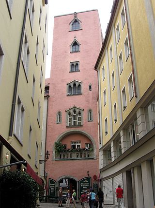
The Baumburger Turm in the street Watmarkt 4 in the old town of Regensburg is one of the family towers that were built by rich patrician families in the Middle Ages as status symbols. The Baumburg Tower, which has been preserved unchanged, is considered the most beautiful of the 20 family towers preserved in Regensburg and is a tourist attraction.
Sight 11: Old Town Hall
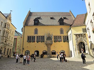
In the medieval Old Town Hall of Regensburg on the Rathausplatz, three buildings can be distinguished from different times: in the south the Reichssaal building with bay window, followed by the portal building with staircase and gateway and east of the passage the oldest town hall building in the style of a patrician house with the town hall tower. This oldest building houses the seat with the reception hall of the Lord Mayor and other rooms for associated offices and for the registry office. The remaining offices of the city administration and also the citizens' office are located in the New Town Hall on Dachauplatz, about 500 m to the east.
Sight 12: document Kepler
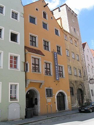
The Kepler Memorial House in Regensburg is the death house of the astronomer Johannes Kepler. In the autumn of 1630, Kepler took up residence in the house, which had been owned by the merchant Hillebrand Hilli since 1622. Kepler died here on 15 November 1630.
Sight 13: Justitiabrunnen
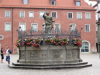
The Justitiabrunnen is a baroque fountain in the centre of the historic old town of Regensburg. It was created in 1656 by the sculptor Leoprand Hilmer in the course of the construction of the city's new water supply.
Sight 14: Goldener Turm
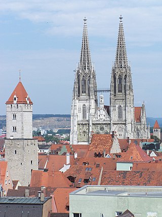
The Golden Tower at Wahlenstraße 14, in the old town of Regensburg, is one of the family towers that were built by rich patrician families in the Middle Ages as status symbols. It was built around 1250, but was only used to a limited extent as a residential tower in the 18th century. The tower was the highest house tower north of the Alps and became a landmark of Regensburg along with St. Peter's Cathedral and Steinerner Brücke.
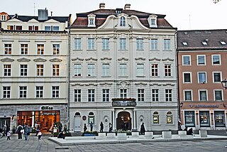
Sight 15: Palais Löschenkohl
The Palais Löschenkohl is a baroque palace, Neupfarrplatz 14, in the World Heritage zone of the old town of Regensburg. It was built from 1730 to 1733 as a princely city palace for the family of the merchant and banker Hieronymus Löschkohl. After the bankruptcy of the banker Löschkohl, his escape and his death, the building served as the residence of the extended remaining family, who rented out many rooms in the building. From 1743 until the end of the Holy Roman Empire in 1806, the estate served as the residence of the delegation of the Electorate of Saxony to the Perpetual Reichstag. For this reason, the building was given the name Electoral Saxon Legation. The building is listed as a listed monument of Regensburg under the file number D-3-62-000-805.
Sight 16: Neupfarrkirche
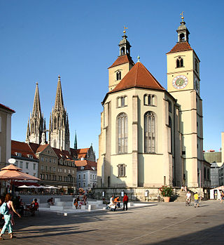
The Neupfarrkirche is a Protestant parish church on Neupfarrplatz in the old town of Regensburg. The construction of the church, originally planned as a Catholic pilgrimage church, began after the destruction of the Jewish quarter in 1519. The high income from the pilgrimage, which was initially stormy, was to be used to finance the construction of a large Catholic pilgrimage church. When it later became apparent with the decline in pilgrimage that the financing of the Catholic church building was no longer secured due to a lack of income, the construction of the church was stopped. The financing of the provisional completion of the church was negotiated between the two parties involved or interested parties and then taken over by the imperial city of Regensburg, which wanted to use the church as a new Protestant church after the introduction of the Reformation.
Sight 17: Sankt Johann
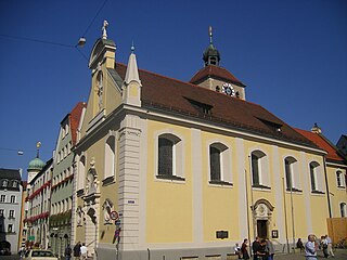
The collegiate church of St. Johann in Regensburg is the spiritual centre of the collegiate monastery of St. Johann, founded in 1127. It is dedicated to St. John the Baptist and St. John the Evangelist. The church is located in the immediate vicinity of St. Peter's Cathedral at Krauterermarkt 5. It is located between the Cathedral Square in the south and the Bishop's Court in the north. The collegiate church has had an eventful history over the centuries. The originally Ottonian building had to be demolished in favor of a westward extension of Regensburg Cathedral. Thus, on the site of today's church, a Gothic building was built, which underwent a radical Baroque redesign in the 1760s. After a fire in 1887, the church was rebuilt in neo-baroque forms.
Sight 18: Domschatzmuseum
The Art Collections of the Diocese of Regensburg are an organization of the Diocese of Regensburg with its headquarters in Regensburg. They look after the artistic treasures that are in the possession of the diocese and operate the two diocesan museums, the Cathedral Treasury and the Museum of St. Ulrich.
Sight 19: Porta praetoria
Get Ticket*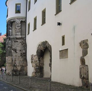
Porta Praetoria is the name given in Regensburg to the visibly preserved remains of the north gate of the former Roman legionary camp Castra Regina, which was built in the 2nd century AD.
Sight 20: Allerheiligenkapelle
The All Saints' Chapel is a small building at the cloister of the Regensburg Cathedral and served as the mausoleum of the client Bishop Hartwig II of Spanheim. He was the first bishop of Regensburg to no longer buried himself in the Sankt Emmeram monastery. The chapel is dated around the middle of the 12th century because Bishop Hartwig died in 1164.
Sight 21: document Niedermünster
Sight 22: Niedermünster
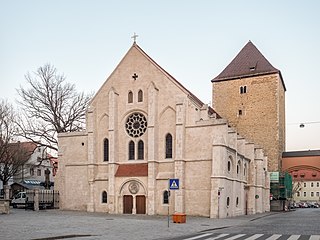
The Niedermünster Church in Regensburg, built around 1150 at the end of the Romanesque period and Baroque in the 17th century, was the church of the former canoness monastery of the Imperial Abbey of Niedermünster, which was dissolved in 1803 in the course of secularization in Bavaria. After the transfer of the buildings to the Kingdom of Bavaria in 1810, the Niedermünster Church has served as a cathedral parish church since 1824.
Sight 23: Saint Peter's Cathedral
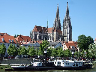
Regensburg Cathedral, also known as St. Peter's Cathedral, is an example of important Gothic architecture within the German state of Bavaria. It is a landmark for the city of Regensburg, Germany, and the seat of the Catholic Diocese of Regensburg.
Sight 24: Maria Läng Kapelle
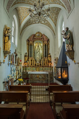
The Catholic chapel Maria Läng is a baroque hall building with a groin vault from 1675. The chapel is an old house chapel on the ground floor of a former canon's courtyard. It houses a figure of the Virgin Mary, which is supposed to represent St. Mary in her true length.
Sight 25: Museum Sankt Ulrich
The former cathedral parish church of St. Ulrich in Regensburg stands at a distance of a good 10 m southeast of Regensburg Cathedral on the cathedral square, which extends eastwards on its south side to the Herzogshof. The St. Ulrich's Church and the exhibitions in the church are now part of the Regensburg Diocesan Museums.
Sight 26: Herzogsturm
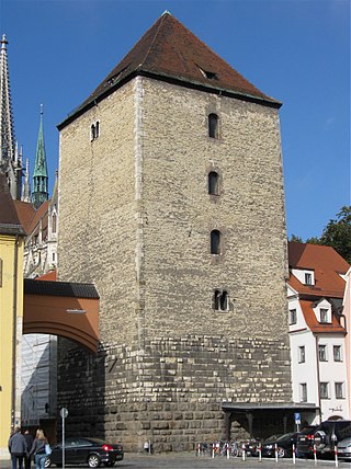
The Roman Tower in the old town of Regensburg dominates the cityscape at the Alter Kornmarkt with its massive block shape. The Romanesque residential tower belonged to the ducal palatinate and was connected to the neighbouring ducal court to the south by a walkable candle arch, which was removed in 1855 and reattached in 1937/40 in a simple form.
Sight 27: Karmelitenkirche Sankt Joseph
The Carmelite Church of St. Joseph on the Alter Kornmarkt in the old town of Regensburg is the monastery church of the convent of St. Joseph of the Discalced Carmelites as well as the most important confession and worship church in Regensburg. The High Baroque church building with echoes of the Italian style was built between 1660 and 1673 according to the plans of a hitherto unknown architect. Carlo Lurago, Antonio Petrini or a student of Petrini are possible authors.
Sight 28: Stift zu Unserer Lieben Frau zur Alten Kapelle
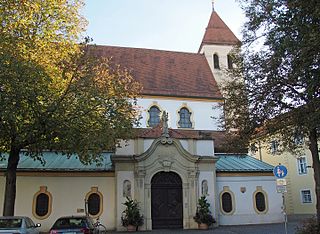
The Basilica of the Nativity of Our Lady also Basilica of the Nativity of Our Lady to the Ancient Chapel or Alten Kapelle It is the oldest Catholic place of worship in Bavaria and one of the most important churches in the city of Regensburg, in the south of Germany.
Wikipedia: Basilica of the Nativity of Our Lady, Regensburg (EN), Website
Sight 29: Jüdisches Gemeindezentrum
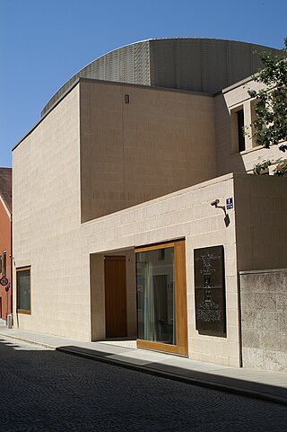
The Jewish Community Center with Synagogue Regensburg is the new community center of the "Jewish Community Regensburg". It was inaugurated on February 27, 2019, 80 years after the destruction of the New Synagogue and exactly 500 years after the expulsion of the Jews from the imperial city of Regensburg. It was built on the property "Am Brixener Hof 2", on which the New Synagogue stood until the pogrom of November 1938 and on which there was only a provisional community hall after the Second World War.
Wikipedia: Jüdisches Gemeindezentrum mit Synagoge Regensburg (DE)
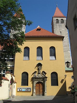
Sight 30: St. Kassian
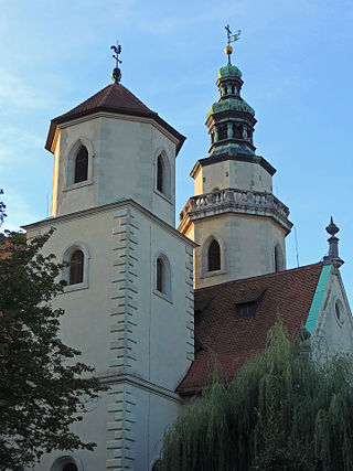
After the collegiate church in Regensburg, the parish church in Regensburg is the second oldest church in the city and is one of the most occupied church buildings in Bavaria. The listed church has a rich building history and was subject to changes in different epochs. Today the rococo style dominates in the interior and on the north facade. The church has been supported by our dear wife to the old chapel since 1225. With only around 65 Catholics, the St. Pfarrei St. Kassian is the smallest parish of the Diocese of Regensburg.
Sight 31: St. Ignaz
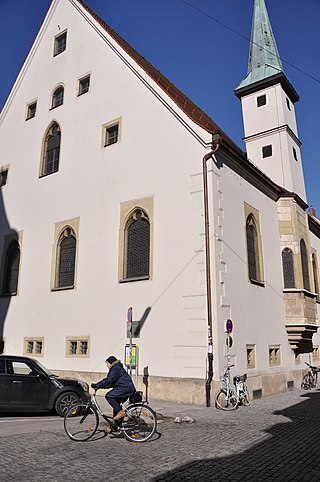
The listed Bruderhauskirche St. Ignaz, the former Protestant hospital church, is located at Emmeramsplatz 12 in the old town of Regensburg. The church was built in 1622 from a predecessor chapel of St. Ignatius, which was created in 1444 after the foundation of the Bruderhaus Foundation for impoverished craftsmen.
Sight 32: St. Ägidien
The Roman Catholic branch church of St. Ägidien, located on the Ägidienplatz in the old town of Regensburg, which is named after it, is a former church of the Teutonic Order and as such was assigned to the Teutonic Order Commandery of St. Ägid. Today, St. Ägidien is a subsidiary church of the parish of St. Emmeram. The church, dedicated to St. Egidius, is a three-aisled staggered hall in the Gothic style.
Sight 33: Volkssternwarte Regensburg
The Public Observatory Regensburg is an astronomical observatory located in Regensburg, Germany. Its history dates back to the year 1774 when Saint Emmeram's Abbey dedicated two towers to astronomical observations. For the most time, it served for educational purposes. Today it is run by a non-profit organization, the Verein der Freunde der Sternwarte Regensburg e.V.. The observatory is accessible for visitors on Friday evenings.
Sight 34: Dreieinigkeitskirche
The Trinity Church is a Protestant, early baroque, columnless hall church in the Ständenstraße, in the old town of Regensburg. The church was built from 1627 to 1631 according to Hanns Carl plans and was one of the first Evangelical Lutheran new church buildings in Bavaria. The church is considered the largest new church building of the then free imperial city of Regensburg; It is a popular destination for visitors because of the in the way over the old town. Another attraction is the southern churchyard accessible from the church. At the churchyard, after the end of the church building forced by Bavarian occupation troops and before the start of final construction work on the southern churchyard, during the Thirty Years' War, in the course of the fighting for Regensburg at the request of the Swedish army guide Bernhard von Sachsen-Weimar High Swedish officers and, at the request of some exulant families, also to some surrounding beds from Austria who had helped finance the construction of the Protestant Church. As usual, their original graves were outside the city walls and could therefore be looted by the enemy imperial-Bavarian troops.
Sight 35: Dominkanerkirche St. Blasius
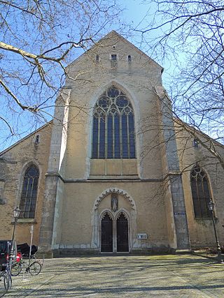
The Dominican Church of St. Blasius with the former monastery buildings is located in the center of the western old town of Regensburg and is located on a large area that is separated from the Trinity Church by the alley Am Ölberg, which runs from north to south. The Dominican Church is located along the Predigergasse, which runs from east to west. The entrance to the Dominican Church is located on Albertus-Magnus-Platz in front of it, which merges into Bismarckplatz to the west. To the south, the former monastery buildings border on Ägidienplatz, which can be reached via Beraiterweg.
Wikipedia: Dominikanerkirche St. Blasius (Regensburg) (DE), Website
Sight 36: Scots Monastery
The Scots Monastery is the former Benedictine Abbey of St James (Jakobskirche) in Regensburg, Germany. It was founded in the 11th century by Irish missionaries and for most of its history was in the hands of first Irish, then Scottish monks. In Middle Latin, Scotti meant Gaels, not differentiating Ireland from Scotland, so that the term Schottenstift dates from the Irish period. The full official name of the actual church, the most prominent building within the abbey complex, is Die irische Benediktinerklosterkirche St. Jakob und St. Gertrud.
Sight 37: Dörnbergpark
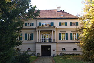
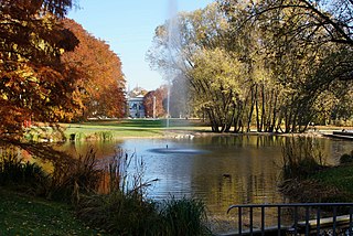
The Dörnbergpark is a 7.4-hectare park, a little west of St. Emmeram Castle and the Helenentor, the exit from the old town of Regensburg. This important monument of 19th-century garden art is also only a little south of Bismarckplatz.
Sight 38: Kunstforum Ostdeutsche Galerie
The Kunstforum Ostdeutsche Galerie (KOG) is an art collection of works by German artists from the former German eastern territories and the German settlement areas in Eastern and Southeastern Europe. Until reunification, works by artists from the GDR were also collected. The seat in Regensburg is also to be seen in connection with the city's patronage of the interests of the Sudeten Germans.
Sight 39: Stadtpark
The Regensburg City Park west of the old town of Regensburg on the Platz der Einheit in front of the Jakobstor is the oldest and, with over eight hectares, also the largest of the inner-city parks in Regensburg.
Sight 40: Alice Heiss
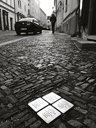
A Stolperstein is a ten-centimetre (3.9 in) concrete cube bearing a brass plate inscribed with the name and life dates of victims of Nazi extermination or persecution. Literally, it means 'stumbling stone' and metaphorically 'stumbling block'.
Share
Disclaimer Please be aware of your surroundings and do not enter private property. We are not liable for any damages that occur during the tours.
GPX-Download For navigation apps and GPS devices you can download the tour as a GPX file.
