Self-guided Sightseeing Tour #4 in Wuppertal, Germany
Legend
Tour Facts
8.2 km
207 m
Experience Wuppertal in Germany in a whole new way with our free self-guided sightseeing tour. This site not only offers you practical information and insider tips, but also a rich variety of activities and sights you shouldn't miss. Whether you love art and culture, want to explore historical sites or simply want to experience the vibrant atmosphere of a lively city - you'll find everything you need for your personal adventure here.
Individual Sights in WuppertalSight 1: Villa Frowein

The Villa Frowein is a late classicist villa in Wuppertal-Elberfeld, Briller Straße 2, on the edge of the Luisenviertel.
Sight 2: Deweerth’scher Garten
The Deweerth'sche Garten is a 200-year-old 1.8-hectare inner-city park in the Wuppertal district of Elberfeld, which is over 200 years old.
Sight 3: Neue Kirche

The New Reformed Church, also known as the New Church, Second Reformed Church, popularly known as the Sophienkirche after the street on which it stands, is the second church built for the Reformed Church in today's Wuppertal district of Elberfeld.
Wikipedia: Neue reformierte Kirche (Wuppertal) (DE), Website, Heritage Website
Sight 4: Palais Meckel

The Palais Meckel is a listed villa in the Wuppertal district of Elberfeld on Friedrich-Ebert-Straße. The villa has a carriage house.
Sight 5: Haus Daniel von der Heydt

The Daniel Von der Heydt House is a listed villa in the Wuppertal district of Elberfeld on Friedrich-Ebert-Straße.
Sight 6: Basilika St. Laurentius

The Basilica of St. Laurentius in Elberfeld is the main Roman Catholic church completed in 1835 and the most important Roman Catholic church building in Wuppertal.
Wikipedia: St. Laurentius (Wuppertal) (DE), Heritage Website
Sight 7: Kirche der Heiligen Mutter Gottes

The Church of the Holy Mother of God is a Serbian Orthodox, formerly Evangelical Lutheran church on the Mount of Olives in Wuppertal's Nordstadt.
Wikipedia: Kirche der Heiligen Gottesmutter (Wuppertal) (DE), Website
Sight 8: Ein neuer erfolgreicher Tag
A new successful day, popularly known as the Tie Man, is the title of a sculpture that shows a young businessman in black suit trousers and a white shirt on a concrete pedestal in a handstand pose with a tie and briefcase. The artwork is located in Wuppertal in the Elberfeld district at the so-called Kasinokreisel, the area between Herzogstraße, Friedrich-Ebert-Straße and Kasinostraße. The artwork was made by the Belgian conceptual artist Guillaume Bijl and was installed here in 2008.
Sight 9: Elastisch schwebend

The Johannisberg Sculpture Park is a sculpture trail between the Von der Heydt Museum and the Johannisberg Street in Wuppertal.
Sight 10: Schwimmoper
The Wuppertal Swimming Opera is a municipal swimming pool in Wuppertal, Germany. It was built until 1957 and was entered into the city's list of monuments in 1995.
Wikipedia: Schwimmoper (Wuppertal) (DE), Website, Heritage Website
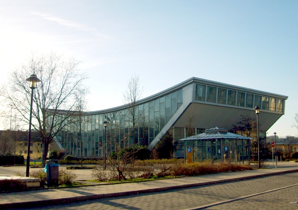
Sight 11: Stadthalle

The Stadthalle Wuppertal is one of the most important sights in the city of Wuppertal and at the same time known worldwide as a concert and event venue due to its unique acoustics. It is located on the Johannisberg in the south of Elberfeld, not far from the city centre and Wuppertal's main train station. In the immediate vicinity are the Schwimmoper and the Wilhelm-Dörpfeld-Gymnasium.
Sight 12: Stadtsparkasse Wuppertal

Stadtsparkasse Wuppertal is a public credit institution based in Wuppertal in North Rhine-Westphalia. Its business area is the city of Wuppertal.
Wikipedia: Stadtsparkasse Wuppertal (DE), Website, Heritage Website
Sight 13: Armenpflegedenkmal

The neoclassical Elberfeld Monument to the Preservation of the Poor is the work of the Elberfeld sculptor Wilhelm Neumann-Torborg (1856–1917), which was erected on 24 September 1903 on the church square of the "Old Reformed Church of Elberfeld". The occasion was the 50th anniversary of the existence of the "Elberfeld System".
Sight 14: CityKirche Elberfeld

The Old Reformed Church is the oldest church in the Elberfeld district of Wuppertal. It is the successor to the Catholic Church of St. Laurentius until the Reformation and has been the main Protestant church of the Wuppertal church district since 2005 as the City Church of Elberfeld.
Wikipedia: Alte reformierte Kirche Elberfeld (DE), Website, Heritage Website
Sight 15: Köbohaus

The Köbo-Haus is a listed building at Alte Freiheit 26 in the Elberfeld district of the city of Wuppertal. It is the only house in the city that is built over the Wupper.
Sight 16: Jubiläumsbrunnen

The Jubilee Fountain is located on the northeastern side of Neumarkt, one of the most important inner-city squares in Wuppertal's Elberfeld district.
Wikipedia: Jubiläumsbrunnen (Wuppertal) (DE), Heritage Website
Sight 17: Von der Heydt-Museum

The Von der Heydt Museum is a museum in Wuppertal, Germany.
Sight 18: Alte lutherische Kirche am Kolk

The church on the Kolk is the second oldest church building in the Wuppertal district of Elberfeld after the Old Reformed Church. The originally baroque church has been rebuilt and renovated several times, most recently in the 2020s. It was deconsecrated at the end of September 2024.
Wikipedia: Kirche am Kolk (DE), Website, Heritage Website, Youtube
Sight 19: Rex Filmtheater

Rex-Theater is a historically protected theatre in Wuppertal, North Rhine-Westphalia, Germany.
Sight 20: Dürer-Haus

The Dürer House is a listed former school building in the Elberfeld district of Wuppertal. It is located on the eastern side of Wuppertal's main railway station on Döppersberg Street.
Sight 21: Sopp'scher Pavillon

The Sopp'sche Pavillon is a former automobile salon and workshop from the 1950s in Wuppertal-Elberfeld, which has been a listed building since 1998.
Sight 22: Kolkmannhaus

The Kolkmannhaus is a former commercial building or department store in Wuppertal-Elberfeld, which is now used as an office building. It is the most famous start-up centre in the city.
Sight 23: Ziegenburghöhlen

The Ziegenburg Caves are three nearby caves in the city of Wuppertal.
Sight 24: St. Marien Kirche

The Church of St. Mary in Wuppertal is the second sacred building built in the 19th century for the Catholic community of Elberfeld.
Sight 25: Waldbühne Hardt

The Waldbühne auf der Hardt is a venue in Wuppertal, Germany. The open-air stage is located on the grounds of the Hardt Landscape Park in the Elberfeld district.
Sight 26: Botanischer Garten

The Botanischer Garten Wuppertal, also known as the Botanischer Garten der Stadt Wuppertal, is a municipal botanical garden located at Elisenhöhe 1, Wuppertal, North Rhine-Westphalia, Germany. It is open daily without charge.
Sight 27: Elisenturm

The Elisenturm is a 21-metre-high observation tower in Wuppertal in a park on the Hardt ridge, north of the Wupper.
Sight 28: Hardt-Anlage

The Hardt-Anlagen, or usually abbreviated the Hardt, are a park on the partly wooded hill Hardtberg in the inner city area of Wuppertal, on the border between the districts of Elberfeld and Barmen.
Sight 29: Bismarckturm Wuppertal

The Bismarck Tower in Wuppertal is on the site of the hard system, a park -like mountain back in the center of Wuppertal on the border between the districts of Elberfeld and Barmen.
Share
How likely are you to recommend us?
Disclaimer Please be aware of your surroundings and do not enter private property. We are not liable for any damages that occur during the tours.
GPX-Download For navigation apps and GPS devices you can download the tour as a GPX file.