Self-guided Sightseeing Tour #3 in Jerusalem, Israel
Legend
Guided Free Walking Tours
Book free guided walking tours in Jerusalem.
Guided Sightseeing Tours
Book guided sightseeing tours and activities in Jerusalem.
Tour Facts
2.6 km
67 m
Experience Jerusalem in Israel in a whole new way with our self-guided sightseeing tour. This site not only offers you practical information and insider tips, but also a rich variety of activities and sights you shouldn't miss. Whether you love art and culture, want to explore historical sites or simply want to experience the vibrant atmosphere of a lively city - you'll find everything you need for your personal adventure here.
Activities in JerusalemIndividual Sights in JerusalemSight 1: New Gate

The New Gate is the newest of the gates of the Old City of Jerusalem. It was built in 1889 by the Ottomans under the directorship of the French consul and Franciscan brotherhood monkship order to provide direct access between the Christian Quarter and the new neighborhoods then going up outside the walls. The arched gate is decorated with crenelated stonework. The New Gate was built at the highest point of the present wall, at 790 metres (2,590 ft) above sea level.
Sight 2: Saint Saviours Church

The Monastery of Saint Saviour is a Catholic Franciscan monastery located on 1 Saint Francis Street, east of the New Gate in the Old City of Jerusalem. The site was purchased from the Georgian Orthodox Church in 1560 with permission of Sultan Suleiman the Magnificent of the Ottoman Empire, and the monastery was constructed in stages. The church building was erected in 1885, with renovation in 1985. The site includes a printing press, an organ workshop, a library and a Catholic school.
Sight 3: Damascus Gate
Get Ticket*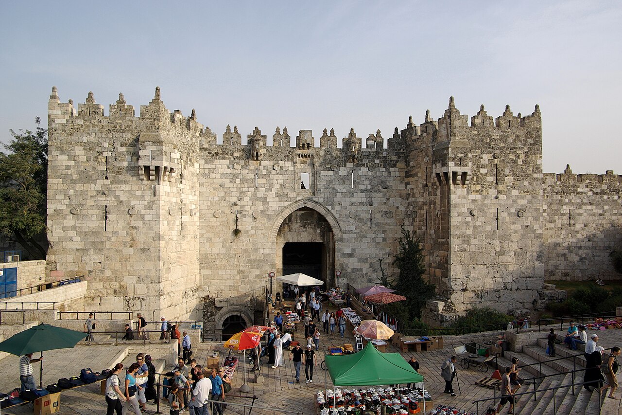
The Damascus Gate is one of the main Gates of the Old City of Jerusalem. It is located in the wall on the city's northwest side and connects to a highway leading out to Nablus, which in the Hebrew Bible was called Shechem or Sichem, and from there, in times past, to the capital of Syria, Damascus; as such, its modern English name is the Damascus Gate, and its modern Hebrew name is Sha'ar Shkhem, meaning Shechem Gate, or in modern terms Nablus Gate. Of its historic Arabic names, Bāb al-Naṣr means "gate of victory", and the current one, Bāb al-ʿĀmūd, means "gate of the column". The latter, in use continuously since at least as early as the 10th century, preserves the memory of a Roman column towering over the square behind the gate and dating to the 2nd century AD.
Sight 4: Zedekiah's cave

Zedekiah's Cave, also known as Solomon's Quarries, is a 5-acre (20,000 m2) underground meleke limestone quarry under the Muslim Quarter of the Old City of Jerusalem that runs the length of five city blocks. It was carved over a period of several thousand years and is a remnant of the largest quarry in Jerusalem.
Sight 5: Herod's Gate

Herod's Gate is one of the seven open Gates of the Old City of Jerusalem. It connects the Muslim Quarter inside of the old city to the eponymic Palestinian neighbourhood of Bab az-Zahra, situated just outside. It is a short distance to the east of the Damascus Gate. Its elevation is 755 meters above sea level.
Sight 6: Lithostrotos
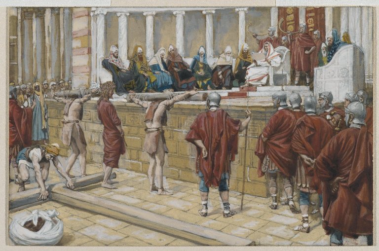
Gabbatha is the name of a place in Jerusalem that is also referred to by the Greek name of Lithostrōtos. It is recorded in the gospels to be the place of the trial of Jesus before his crucifixion c. 30/33 AD. The site of the Church of Ecce Homo is traditionally thought to be its location, but archaeological investigation has proven this unlikely. Herod's Palace is a more likely location.
Sight 7: Ecce Homo Basilica

The Convent of the Sisters of Zion is a Roman Catholic convent of the Congregation of Notre-Dame de Sion, located near the eastern end of the Via Dolorosa in the Old City of Jerusalem. The convent was built in 1857 by Marie-Alphonse Ratisbonne. The site includes the Church of Ecce Homo, also known as the Basilica of Ecce Homo, named for Pontius Pilate's Ecce homo speech which is traditionally thought to have taken place on the pavement below the church.
Sight 8: Ateret Cohanim Yeshiva

Ateret Cohanim, also Ateret Yerushalayim, is an Israeli Jewish organization with a yeshiva located in the Muslim Quarter of the Old City of Jerusalem. It supports the creation of a Jewish majority in the Old City and in Arab neighborhoods in East Jerusalem. Notable alumni of the yeshiva include Rabbi Nissan Ben-Avraham and Rabbi Eyal Karim.
Sight 9: Gate of the Watchman

The Inspector's Gate is one of the gates of the al-Aqsa Compound. It is the second-northernmost gates in the compound's west wall, after the Bani Ghanim Gate. It is north of the Iron Gate.
Sight 10: Pool of Bethesda

The Pool of Bethesda is referred to in John's Gospel in the Christian New Testament, in an account of Jesus healing a paralyzed man at a pool of water in Jerusalem, described as being near the Sheep Gate and surrounded by five covered colonnades or porticoes. It is also referred to as Bethzatha. It is now associated with the site of a pool in the current Muslim Quarter of the city, near the gate now called the Lions' Gate or St. Stephen's Gate and the Church of St. Anne, which was excavated in the late 19th century.
Share
Disclaimer Please be aware of your surroundings and do not enter private property. We are not liable for any damages that occur during the tours.
GPX-Download For navigation apps and GPS devices you can download the tour as a GPX file.