Self-guided Sightseeing Tour #4 in Zakopane, Poland
Legend
Tour Facts
1.9 km
255 m
Experience Zakopane in Poland in a whole new way with our free self-guided sightseeing tour. This site not only offers you practical information and insider tips, but also a rich variety of activities and sights you shouldn't miss. Whether you love art and culture, want to explore historical sites or simply want to experience the vibrant atmosphere of a lively city - you'll find everything you need for your personal adventure here.
Activities in ZakopaneIndividual Sights in ZakopaneSight 1: Juhaska Kopa

Juhaska Kopa – a small bulge in the ridge of the Long Giewont in the Polish Western Tatras between Juhaska Przehyba and Wyżni Wrótki. The northern slopes descend with a wall both to the Sucha Valley and to the Banie couloir in the upper part of the Strążyska Valley. The southern slopes descend to the Kondratowa Valley.
Sight 2: Turnia nad Białem
Crag on the Biały River – a crag in the ridge of the Long Giewont in the Polish Western Tatras. It is located in the eastern part of this ridge, steeply descending to Kalacka Kopa, between Wrótki and Wyżne Wrótki. The latter pass is located just on the west side of Turnia nad Białem, while a grassy and rocky ridge about 450 m long descends to Wrótka.
Sight 3: Kalacka Kopa

Kalacka Kopa – a peak in the eastern ridge of the Long Giewont in the Polish Tatra Mountains.
Sight 4: Mokra Koleba
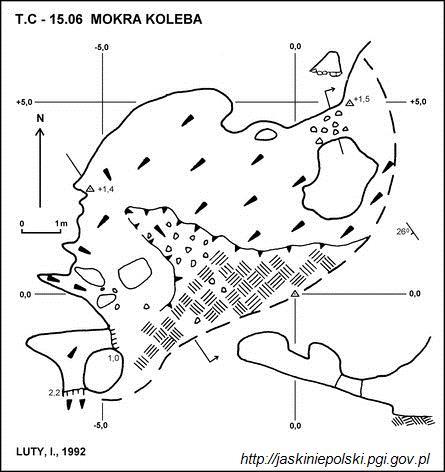
Mokra Koleba – a cave, or rather a shelter, in the Kondratowa Valley in the Western Tatras. The entrance to it is located on the southern slope of Kalacka Turnia, at an altitude of 1285 meters above sea level. The length of the cave is 11 meters, and its denivelation is 2.5 meters.
Sight 5: Jaskinia Bystrej

Bystra Cave, formerly also Nižní Kalacká Cave – a cave located in the Western Tatras in the Bystra Valley, at the foot of Kalacká Turnia. Together with the Kalacka Cave and the Dudnica Cave, it is part of the drainage system of the Giewont massif.
Sight 6: Kalacka Turnia

Kalacka Turnia – a crag rising above the Kalatówki clearing in the Polish Tatra Mountains. It is located at the end of the eastern ridge of the Long Giewont. On Kalacka Kopa this ridge splits into two branches; Kalacka Turnia is located in the orographically right. Its south-western slopes descend to the Bystra Valley, the north-eastern slopes to the Kalacký Riverbed. The slopes are now completely forested, only the very top is rocky, similar to the ruins of a castle. For this reason, in the first half of the nineteenth century, it was called the "Zakopane Castle". It is built of limestone rocks. The limestone substrate causes karst phenomena to occur here. At the south-western foot of Kalacka Turnia there is a large Bystra Spring, and in the slopes there are caves: Mokra Koleba, Fascinating Nyża, Kalacki Tunnel, Dudnica, Kalacka Cave, Bystra Cave, Hole behind the Boulders, Kozi Korytarz.
Sight 7: Dudnica
Dudnica – a cave in the Bystra Valley in the Western Tatras. It has two entrance openings, located close to each other, at the foot of Kalacka Turnia at an altitude of 1181 meters above sea level, near the mouth of the Bystra Cave. The length of the cave is 185 meters, and the denivelation is 12 meters.
Sight 8: Jaskinia Kalacka

Kalacka Cave – a cave located in the Bystra Valley in the Western Tatras. The entrance to it is located on the eastern slope of Kalacka Turnia descending to the Kalatówka clearing, above the Bystra Spring, slightly above the marked tourist trail to the Kondratowa Valley, at an altitude of 1230 meters above sea level. The length of the cave is 405 meters, and its denivelation is 19 meters.
Share
Disclaimer Please be aware of your surroundings and do not enter private property. We are not liable for any damages that occur during the tours.
GPX-Download For navigation apps and GPS devices you can download the tour as a GPX file.