Self-guided Sightseeing Tour #1 in Lloret de Mar, Spain
Legend
Tour Facts
2.8 km
127 m
Experience Lloret de Mar in Spain in a whole new way with our free self-guided sightseeing tour. This site not only offers you practical information and insider tips, but also a rich variety of activities and sights you shouldn't miss. Whether you love art and culture, want to explore historical sites or simply want to experience the vibrant atmosphere of a lively city - you'll find everything you need for your personal adventure here.
Individual Sights in Lloret de MarSight 1: Castell de Sant Joan
The castle of Sant Joan is a fortification in the municipality of Lloret de Mar (Selva) declared a cultural asset of national interest. The bastion is located on a small elevation popularly known as the Turó des Castell, which accumulates a slope of 60 meters above sea level. From its position we can perfectly see, in addition to the area near the centre of Lloret, the castle of Sant Joan de Blanes, which is part of the same line of fortifications. The castle of Sant Joan is located on the hill that separates Lloret from Fenals, on a cliff. There is a path that starts from Passeig Manuel i Bernat and runs along the sea until you reach the castle. It has no loss. This is the walking tour. At the same time, you can also leave by car from Plaça de la Riera; take Carrer Francesc Campedrà straight on, and then Carrer Marià Fortuny, which ends up taking us to the castle. The castle is literally hanging next to the cliffs.
Sight 2: La Dona Marinera
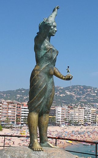
The Venus of Lloret is an open-air sculpture in the municipality of Lloret de Mar (Selva) that is part of the Inventory of the Architectural Heritage of Catalonia.
Sight 3: Sant Romà
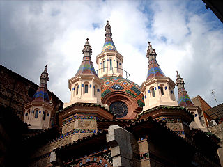
Sant Romà de Lloret is a church in the municipality of Lloret de Mar (Selva) that is part of the Inventory of the Architectural Heritage of Catalonia. The parish of Sant Romà is attached to the Diocese of Girona.
Sight 4: Museu del Mar
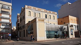
Can Garriga is a building in the municipality of Lloret de Mar (Selva) that is part of the Inventory of the Architectural Heritage of Catalonia. It is a three-storey corner building with a terrace located on the right side of Paseo Jacint Verdaguer, next to the sea. It is located between the promenades of Camprodon and Arrieta, Verdaguer, Carrer Joan Durall and the Travessia de Venècia. It is formed by the union of two houses that occupied an entire block of houses in the old town of Lloret. This other house, which also has a courtyard to the east, but is simpler to build and decorate. It is the headquarters of the Museum of the Sea in Lloret de Mar.
Sight 5: Castell d'en Plaja
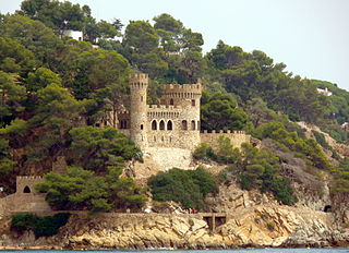
The Castell d'en Plaja is an isolated castle-shaped building in the municipality of Lloret de Mar (Selva) included in the Inventory of the Architectural Heritage of Catalonia. It is located near Turó Rodó, on the left side of Lloret's main beach. It is a place with a lot of visibility and very visible from all over the beach of Lloret, which has made it the motif and logo of traditional beach tourism in Lloret.
Sight 6: Jaciment Ibèric del Turó Rodó
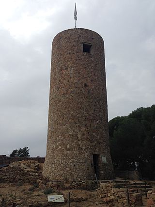
The Iberian settlement of Turó Rodó is located on a peninsular promontory 40 metres high, located northeast of the town of Lloret de Mar. The eastern and southern sides rise directly above the sea, with the beach of Sa Caleta to the west. This situation makes it a strategic place, both because of the wide visual panorama that allows you to see, and because it is a place that is easy to defend. In addition, the beach of Sa Caleta served as a refuge for boats, a very important aspect for these communities that practiced fishing.
Share
How likely are you to recommend us?
Disclaimer Please be aware of your surroundings and do not enter private property. We are not liable for any damages that occur during the tours.
GPX-Download For navigation apps and GPS devices you can download the tour as a GPX file.
