Self-guided Sightseeing Tour #9 in Birmingham, United Kingdom
Legend
Tour Facts
8.3 km
200 m
Experience Birmingham in United Kingdom in a whole new way with our free self-guided sightseeing tour. This site not only offers you practical information and insider tips, but also a rich variety of activities and sights you shouldn't miss. Whether you love art and culture, want to explore historical sites or simply want to experience the vibrant atmosphere of a lively city - you'll find everything you need for your personal adventure here.
Activities in BirminghamIndividual Sights in BirminghamSight 1: St Basil's Centre
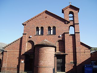
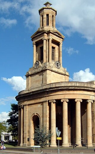
St Basil's Church, Deritend is a Grade II listed former parish church in the Church of England in Birmingham.
Sight 2: Canalside Warehouse at Warwick Bar, Dock and Stoplock
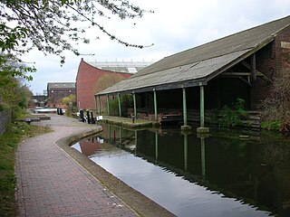
The Warwick Bar conservation area is a conservation area in Birmingham, England which was home to many canalside factories during the Industrial Revolution of the eighteenth and nineteenth centuries.
Sight 3: Eastside City Park
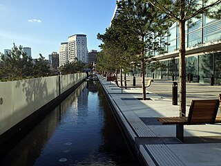
Eastside City Park is a 6.75 acre urban park located in the Eastside district of Birmingham City Centre. Designed by architects Patel taylor with landscape architect Allain Provost, the park was opened to the public on 5 December 2012 at a cost of £11.75 million. Lining the frontage of Millennium Point, the park provides 14,300 square metres of landscaped green space, 310 trees, a 110 metres (360 ft) canal water feature and a public square incorporating 21 jet fountains.
Sight 4: The Woodman
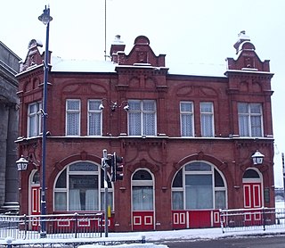
The Woodman is a pub in the Digbeth area of Birmingham, England. It is located on the corner of New Canal Street and what was formerly part of Albert Street, now part of an urban park called Eastside City Park and is Grade II listed. After an extended period of closure owing to the COVID-19 pandemic and the development of an HS2 rail scheme, the pub reopened on 13 September 2024.
Sight 5: Curzon Street Station
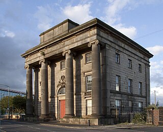
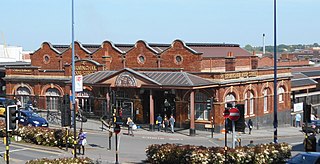
Birmingham Curzon Street railway station was a railway station in central Birmingham, England. Initially used as a major early passenger terminus before being eclipsed by newer facilities and converted into a goods depot, it was a continuously active railway facility up until 1966.
Wikipedia: Birmingham Curzon Street railway station (1838–1966) (EN)
Sight 6: Christopher Wray Lighting Works
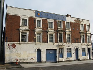
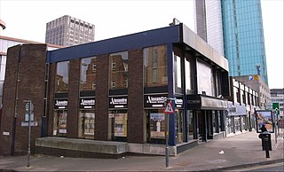
Christopher Wray Lighting works is a grade II-listed building in the east side of Birmingham city centre, England. The works consist of a complex of buildings fronted by a row of three townhouses, left vacant since 2003.
Sight 7: Birmingham Moor Street
Get Ticket*Birmingham Moor Street, also known as Moor Street station, is one of three main railway stations in the city centre of Birmingham, England, along with Birmingham New Street and Birmingham Snow Hill.
Sight 8: The Rotunda
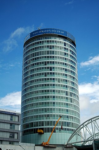
The Rotunda is a cylindrical highrise building in Birmingham, England. The Grade II listed building is 81 metres (266 ft) tall and was completed in 1965. Originally designed to be an office block, by architect James A. Roberts ARIBA, it was refurbished between 2004 and 2008 by Urban Splash with Glenn Howells who turned it into a residential building, with serviced apartments on 19th and 20th floors. The building was officially reopened on 13 May 2008.
Sight 9: Lord Nelson
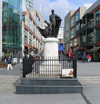
The Statue of Horatio Nelson, 1st Viscount Nelson, by Richard Westmacott stands in the Bull Ring, Birmingham, England.
Sight 10: St Martins
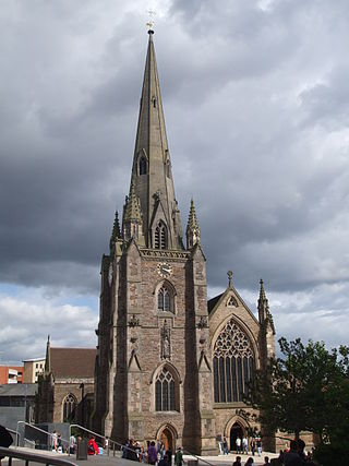
St Martin in the Bull Ring is a Church of England parish church in the city of Birmingham, West Midlands, England. It is the original parish church of Birmingham and stands between the Bull Ring Shopping Centre and the markets.
Sight 11: The Institute
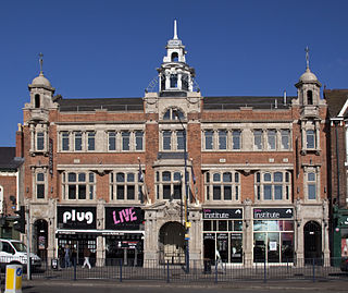
The Digbeth Institute (currently known for sponsorship reasons as the O2 Institute) is a music venue located in Birmingham, England. The venue opened in 1908 as a mission of Carrs Lane Congregational Church. It has also served as an event centre, civic building and nightclub.
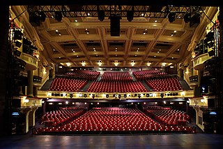
Sight 12: Birmingham Hippodrome Theatre
The Birmingham Hippodrome is a theatre situated on Hurst Street in the Chinese Quarter of Birmingham, England.
Wikipedia: Birmingham Hippodrome (EN), Website, Theatricalia
Sight 13: Back To Backs
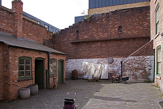
The Birmingham Back to Backs are the city's last surviving court of back-to-back houses. They are preserved as examples of the thousands of similar houses that were built around shared courtyards, for the rapidly increasing population of Britain's expanding industrial towns. They are a very particular sort of British terraced housing. This sort of housing was deemed unsatisfactory, and the passage of the Public Health Act 1875 meant that no more were built; instead byelaw terraced houses took their place. This court, at 50–54 Inge Street and 55–63 Hurst Street, is now operated as a historic house museum by the National Trust.
Sight 14: Meridian House
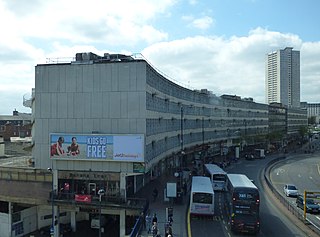
Ringway Centre is a Grade B locally listed building located on Smallbrook Queensway in the city centre of Birmingham, England. The six-storey, 230 metres (750 ft) long building was designed by architect James Roberts as part of the Inner Ring Road scheme in the 1950s and is notable for its gentle sweeping curved frontal elevation.
Sight 15: The Old Repertory Theatre
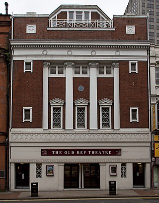
The Old Rep is a Grade II listed theatre, located on Station Street in Birmingham, England. When it was constructed in 1913, it was the United Kingdom's first ever purpose-built repertory theatre. When built, it became the permanent home for Barry Jackson's newly formed Birmingham Repertory Company, which began life in 1911, born from his amateur theatre group, The Pilgrim Players, founded in 1907. Jackson funded the construction of the theatre and established a professional, resident company there, which soon became a major powerhouse within the British theatre due to its innovative stagings of the works of both Shakespeare and George Bernard Shaw, resulting in some considering it to be Birmingham’s answer to The Old Vic.
Sight 16: New Alexandra Theatre
The Alexandra, commonly known as the Alex, is a theatre on Suffolk Queensway in Birmingham, England.
Sight 17: Alpha Tower
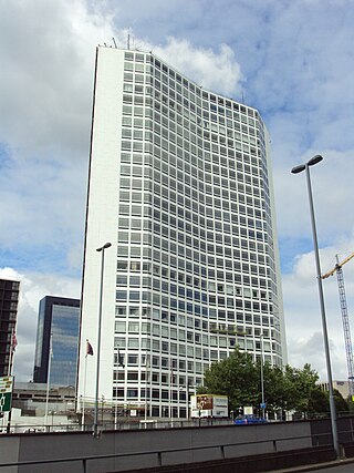
Alpha Tower is a Grade II listed office skyscraper in Birmingham, England. It was designed by the Birmingham-born architect George Marsh of Richard Seifert & Partners as the headquarters of the commercial television company ATV and part of the company's production studio complex known as ATV Centre, an adjacent shorter tower was planned but was never built. ATV closed in 1982, after which the building became offices.
Sight 18: Victoria Square House
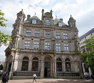
Victoria Square House, is an office building on the south side of Victoria Square, Birmingham, England. It was formerly Birmingham's Head Post Office, designed in the French Renaissance style by architect for the Office of Works Henry Tanner for the General Post Office.
Sight 19: Pagoda
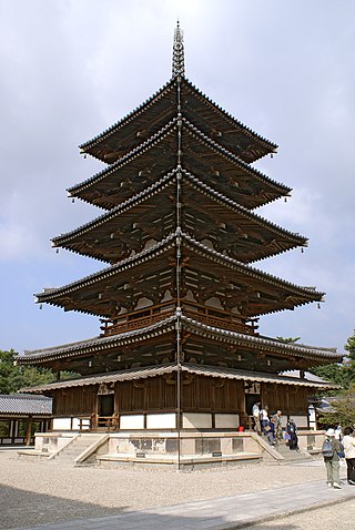
A pagoda is a tiered tower with multiple eaves common to Thailand, Cambodia, Nepal, China, Japan, Korea, Myanmar, Vietnam, and other parts of Asia. Most pagodas were built to have a religious function, most often Buddhist, but sometimes Taoist, and were often located in or near viharas. The pagoda traces its origins to the stupa, while its design was developed in ancient India. Chinese pagodas are a traditional part of Chinese architecture. In addition to religious use, since ancient times Chinese pagodas have been praised for the spectacular views they offer, and many classical poems attest to the joy of scaling pagodas.
Sight 20: St. Catherine's Catholic Church
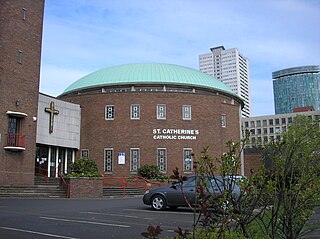
St Catherine of Siena Church is a parish of the Roman Catholic Church situated on Bristol Street in Birmingham, in the Archdiocese of Birmingham. Founded in 1874, its parish church was demolished and replaced in 1964. It was run by the Missionary Society of St. Columban from 2005 to 2013.
Sight 21: St. Thomas' Peace Garden
St Thomas' Peace Garden is a small public park in Birmingham, England, designated as a monument to peace and a memorial to all those killed in armed conflict.
Share
How likely are you to recommend us?
Disclaimer Please be aware of your surroundings and do not enter private property. We are not liable for any damages that occur during the tours.
GPX-Download For navigation apps and GPS devices you can download the tour as a GPX file.
