Self-guided Sightseeing Tour #15 in London, United Kingdom

Legend

Churches & Art
Nature
Water & Wind
Historical
Heritage & Space
Tourism
Paid Tours & Activities

Tour Facts

Number of sights 25 sights
Distance 13.7 km
Ascend 177 m
Descend 166 m

Experience London in United Kingdom in a whole new way with our self-guided sightseeing tour. This site not only offers you practical information and insider tips, but also a rich variety of activities and sights you shouldn't miss. Whether you love art and culture, want to explore historical sites or simply want to experience the vibrant atmosphere of a lively city - you'll find everything you need for your personal adventure here.

Activities in LondonIndividual Sights in London

Sight 1: Helios

Show sight on map

Helios is a three-metre high bronze, gilded sculpture created by T. B. Huxley-Jones in 1960, located at Television Centre in London, part of the Helios Building, a listed building in White City. The statue was restored and returned to the site in 2017.

Wikipedia: Helios (statue) (EN)

1276 meters / 15 minutes

Sight 2: St. Clement's Church

Show sight on map

St Clement's Church is a Church of England parish church in Notting Hill, Royal Borough of Kensington and Chelsea, London. The church is a grade II listed building.

Wikipedia: St Clement's Church, Notting Dale (EN)

755 meters / 9 minutes

Sight 3: St James Norlands

Show sight on map

St James' Church, Norlands, is a historic Grade II listed church in London, United Kingdom. It is affiliated with the Church of England. It was designed by architects Lewis Vulliamy and Robert Jewell Withers, and its construction was completed in 1845. The church was consecrated on 17 July of the same year.

Wikipedia: St James' Church, Norlands (EN), Heritage Website

784 meters / 9 minutes

Sight 4: St. Johns Church

Show sight on map

St John's Notting Hill is a Victorian Anglican church built in 1845 in Lansdowne Crescent, Notting Hill, London, designed by the architects John Hargrave Stevens (1805/6–1857) and George Alexander (1810–1885), and built in the Victorian Gothic style. Dedicated to St John the Evangelist, the church was originally built as the centrepiece of the Ladbroke Estate, a mid nineteenth century housing development designed to attract upper- and upper middle-class residents to what was then a largely rural neighbourhood in the western suburbs of London.

Wikipedia: St John's, Notting Hill (EN), Website, Heritage Website

377 meters / 5 minutes

Sight 5: Ladbroke Square

Show sight on map

Ladbroke Square is a garden square in Notting Hill, west London, England.

Wikipedia: Ladbroke Square (EN)

495 meters / 6 minutes

Sight 6: St Peter's

Show sight on map
St Peter's

St Peter's Notting Hill is a Victorian Anglican church in Kensington Park Road, Notting Hill, London. Designed in the classical style by architect Thomas Allom, work was begun in 1855 and completed in 1857.

Wikipedia: St Peter's, Notting Hill (EN), Website, Heritage Website

633 meters / 8 minutes

Sight 7: Powis Square

Show sight on map
Powis SquareJim Linwood from London / CC BY 2.0

Powis Square is a garden square and locality in Notting Hill, in the Royal Borough of Kensington and Chelsea in London, England. The closest London Underground station to the square is Westbourne Park tube station.

Wikipedia: Powis Square, London (EN)

433 meters / 5 minutes

Sight 8: St Mary of the Angels

Show sight on map
St Mary of the Angels David Anstiss / CC BY-SA 2.0

St Mary of the Angels is a Roman Catholic church on Moorhouse Road in Bayswater, London, England, within the City of Westminster. The parish it serves is partly in the City of Westminster and partly in the Royal Borough of Kensington and Chelsea.

Wikipedia: St Mary of the Angels, Bayswater (EN)

832 meters / 10 minutes

Sight 9: Leinster Square Gardens

Show sight on map

Leinster Square and Prince's Square are mirroring garden squares in Bayswater on the cusp of Westbourne and Notting Hill. One street overlaps the two squares. It is within the large additions of 1965 to the City of Westminster, London, W2.

Wikipedia: Leinster Square (EN)

310 meters / 4 minutes

Sight 10: Greek Orthodox Cathedral of St Sophia

Show sight on map

Saint Sophia Cathedral is a Greek Orthodox church on Moscow Road in the Bayswater area of London.

Wikipedia: Saint Sophia Cathedral, London (EN), Heritage Website

1360 meters / 16 minutes

Sight 11: Paddington Bear

Show sight on map

The statue of Paddington Bear at London Paddington station is a bronze sculpture by Marcus Cornish. Erected in 2000, it marks the association between Michael Bond's fictional bear and the station from which his name derives.

Wikipedia: Statue of Paddington Bear (EN)

51 meters / 1 minutes

Sight 12: Great Western Railway War Memorial

Show sight on map

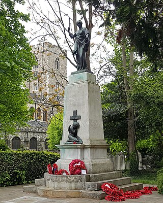
The Great Western Railway War Memorial is a First World War memorial by Charles Sargeant Jagger and Thomas S. Tait. It stands on platform 1 at London Paddington station, commemorating the 2,500 employees of the Great Western Railway (GWR) who were killed in the conflict. One-third of the GWR's workforce of almost 80,000 left to fight in the First World War, the company guaranteeing their jobs, and the GWR gave over its workshops for munitions manufacturing as well as devoting its network to transporting soldiers and military equipment. The company considered several schemes for a war memorial before approaching Jagger to design a statue. Some officials continued to push for an alternate design, to the point that Jagger threatened to resign. Jagger was working on several other war memorial commissions at the same time as the GWR's, including his most famous, the Royal Artillery Memorial.

Wikipedia: Great Western Railway War Memorial (EN), Website

561 meters / 7 minutes

Sight 13: The Rolling Bridge

Show sight on map

The Rolling Bridge is a kinetic sculpture, and a unique type of curling moveable bridge, completed in 2004 as part of the Grand Union Canal office and retail development project at Paddington Basin, London.

Wikipedia: The Rolling Bridge (EN)

393 meters / 5 minutes

Sight 14: Church of St Mary

Show sight on map

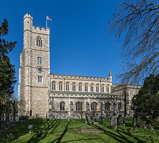
St Mary on Paddington Green is an Anglican church in the Parish of Little Venice, London, and forms part of Paddington Green conservation area. Today it stands at the junction of Edgware Road and Harrow Road, overlooking the East end of Westway and the approaches to Marylebone Flyover, so seen by tens of thousands of motorists daily.

Wikipedia: St Mary on Paddington Green Church (EN), Website, Heritage Website

660 meters / 8 minutes

Sight 15: Lisson Gallery

Show sight on map
Lisson GalleryEwan Munro from London, UK / CC BY-SA 2.0

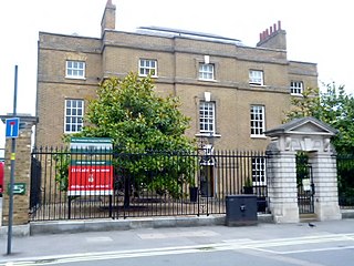
Lisson Gallery is a contemporary art gallery with locations in London and New York, founded by Nicholas Logsdail in 1967. The gallery represents over 50 artists such as Art & Language, Ryan Gander, Carmen Herrera, Richard Long, John Latham, Sol LeWitt, Robert Mangold, Jonathan Monk, Julian Opie, Richard Wentworth, Anish Kapoor, Richard Deacon and Ai Weiwei.

Wikipedia: Lisson Gallery (EN), Website

409 meters / 5 minutes

Sight 16: The Show room

Show sight on map

The Showroom is a not-for-profit art gallery in Marylebone, London, which displays site-specific works by emerging artists. The gallery presents four shows each year, a schedule that allows artists the time to develop and realise their work on site.

Wikipedia: The Showroom (EN), Website

369 meters / 4 minutes

Sight 17: The Cockpit Theatre

Show sight on map
The Cockpit Theatre

The Cockpit was a theatre in London, operating from 1616 to around 1665. It was the first theatre to be located near Drury Lane. After damage in 1617, it was named The Phoenix.

Wikipedia: Cockpit Theatre (EN), Website

603 meters / 7 minutes

Sight 18: Marylebone station

Show sight on map
Marylebone station N Chadwick / CC BY-SA 2.0

Marylebone station is a Central London railway terminus and connected London Underground station in the Marylebone area of the City of Westminster. On the National Rail network, it is also known as London Marylebone and is the southern terminus of the Chiltern Main Line to Birmingham. An accompanying Underground station is on the Bakerloo line, sited between Edgware Road and Baker Street stations in Transport for London's fare zone 1.

Wikipedia: Marylebone station (EN), Heritage Website

249 meters / 3 minutes

Sight 19: Dorset Square

Show sight on map

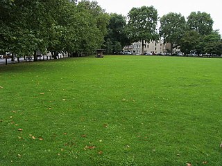
Dorset Square is a garden square in Marylebone, London. All buildings fronting it are terraced houses and listed, in the mainstream (initial) category. It takes up the site of Lord's (MCC's) Old Cricket Ground, which lasted 23 years until the 1811 season. Internally it spans 100,000 square feet (9,290 m2).

Wikipedia: Dorset Square (EN)

558 meters / 7 minutes

Sight 20: St Mary's

Show sight on map
St Mary's

St Mary's, Bryanston Square, is a Church of England church dedicated to the Virgin Mary on Wyndham Place, Bryanston Square, London. A related Church of England primary school which was founded next to it bears the same name.

Wikipedia: St Mary's, Bryanston Square (EN), Heritage Website

867 meters / 10 minutes

Sight 21: Madame Tussauds

Show sight on map
Madame Tussauds self-made / CC BY-SA 3.0

Madame Tussauds is a wax museum founded in London in 1835 by the French wax sculptor Marie Tussaud. One of the early main attractions was the Chamber of Horrors, which appeared in advertising in 1843.

Wikipedia: Madame Tussauds (EN), Website

473 meters / 6 minutes

Sight 22: St Cyprian's

Show sight on map

St Cyprian's Church is a parish church of the Church of England in the Marylebone district of London. The church was consecrated in 1903, but the parish was founded in 1866. It is dedicated to Cyprian, a third-century martyr and bishop of Carthage and is near the Clarence Gate Gardens entrance to Regent's Park, off Baker Street. The present church was designed by Ninian Comper and is a Grade II* listed building.

Wikipedia: St Cyprian's, Clarence Gate (EN), Website, Url, Heritage Website

276 meters / 3 minutes

Sight 23: Clarence Terrace

Show sight on map

Clarence Terrace overlooks Regent's Park in Marylebone, City of Westminster, London, England. This terrace is the smallest in the park. The terrace is a Grade I listed building.

Wikipedia: Clarence Terrace (EN), Heritage Website

236 meters / 3 minutes

Sight 24: Cornwall Terrace

Show sight on map

Cornwall Terrace is a Grade I listed building of consecutive terraced mansions overlooking Regent's Park in the City of Westminster, London. It is situated at the park's southwest corner, near Baker Street, between York Terrace and Clarence Terrace, within the park's Crown Estate development. Cornwall Terrace was part of the scheme of the Prince Regent, later King George IV, to develop grand housing in Regent's Park. The buildings are Grade I listed buildings.

Wikipedia: Cornwall Terrace (EN), Heritage Website

763 meters / 9 minutes

Sight 25: Park Square Gardens

Show sight on map

Park Square is a large garden square or private appendix to Regent's Park in London and is split from a further green, the long northern side of Park Crescent, by Marylebone Road and (single-entrance) Regent's Park tube station. It consists of two facing rows of large, very classically formed, stuccoed, terraced houses with decorative lower floor balconies and a colonnade of consecutive porticos by architect John Nash, and was built in 1823–24. Alike, shorter-length terraces flank its corners at right angles, equally Grade I listed buildings: Ulster Terrace, Ulster Place, St Andrew's Place and Albany Terrace.

Wikipedia: Park Square, London (EN), Website

Share

Spread the word! Share this page with your friends and family.

Disclaimer Please be aware of your surroundings and do not enter private property. We are not liable for any damages that occur during the tours.

GPX-Download For navigation apps and GPS devices you can download the tour as a GPX file.