Self-guided Sightseeing Tour #16 in London, United Kingdom
Legend
Tour Facts
7.9 km
128 m
Experience London in United Kingdom in a whole new way with our free self-guided sightseeing tour. This site not only offers you practical information and insider tips, but also a rich variety of activities and sights you shouldn't miss. Whether you love art and culture, want to explore historical sites or simply want to experience the vibrant atmosphere of a lively city - you'll find everything you need for your personal adventure here.
Activities in LondonIndividual Sights in LondonSight 1: Bedford Square
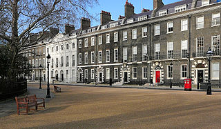
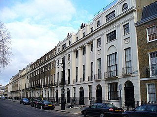
Bedford Square is a garden square in the Bloomsbury district of the Borough of Camden in London, England.
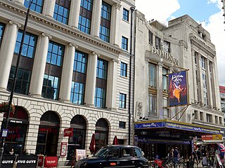
Sight 2: Dominion Theatre
The Dominion Theatre is a West End theatre and former cinema on Tottenham Court Road, close to St Giles Circus and Centre Point, in the London Borough of Camden. Planned as primarily a musical theatre, it opened in 1929, but the following year became a cinema—it hosted the London premiere of Charlie Chaplin's City Lights with Chaplin in attendance—and in 1933 after liquidation of the controlling company was sold to Gaumont cinema chain, which later became part of the Rank Organisation. It was a major premiere cinema until the 1970s, when it began to host live concerts.
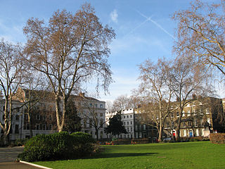
Sight 3: Bloomsbury Square
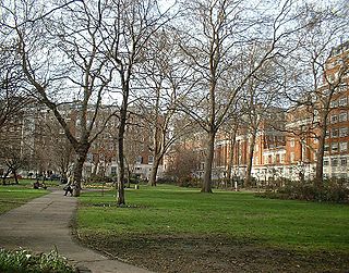
Bloomsbury Square is a garden square in Bloomsbury, in the London Borough of Camden, London. Developed in the late 17th century, it was initially known as Southampton Square and was one of the earliest London squares. By the early 19th century, Bedford House along the north of the square had been demolished and replaced with terraced housing designed by James Burton.
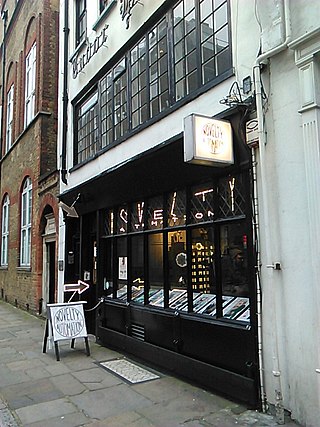
Sight 4: Novelty Automation
Novelty Automation is an amusement arcade of satirical game machines in Holborn, London. The machines are constructed by cartoonist and engineer Tim Hunkin, often by hand, and the arcade includes an expressive photo booth, an interactive divorce and a "small hadron collider". The arcade also includes three of Hunkin's machines which were once on display at Cabaret Mechanical Theatre's Covent Garden exhibition: The Frisker, Test Your Nerve and The Chiropodist.
Sight 5: Red Lion Square
Red Lion Square is a small square in Holborn, London. The square was laid out in 1684 by Nicholas Barbon, taking its name from the Red Lion Inn. According to some sources, the bodies of three regicides—Oliver Cromwell, John Bradshaw and Henry Ireton—were placed in a pit on the site of the square.
Sight 6: October Gallery
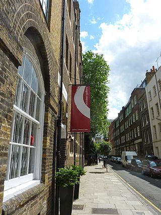
October Gallery is an art gallery in central London, England, established in 1979. It is notable for promoting the work of artists of the "Transvangarde" or trans-cultural avant-garde movement. The gallery also hosts talks, performances and seminars.
Sight 7: Queen Square Gardens
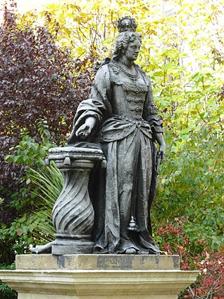
Queen Square is a garden square in the Bloomsbury district of central London. Many of its buildings are associated with medicine, particularly neurology.
Sight 8: Russell Square
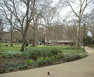
Russell Square is a large garden square in Bloomsbury, in the London Borough of Camden, built predominantly by the firm of James Burton. It is near the University of London's main buildings and the British Museum. Almost exactly square, to the north is Woburn Place and to the south-east is Southampton Row. Russell Square tube station sits to the north-east.
Sight 9: Woburn Square
Woburn Square is the smallest of the Bloomsbury squares and owned by the University of London. Designed by Thomas Cubitt and built between 1829 and 1847, it is named after Woburn Abbey, the main country seat of the Dukes of Bedford, who developed much of Bloomsbury.
Sight 10: Gordon Square
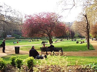
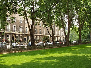
Gordon Square is a public park square in Bloomsbury, London, England. It is part of the Bedford Estate and was designed as one of a pair with the nearby Tavistock Square. It is owned by the University of London.
Sight 11: Tavistock Square
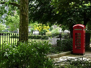
Tavistock Square is a public square in Bloomsbury, in the London Borough of Camden near Euston Station.
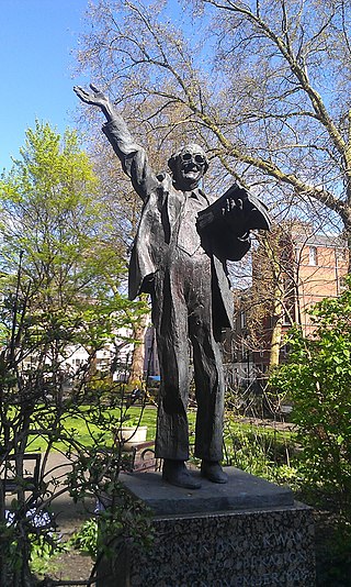
Sight 12: Mahatma Gandhi
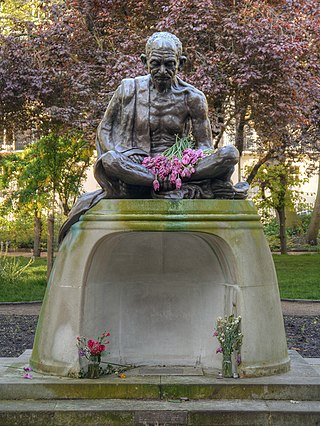
A bronze statue of Mahatma Gandhi by Fredda Brilliant was unveiled in 1968 at the centre of Tavistock Square in London, to mark the impending centenary of Gandhi's birth in 1869. Mahatma Gandhi had studied law at University College London nearby from 1888 to 1891, before being called to the bar at the Inner Temple.
Sight 13: Brunswick Square Gardens
Brunswick Square is a 3-acre (1.2 ha) public garden and ancillary streets along two of its sides in Bloomsbury, in the London Borough of Camden. It is overlooked by the School of Pharmacy and the Foundling Museum to the north; the Brunswick Centre to the west; and International Hall to the south. East is an enclosed area of playgrounds with further trees, Coram's Fields, associated with charity Coram Family which is just over double its size; next to that area Brunswick Square is mirrored, symmetrically by Mecklenburgh Square, likewise of 3 acres including roads. The squares are named after contemporary Queen consorts.
Sight 14: Mecklenburgh Square Gardens
Mecklenburgh Square is a Grade II listed square in Bloomsbury, London. The square and its garden were part of the Foundling Estate, a residential development of 1792–1825 on fields surrounding and owned by the Foundling Hospital. The square was named in honour of King George III's queen, Charlotte of Mecklenburg-Strelitz. It was begun in 1804, but was not completed until 1825.
Sight 15: Mail Rail Museum
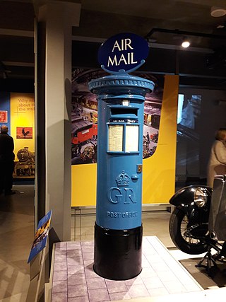
The Postal Museum is a postal museum run by the Postal Heritage Trust. It began in 2004 as The British Postal Museum & Archive and opened in Central London as The Postal Museum on 28 July 2017.
Sight 16: Church of our Most Holy Redeemer
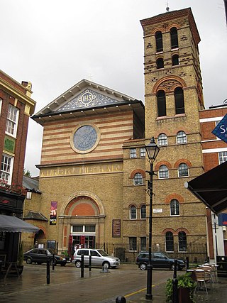
Our Most Holy Redeemer is a late 19th-century church in Clerkenwell, London, England, by the architect John Dando Sedding. It is an Anglo-Catholic church in the Diocese of London of the Church of England. It is at the junction of Exmouth Market and Rosebery Avenue in the London Borough of Islington. The church with attached clergy house, campanile, and parish hall is a Grade II*-listed building.
Wikipedia: Our Most Holy Redeemer (EN), Website, Heritage Website
Sight 17: St. James's Church
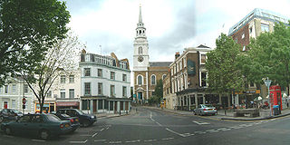
St James Church, Clerkenwell is an Anglican parish church in Clerkenwell, London, England.
Wikipedia: St James's Church, Clerkenwell (EN), Website, Heritage Website
Sight 18: Marx Memorial Library
The Marx Memorial Library in London, United Kingdom is a library, archive, educational, and community outreach charity focused on Marxist and wider socialist bodies of work.
Wikipedia: Marx Memorial Library (EN), Website, Heritage Website
Sight 19: Northampton Square
Northampton Square, a green town square, is in a corner of Clerkenwell projecting into Finsbury, in Central London. It is between Goswell Road and St John Street, has a very broad pedestrian walkway on the north-west side between university buildings and is fronted chiefly by main buildings of City, University of London.
Sight 20: Islington Museum
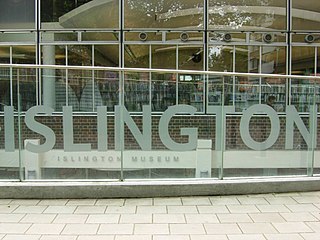
Islington Museum is a public museum dedicated to the history of the London Borough of Islington. It opened in 2008 and covers various themes on local and social history.
Share
How likely are you to recommend us?
Disclaimer Please be aware of your surroundings and do not enter private property. We are not liable for any damages that occur during the tours.
GPX-Download For navigation apps and GPS devices you can download the tour as a GPX file.
