Self-guided Sightseeing Tour #7 in Boston, United States
Legend
Tour Facts
12 km
436 m
Experience Boston in United States in a whole new way with our free self-guided sightseeing tour. This site not only offers you practical information and insider tips, but also a rich variety of activities and sights you shouldn't miss. Whether you love art and culture, want to explore historical sites or simply want to experience the vibrant atmosphere of a lively city - you'll find everything you need for your personal adventure here.
Activities in BostonIndividual Sights in BostonSight 1: Commonwealth Ave Mall
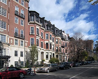
Commonwealth Avenue is a major street in the cities of Boston and Newton, Massachusetts. It begins at the western edge of the Boston Public Garden, and continues west through the neighborhoods of the Back Bay, Kenmore Square, Boston University, Allston, Brighton and Chestnut Hill. It continues as part of Route 30 through Newton until it crosses the Charles River at the border of the town of Weston.
Sight 2: Hotel Agassiz
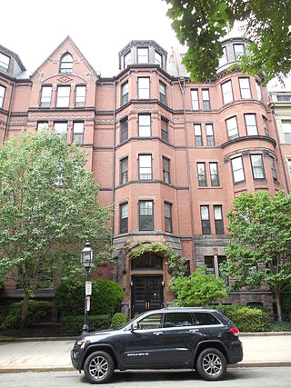
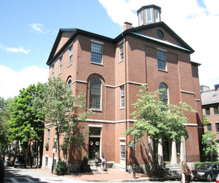
Hotel Agassiz is a historic building in Boston designed by Weston & Rand and built in 1872. It is located at 191 Commonwealth Avenue in the Back Bay. The building was designed for Alexander Agassiz and his brother-in-law Henry Lee Higginson (son of George Higginson who founded the Boston Symphony Orchestra. Alexander Agassiz was the developer and president of the Calumet Mine and Hecla Copper Mines.
Sight 3: Vendome Firefighters’ Memorial
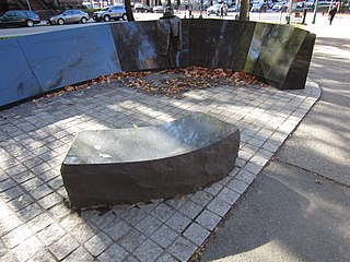
The Hotel Vendome Fire Memorial commemorates victims of the Hotel Vendome fire. It is installed along Boston's Commonwealth Avenue Mall, in the U.S. state of Massachusetts. The work was designed by the artist Ted Clausen and landscape architect Peter White. A group of firefighters originally proposed the memorial in 1982, but it was not initially approved by the Boston Arts Commission. The rejected proposal led to claims that the affluent residents of Back Bay had thwarted the proposal out of snobbery, regarding the design as "tacky." The Boston Globe columnist Mike Barnicle attributed the obstruction to the "elitism and self-importance" of those in the neighborhood. The design was finally approved in 1995 and ground was broken the following year.
Sight 4: Co|So: Copley Society of Art
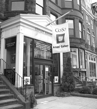
The Copley Society of Art is America's oldest non-profit art association. It was founded in 1879 by the first graduating class of the School of the Museum of Fine Arts and continues to play an important role in promoting its member artists and the visual arts in Boston. The Society is named after the renowned John Singleton Copley. The gallery currently represents over 400 living artist members, ranging in experience from students to nationally recognized artists and in style from traditional and academic realists to contemporary and abstract painters, photographers, sculptors, and printmakers. Several of the artists working in the tradition of the Boston School of painters exhibit at the Copley Society of Art, along with the Guild Of Boston Artists a few doors down from the Copley Society of Art's Newbury Street location.
Sight 5: New England Historic Genealogical Society
The New England Historic Genealogical Society (NEHGS) is the oldest and largest genealogical society in the United States, founded in year 1845.
Wikipedia: New England Historic Genealogical Society (EN), Website
Sight 6: First Church in Boston
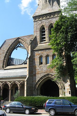
First Church in Boston is a Unitarian Universalist Church founded in 1630 by John Winthrop's original Puritan settlement in Boston, Massachusetts. The current building, located on 66 Marlborough Street in the Back Bay neighborhood, was designed by Paul Rudolph in a modernist style after a fire in 1968. It incorporates part of the earlier gothic revival building designed by William Robert Ware and Henry Van Brunt in 1867. The church has long been associated with Harvard University.
Sight 7: Gibson House
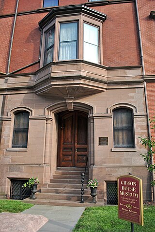
The Gibson House Museum is a historic house museum located at 137 Beacon Street in the Back Bay neighborhood of Boston, Massachusetts. It preserves the 1860 Victorian rowhouse occupied by three generations of the Gibson family. The house was one of the first to be built in Back Bay, and has an unparalleled state of preservation that includes wallpaper, textiles, furnishings, and family artifacts and collections. Both the public and service areas of the house exhibit a high degree of preservation, and are viewable on tours. The property was designated a Boston Landmark in 1992 by the Boston Landmarks Commission and a National Historic Landmark in 2001.
Sight 8: Ether Monument
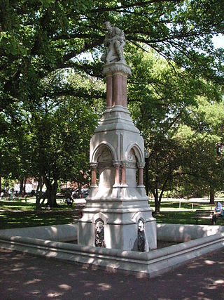
The Ether Monument, also known as The Good Samaritan, is a statue and fountain near the northwest corner of Boston's Public Garden, near the intersection of Arlington Street and Marlborough Street.
Sight 9: Japanese Lantern
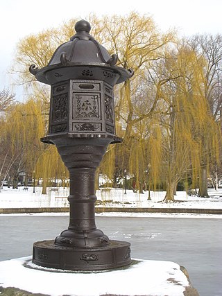
Japanese Lantern is a 1587 lantern sculpture, installed in Boston Public Garden, in Boston, Massachusetts, United States. The lantern was given to the city by Bunkio Matsuki in 1904.
Sight 10: George Washington Statue
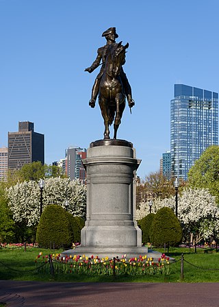
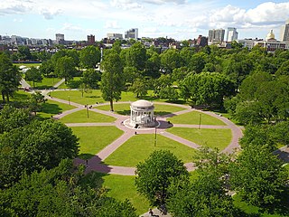
An equestrian statue of George Washington by Thomas Ball is installed in Boston's Public Garden, in the U.S. state of Massachusetts.
Wikipedia: Equestrian statue of George Washington (Boston) (EN)
Sight 11: Small Child
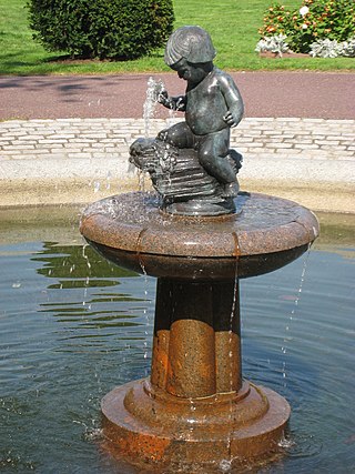
Small Child Fountain, also known as Baby Fountain, is a fountain and sculpture by Mary E. Moore, installed in Boston's Public Garden, in the U.S. state of Massachusetts. The fountain features a bronze sculpture of a nude boy, cast in 1929, that measure approximately 2 ft. 4 in. x 21 in. x 17 in. It rests on a granite base. The work was surveyed as part of the Smithsonian Institution's "Save Outdoor Sculpture!" program in 1993.
Wikipedia: Small Child Fountain (EN), Website, Heritage Website
Sight 12: Emmanuel Church
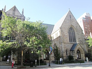
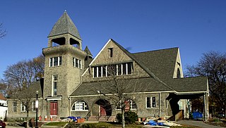
Emmanuel Episcopal Church is a historic church at 15 Newbury Street in the Back Bay neighborhood of Boston, Massachusetts. It was founded in 1860 as part of the Episcopal Diocese of Massachusetts.
Sight 13: Paine Furniture Building
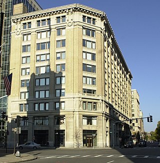
The Paine Furniture Building is an historic commercial building at 75-81 Arlington Street in Boston, Massachusetts. It occupies the entire block between St. James and Stuart Streets, and has a prominent position on Park Square.
Sight 14: Statler Fountain
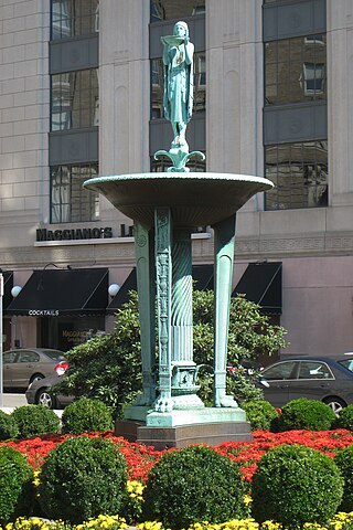
Statler Fountain is a 1930 fountain designed by Ulysses Anthony Ricci, installed in Boston's Statler Park, in the U.S. state of Massachusetts. The Art Deco fountain features a bronze statue of a woman. It was surveyed as part of the Smithsonian Institution's "Save Outdoor Sculpture!" program in 1993.
Sight 15: Statler Park
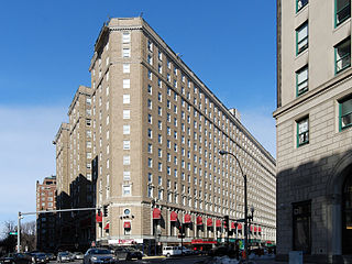
The Hilton Boston Park Plaza is a historic hotel in Boston, Massachusetts, United States, opened on March 10, 1927. It was built by hotelier E.M. Statler as part of his Statler Hotels chain. A prototype of the grand American hotel, it was called a "city within a city" and also contains an adjoining office building. It was the first hotel in the world to offer in-room radio in every room.
Sight 16: Marvin E. Goody Memorial
The Marvin E. Goody Memorial by Joan Goody is installed in Boston's Public Garden, in the U.S. state of Massachusetts. The red granite and Dakota mahogany memorial was dedicated in 1984, having been funded by Friends of the Public Garden and Common. It was surveyed as part of the Smithsonian Institution's "Save Outdoor Sculpture!" program in 1993.
Sight 17: Poe Returning to Boston
Poe Returning to Boston is a statue of American author Edgar Allan Poe in Boston, Massachusetts. It was created by the American sculptor Stefanie Rocknak. The statue is located at the corner of Boylston and Charles streets at Edgar Allan Poe Square.
Sight 18: Dorchester Temple Baptist Church
Dorchester Temple Baptist Church is a historic African American Baptist church at 670 Washington Street in Boston, Massachusetts. It is now known as Global Ministries Christian Church.
Sight 19: Paramount Theatre
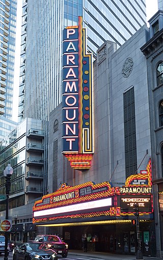
Paramount Theatre is a theatre in Boston on Washington Street, between Avery and West Streets.
Sight 20: Old South Meeting Place
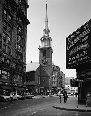
The Old South Meeting House is a historic Congregational church building located at the corner of Milk and Washington Streets in the Downtown Crossing area of Boston, Massachusetts, built in 1729. It gained fame as the organizing point for the Boston Tea Party on December 16, 1773. Five thousand or more colonists gathered at the Meeting House, the largest building in Boston at the time.
Sight 21: 5 Post Office Square
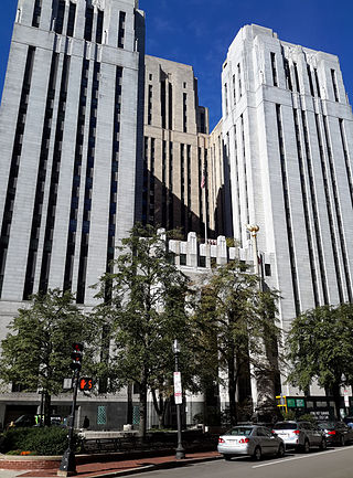
The John W. McCormack Post Office and Courthouse, formerly the United States Post Office, Courthouse, and Federal Building, is a historic building at 5 Post Office Square in Boston, Massachusetts. The twenty-two-story, 331-foot (101 m) skyscraper was built between 1931 and 1933 to house federal courts, offices, and post office facilities. The Art Deco and Moderne structure was designed in a collaboration between the Supervising Architect of the United States Treasury Department and the Boston architectural firm of Cram and Ferguson. It occupies a city block bounded by Congress, Devonshire, Water, and Milk Streets, and has over 600,000 square feet (56,000 m2) of floor space. The exterior of the building is faced in granite from a variety of New England sources, as well as Indiana limestone. It was built on the site of the 1885 United States Post Office and Sub-Treasury Building.
Wikipedia: John W. McCormack Post Office and Courthouse (EN)
Sight 22: Norman B. Leventhal Park
Get Ticket*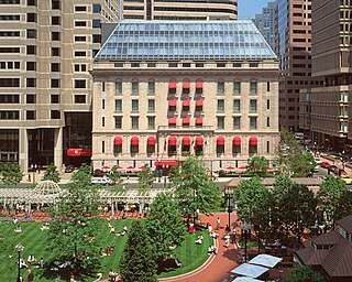
Post Office Square in Boston, Massachusetts, is a square located in the financial district at the intersection of Milk, Congress, Pearl and Water Streets. It was named in 1874 after the United States Post Office and Sub-Treasury which fronted it, now replaced by the John W. McCormack Post Office and Courthouse.
Sight 23: Codman Building
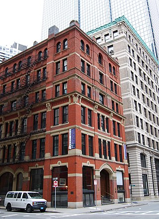
The Codman Building is a historic building at 55 Kilby Street in Boston, Massachusetts. The first four stories of this six-story brick and stone building were designed by Sturgis & Brigham and built in 1874 in the Gothic Revival style. It is the only one of the firm's commercial designs in the Financial District to survive. The upper three floors, in a more typical Late Victorian fashion, were added sometime before 1898.
Sight 24: Flour and Grain Exchange Building
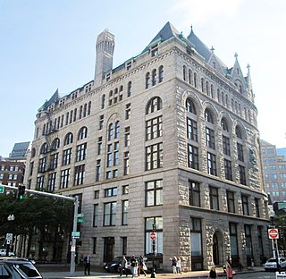
The Flour and Grain Exchange Building is a 19th-century office building in Boston. Located at 177 Milk Street in the Custom House District, at the edge of the Financial District near the waterfront, it is distinguished by the large black slate conical roof at its western end. It is referred to as the Grain Exchange Building and sometimes as the Boston Chamber of Commerce Building.
Sight 25: New England Aquarium
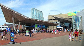
The New England Aquarium is a nonprofit organization located in Boston, Massachusetts. The species exhibited include harbor and northern fur seals, California sea lions, African and southern rockhopper penguins, giant Pacific octopuses, weedy seadragons, and thousands of saltwater and freshwater fishes. In addition to the main aquarium building, attractions at Central Wharf include the Simons Theatre and the New England Aquarium Whale Watch. More than 1.3 million guests visited the aquarium each year prior to the outbreak of the COVID-19 pandemic.
Sight 26: Christopher Columbus Waterfront Park
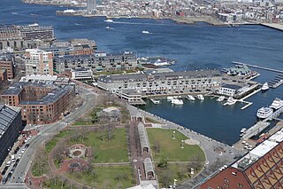
Get Ticket*The Christopher Columbus Waterfront Park is a public park in the Boston's North End. It is considered the start of the Boston Irish heritage trail.
Wikipedia: Christopher Columbus Waterfront Park (EN), Website, Facebook
Sight 27: Quincy Market
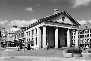
Get Ticket*Quincy Market is a historic building near Faneuil Hall in downtown Boston, Massachusetts. It was constructed between 1824 and 1826 and named in honor of mayor Josiah Quincy, who organized its construction without any tax or debt. The market is a designated National Historic Landmark and a designated Boston Landmark in 1996, significant as one of the largest market complexes built in the United States in the first half of the 19th century. According to the National Park Service, some of Boston's early slave auctions took place near what is now Quincy Market.
Sight 28: Faneuil Hall
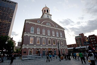
Faneuil Hall is a marketplace and meeting hall located near the waterfront and today's Government Center, in Boston, Massachusetts. Opened in 1742, it was the site of several speeches by Samuel Adams, James Otis, and others encouraging independence from Great Britain. It is now part of Boston National Historical Park and a well-known stop on the Freedom Trail. It is sometimes referred to as "the Cradle of Liberty", though the building and location have ties to slavery.
Sight 29: New England Holocaust Memorial
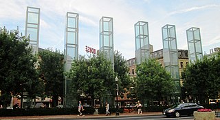
The New England Holocaust Memorial in Boston, Massachusetts, is dedicated to the Jewish people who were murdered by Nazi Germany during the Holocaust.
Sight 30: Sears' Crescent and Sears' Block Building
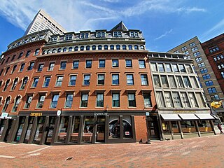
Sears' Crescent and Sears' Block are a pair of adjacent historic buildings located along Cornhill in Boston, Massachusetts. It is adjacent to City Hall and City Hall Plaza, Government Center, Boston.
Sight 31: Old City Hall
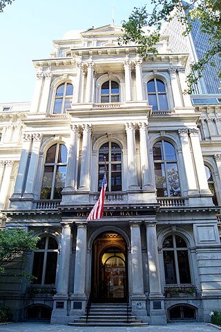
Get Ticket*Boston's Old City Hall was home to its city council from 1865 to 1969. It was one of the first buildings in the French Second Empire style to be built in the United States. After the building's completion, the Second Empire style was used extensively elsewhere in Boston and for many public buildings in the United States, including the Eisenhower Executive Office Building in Washington, D.C., Providence City Hall in Providence, Baltimore City Hall in Baltimore, and Philadelphia City Hall in Philadelphia. The building's architects were Gridley James Fox Bryant and Arthur Gilman.
Sight 32: Kings Chapel
Get Ticket*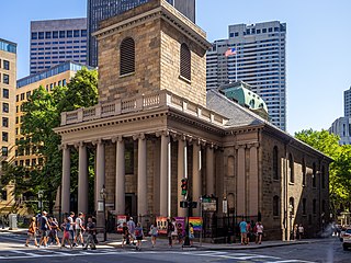
King's Chapel is an American independent Christian unitarian congregation affiliated with the Unitarian Universalist Association that is "unitarian Christian in theology, Anglican in worship, and congregational in governance." It is housed in what was for a time after the Revolution called the "Stone Chapel", an 18th-century structure at the corner of Tremont Street and School Street in Boston, Massachusetts. The chapel building, completed in 1754, is one of the finest designs of the noted colonial architect Peter Harrison, and was designated a National Historic Landmark in 1960 for its architectural significance. The congregation has worshipped according to a Unitarian version of the Book of Common Prayer since 1785, currently in its ninth edition.
Sight 33: Granary Burying Ground
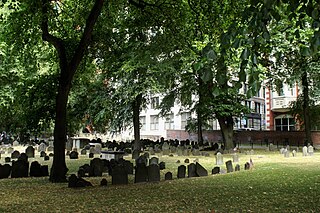
Get Ticket*The Granary Burying Ground in Massachusetts is the city of Boston's third-oldest cemetery, founded in 1660 and located on Tremont Street. It is the burial location of Revolutionary War-era patriots, including Paul Revere, the five victims of the Boston Massacre, and three signers of the Declaration of Independence: Samuel Adams, John Hancock, and Robert Treat Paine. The cemetery has 2,345 grave-markers, but historians estimate that as many as 5,000 people are buried in it. The cemetery is adjacent to Park Street Church, behind the Boston Athenæum and immediately across from Suffolk University Law School. It is a site on Boston's Freedom Trail. The cemetery's Egyptian revival gate and fence were designed by architect Isaiah Rogers (1800–1869), who designed an identical gate for Newport's Touro Cemetery.
Sight 34: Park Street Church
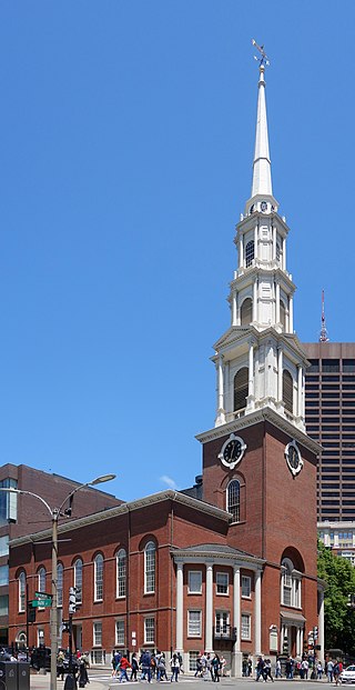
Get Ticket*Park Street Congregational Church, founded in 1809, is a historic and active evangelical congregational church in Downtown Boston, Massachusetts, United States. The Park Street Church is a member of the Conservative Congregational Christian Conference. Church membership records are private, but the congregation has over 1,200 members. The church is located at 1 Park Street, at the corner of Tremont Street.
Sight 35: General Joseph Hooker
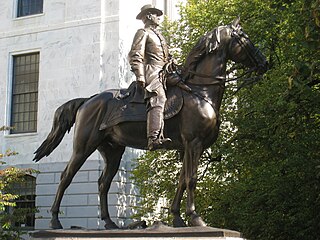
An equestrian statue of Joseph Hooker is installed outside the Massachusetts State House, facing Beacon Street in Boston, in the United States.
Sight 36: Declaration of Independence Tablet
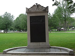
Declaration of Independence Tablet is a 1925 sculpture by John Francis Paramino, installed at Boston Common, in Boston, Massachusetts, United States.
Sight 37: Parkman Bandstand
The Parkman Bandstand is a landmark bandstand located on the eastern side of the Boston Common in Boston, Massachusetts, United States. It was built in 1912 from a design by Derby, Robinson & Shephard at a cost of $1 million on the site of the Cow Pond, which had been filled in 1838 after cattle-grazing had been outlawed on the Common.
Sight 38: Soldiers and Sailors Monument
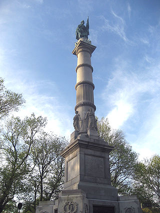
The Soldiers and Sailors Monument is a monument erected in Boston Common in downtown Boston, dedicated to soldiers and sailors of the Commonwealth of Massachusetts who died in the American Civil War. Designed by Martin Milmore, construction began in 1874 and the monument was dedicated on September 17, 1877. Union Generals George B. McClellan and Joseph Hooker were among the estimated 25,000 people attending the dedication on Boston Common.
Sight 39: Oneida Tablet
The Oneida Football Club, founded and captained by Gerrit Smith Miller in Boston, Massachusetts, in 1862, was the first organized team to play any kind of football in the United States. The game played by the club, known as the "Boston game", was an informal local variant that combined association and rugby football and predated the codification of rules for American football.
Sight 40: William Hickling Prescott House
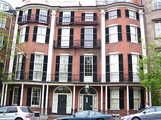
William Hickling Prescott House, also known as the Headquarters House, is an historic house museum located at 55 Beacon Street on Beacon Hill in Boston, Massachusetts. It is the left-hand portion of a double townhouse at 54–55 Beacon Street, seen in the photograph. The townhouse, built in 1808 to a design by Asher Benjamin, was designated a National Historic Landmark in 1964 for its association with William Hickling Prescott (1796–1859), one of the nation's first historians. The house is now a museum operated by the Massachusetts chapter of the National Society of the Colonial Dames of America, which purchased it for its headquarters in 1944.
Sight 41: Francis Parkman House
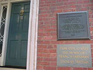
The Francis Parkman House is a National Historic Landmark at 50 Chestnut Street, on Beacon Hill in Boston, Massachusetts. Speculated to be designed by Cornelius Coolidge and built in 1824, it is one of a series of fine brick townhouses on Beacon Hill. Its significance lies in its ownership and occupancy by noted historian and horticulturalist Francis Parkman (1823–1893) from 1865 until his death. While living here, Parkman produced a significant portion of his landmark work, France and England in North America, a multi-volume epic history recounting the conflict for control of North America in the 17th and 18th centuries.
Sight 42: Phillips School
The Phillips School was a 19th-century school located in Beacon Hill, Boston, Massachusetts. It is now a private residence. It is on the Black Heritage Trail and its history is included in walking tours by the Boston African American National Historic Site. Built in 1824, it was a school for white children. After Massachusetts law from 1855 required school desegregation, Phillips was one of the first integrated schools in Boston.
Sight 43: Louisburg Square
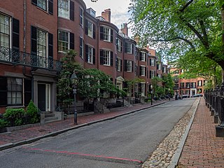
Louisburg Square is a street in the Beacon Hill neighborhood of Boston, Massachusetts, bisected by a small private park. The park, which is bounded by Pinckney Street to the north and Mount Vernon Street to the south, is maintained by the Louisburg Square Proprietors. While the Proprietors pay taxes to the City of Boston, the city does not own the park or its garden.
Sight 44: Church of the Advent
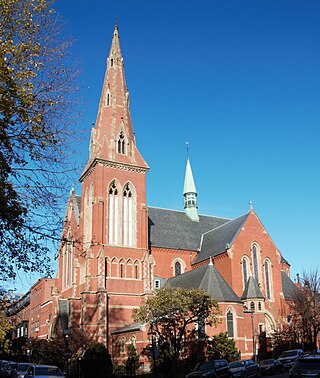
The Church of the Advent is an Episcopal parish in Boston, Massachusetts, United States. The church is housed in a Victorian Gothic building, faced in brick with eight large change ringing bells and a 172-foot spire. It is well known as a prominent center of Anglo-Catholic worship.
Sight 45: Make Way For Ducklings
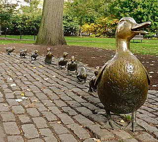
Make Way for Ducklings is a sculpture by Nancy Schön, which recreates the duck family in Robert McCloskey's children's classic Make Way for Ducklings.
Sight 46: Edwin Upton Curtis Memorial
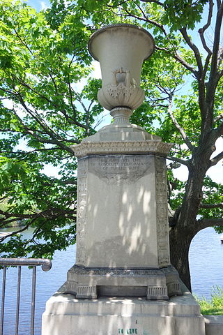
The Edwin Upton Curtis Memorial is a memorial commemorating Edwin Upton Curtis, installed along Boston's Charles River Esplanade, in the U.S. state of Massachusetts. The memorial features two large urns, and was originally installed near Clarendon Street during 1923–1924 before being relocation to their current position near the Hatch Shell.
Sight 47: The Lotta Fountain
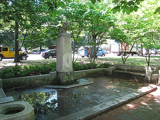
Lotta Fountain is a 1939 fountain and sculpture by artist Katharine Lane Weems and architects J. W. Ames and E. S. Dodge. It is installed along Boston's Charles River Esplanade in the U.S. state of Massachusetts.
Share
How likely are you to recommend us?
Disclaimer Please be aware of your surroundings and do not enter private property. We are not liable for any damages that occur during the tours.
GPX-Download For navigation apps and GPS devices you can download the tour as a GPX file.
