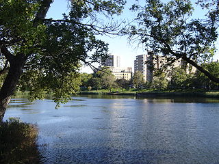
Self-guided Sightseeing Tour #1 in Minneapolis, United States
Legend
Tour Facts
2.4 km
50 m
Experience Minneapolis in United States in a whole new way with our free self-guided sightseeing tour. This site not only offers you practical information and insider tips, but also a rich variety of activities and sights you shouldn't miss. Whether you love art and culture, want to explore historical sites or simply want to experience the vibrant atmosphere of a lively city - you'll find everything you need for your personal adventure here.
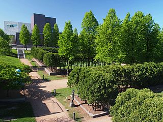
Individual Sights in MinneapolisSight 1: Minneapolis Sculpture Garden
The Minneapolis Sculpture Garden is an 11-acre (4.5 ha) park in Minneapolis, Minnesota, in the United States. It is located near the Walker Art Center, which operates it in coordination with the Minneapolis Park and Recreation Board. It reopened June 10, 2017, after a reconstruction that resulted with the Walker and Sculpture Garden being unified as one 19-acre campus. It is one of the largest urban sculpture gardens in the country, with 40 permanent art installations and several other temporary pieces that are moved in and out periodically.
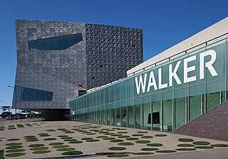
Sight 2: Walker Art Center
The Walker Art Center is a multidisciplinary contemporary art center in the Lowry Hill neighborhood of Minneapolis, Minnesota, United States. The Walker is one of the most-visited modern and contemporary art museums in the U.S.: together with the adjacent Minneapolis Sculpture Garden and Cowles Conservatory, it has an annual attendance of around 700,000 visitors. The museum's permanent collection includes over 13,000 modern and contemporary art pieces, including books, costumes, drawings, media works, paintings, photography, prints, and sculpture.
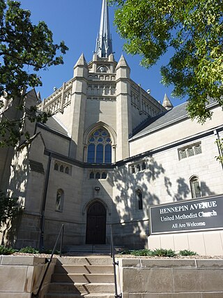
Sight 3: Hennepin Avenue United Methodist Church
Hennepin Avenue United Methodist Church is a church across the Virginia Triangle from the Walker Art Center in Minneapolis, Minnesota. Its address is 511 Groveland Avenue.
Wikipedia: Hennepin Avenue United Methodist Church (EN), Website
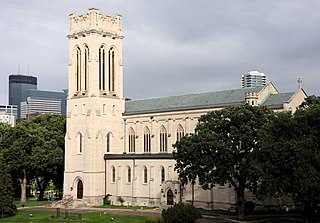
Sight 4: St. Mark's Episcopal Cathedral
Saint Mark's Episcopal Cathedral in Minneapolis is one of two cathedrals in the Episcopal Church in Minnesota. The church was founded in 1858 and designated as a cathedral in 1941. Its current building dates from 1910. In 2020, it reported 764 members, 315 average attendance, and $1,021,278 in plate and pledge financial support.
Wikipedia: St. Mark's Episcopal Cathedral (Minneapolis) (EN), Website
Sight 5: Loring Park
Loring Park is a park in the Loring Park neighborhood of Minneapolis, Minnesota.
Sight 6: Peavey Plaza
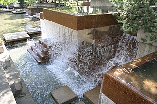
Peavey Plaza is a park plaza that serves as a public outdoor space in downtown Minneapolis, Minnesota at the south end of Nicollet Mall between South 11th and 12th Streets. The sunken plaza and its amphitheater were designed by landscape architect M. Paul Friedberg and built in 1975 alongside Orchestra Hall. The Cultural Landscape Foundation has deemed the plaza a "marvel of modernism" and it was named one of the top ten most endangered historical sites in Minnesota before its rehabilitation in 2019.
Share
How likely are you to recommend us?
Disclaimer Please be aware of your surroundings and do not enter private property. We are not liable for any damages that occur during the tours.
GPX-Download For navigation apps and GPS devices you can download the tour as a GPX file.
