Self-guided Sightseeing Tour #2 in Savannah, United States
Legend
Tour Facts
4.2 km
44 m
Experience Savannah in United States in a whole new way with our free self-guided sightseeing tour. This site not only offers you practical information and insider tips, but also a rich variety of activities and sights you shouldn't miss. Whether you love art and culture, want to explore historical sites or simply want to experience the vibrant atmosphere of a lively city - you'll find everything you need for your personal adventure here.
Activities in SavannahIndividual Sights in SavannahSight 1: Emmet Park
Get Ticket*Emmet Park, also known as The Strand, is an urban park in Savannah, Georgia, United States. Its most prominent section is located in the northeastern corner of the city's historic downtown area, in what was known as the Old Fort neighborhood, it continues in a dotted fashion for around 0.6 miles (0.97 km) west along Bay Street to its intersection with Jefferson Street. Monuments occupy several of the individual sections.
Sight 2: Yamacraw Bluff
Yamacraw Bluff is a bluff situated on the southern bank of the Savannah River. Now completely enclosed within downtown Savannah, Georgia, the bluff is most notable for being the site upon which General James Oglethorpe arrived to settle the British colony of Georgia. The area was originally inhabited by the Yamacraw Indians. A stone marker and statue now adorn the bluff in honor of its historic significance.
Sight 3: U.S. Customs and Border Protection
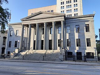
The U.S. Customhouse is a historic custom house located in Savannah in Chatham County, Georgia. It was built to house offices of the United States Customs Service.
Wikipedia: United States Customhouse (Savannah, Georgia) (EN), Website, Heritage Website
Sight 4: Wright Square
Get Ticket*The city of Savannah, Province of Georgia, was laid out in 1733, in what was colonial America, around four open squares, each surrounded by four residential "tithing") blocks and four civic ("trust") blocks. The layout of a square and eight surrounding blocks was known as a "ward." The original plan was part of a larger regional plan that included gardens, farms, and "outlying villages." Once the four wards were developed in the mid-1730s, two additional wards were laid. Oglethorpe's agrarian balance was abandoned after the Georgia Trustee period. Additional squares were added during the late 18th and 19th centuries, and by 1851 there were 24 squares in the city. In the 20th century, three of the squares were demolished or altered beyond recognition, leaving 21. In 2010, one of the three "lost" squares, Ellis, was reclaimed, bringing the total to today's 22.
Sight 5: Owens-Thomas House
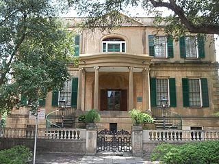
Get Ticket*The Owens–Thomas House & Slave Quarters is a historic home in Savannah, Georgia, that is operated as a historic house museum by Telfair Museums. It is located at 124 Abercorn Street, on the northeast corner of Oglethorpe Square. The Owens–Thomas House was designated a National Historic Landmark in 1976, as one of the nation's finest examples of English Regency architecture.
Sight 6: Savannah Theatre
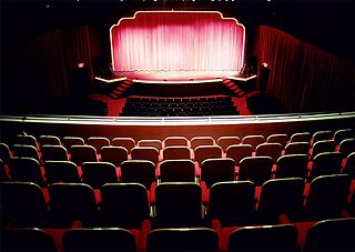
Get Ticket*The Savannah Theatre, first opened in 1818 and located on Bull Street, at Chippewa Square, in Savannah, Georgia, is one of the United States' oldest continually operating theatres. The structure has been both a live performance venue and a movie theater. Since 2002, the theatre has hosted regular performances of a variety of shows, primarily music revues.
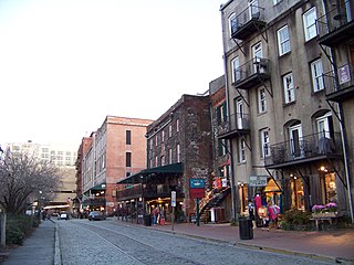
Sight 7: Savannah Historic District
Get Ticket*The Savannah Historic District is a large urban U.S. historic district that roughly corresponds to the pre–Civil War city limits of Savannah, Georgia. The area was declared a National Historic Landmark District in 1966, and is one of the largest urban, community-wide historic preservation districts in the United States. The district was established in recognition of the Oglethorpe Plan, a unique model of urban planning begun in 1733 by James Oglethorpe at Savannah's founding and propagated during the first century of the city's growth.
Wikipedia: Savannah Historic District (Savannah, Georgia) (EN)
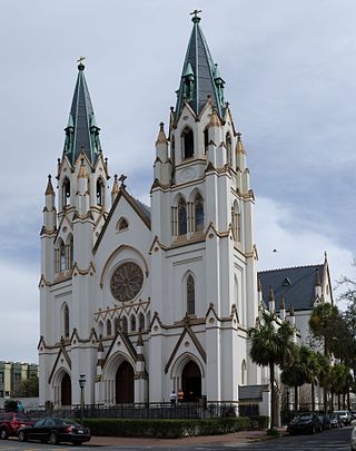
Sight 8: The Cathedral of Saint John the Baptist
The Cathedral Basilica of St. John the Baptist is a Roman Catholic cathedral and minor basilica near Lafayette Square at 222 East Harris Street, Savannah, Georgia, in the United States. It is the mother church of the Roman Catholic Diocese of Savannah.
Wikipedia: Cathedral Basilica of St. John the Baptist (Savannah, Georgia) (EN), Website
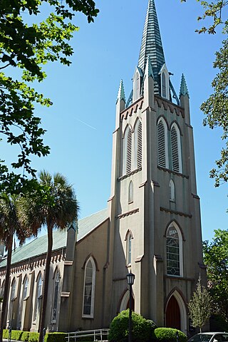
Sight 9: Saint Johns Episcopal Church
St. John's Church in Savannah is a parish of the Episcopal Diocese of Georgia.
Sight 10: Susie King Taylor Square
Taylor Square, formerly known as Calhoun Square, is one of the 22 squares of Savannah, Georgia, United States. Laid out in 1851 south of Lafayette Square, west of Whitefield Square, and east of Monterey Square, it is named in honor of the first American Civil War black nurse, educator and memoirist, Susie King Taylor.
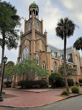
Sight 11: Congregation Mickve Israel
Congregation Mickve Israel is a Reform Jewish congregation and synagogue located at 20 East Gordon Street, Monterey Square, in Savannah, Georgia, in the United States. The site also contains a Jewish history museum.
Sight 12: Casimir Pulaski Monument
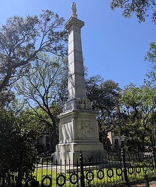
The Casimir Pulaski Monument in Savannah, or Pulaski Monument on Monterey Square, is a 19th-century monument to Casimir Pulaski, in Monterey Square, on Bull Street, Savannah, Georgia, not far from the battlefield where Pulaski lost his life during the siege of Savannah.
Wikipedia: Casimir Pulaski Monument (Savannah, Georgia) (EN)
Sight 13: Forsyth Park
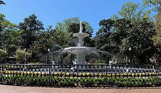
Get Ticket*Forsyth Park is a large city park that occupies 30 acres (0.12 km2) in the historic district of Savannah, Georgia, United States. The park is bordered by Gaston Street to the north, Drayton Street to the east, Park Avenue to the south and Whitaker Street to the west. It contains walking paths, a children's play area, a Fragrant Garden for the blind, a large fountain, tennis courts, basketball courts, areas for soccer and Frisbee, and home field for Savannah Shamrocks Rugby Club. From time to time, there are concerts held at Forsyth to the benefit of the public.
Share
How likely are you to recommend us?
Disclaimer Please be aware of your surroundings and do not enter private property. We are not liable for any damages that occur during the tours.
GPX-Download For navigation apps and GPS devices you can download the tour as a GPX file.
