Self-guided Sightseeing Tour #11 in Washington, United States
Legend
Tour Facts
7.8 km
147 m
Experience Washington in United States in a whole new way with our self-guided sightseeing tour. This site not only offers you practical information and insider tips, but also a rich variety of activities and sights you shouldn't miss. Whether you love art and culture, want to explore historical sites or simply want to experience the vibrant atmosphere of a lively city - you'll find everything you need for your personal adventure here.
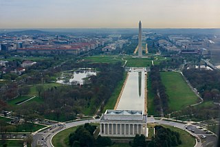
Individual Sights in WashingtonSight 1: The Mall
The National Mall is a landscaped park near the downtown area of Washington, D.C., the capital city of the United States. It contains and borders a number of museums of the Smithsonian Institution, art galleries, cultural institutions, and various memorials, sculptures, and statues. It is administered by the National Park Service (NPS) of the United States Department of the Interior as part of the National Mall and Memorial Parks unit of the National Park System. The park receives approximately 24 million visitors each year. Designed by Pierre L'Enfant, the "Grand Avenue" or Mall was to be a democratic and egalitarian space—unlike palace gardens, such as those at Versailles in France, that were paid for by the people but reserved for the use of a privileged few.
Sight 2: International Spy Museum
The International Spy Museum is an independent non-profit history museum which documents the tradecraft, history, and contemporary role of espionage. It holds the largest collection of international espionage artifacts on public display. The museum opened in 2002 in the Penn Quarter neighborhood of Washington, D.C., and relocated to L'Enfant Plaza in 2019.
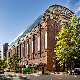
Sight 3: Museum of the Bible
The Museum of the Bible is a museum in Washington, D.C., owned by Museum of the Bible, Inc., a non-profit organization established in 2010 by the Green family. The museum documents the narrative, history, and impact of the Bible. It opened on November 17, 2017, and has 1,150 items in its permanent collection and 2,000 items on loan from other institutions and collections.
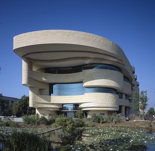
Sight 4: National Museum of the American Indian
The National Museum of the American Indian is a museum in the United States devoted to the culture of the Indigenous peoples of the Americas. It is part of the Smithsonian Institution group of museums and research centers.
Wikipedia: National Museum of the American Indian (EN), Website, Facebook, Instagram
Sight 5: Union Square
Union Square is an 11-acre public plaza at the foot of Capitol Hill in Washington, D.C., United States. It encompasses the Ulysses S. Grant Memorial (1924) and the 6-acre Capitol Reflecting Pool (1971) and is just west of the United States Capitol building. Views differ as to whether the Square is just east of the National Mall or is itself the eastern end.
Sight 6: James A. Garfield Monument
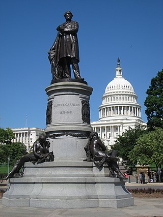
The James A. Garfield Monument stands on the grounds of the United States Capitol in Garfield Circle, a traffic circle at First Street and Maryland Avenue SW in Washington, D.C. It is a memorial to U.S. President James A. Garfield, who was elected in 1880 and assassinated in 1881 after serving only four months of his term. The perpetrator was an attorney and disgruntled office-seeker named Charles J. Guiteau. Garfield lived for several weeks after the shooting, but eventually succumbed to his injuries. The monument is part of a three-part sculptural group near the Capitol Reflecting Pool, including the Peace Monument and the Ulysses S. Grant Memorial in Union Square. The monument is also a contributing property to the National Mall and L'Enfant Plan, both of which are listed on the National Register of Historic Places and the District of Columbia Inventory of Historic Sites. The bronze statue rests on a granite pedestal that features three sculptures, each one representing a time period in Garfield's life.
Sight 7: Ulysses S. Grant Statue
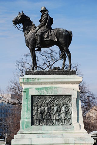
The Ulysses S. Grant Memorial is a presidential memorial in Washington, D.C., honoring American Civil War general and 18th president of the United States, Ulysses S. Grant. It sits at the base of Capitol Hill, below the west front of the United States Capitol. Its central sculpture of Grant on horseback faces west, overlooking the Capitol Reflecting Pool and facing toward the Lincoln Memorial, which honors Grant's wartime president, Abraham Lincoln. Grant's statue is raised on a pedestal decorated with bronze reliefs of the infantry; flanking pedestals hold statues of protective lions and bronze representations of the Union cavalry and artillery. The whole is connected with marble covered platforms, balustrades, and stairs. The Grant and Lincoln memorials define the eastern and western ends, respectively, of the National Mall.
Sight 8: Peace Monument
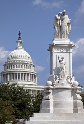
The Peace Monument, also known as the Navy Monument, Naval Monument or Navy-Peace Monument, stands on the western edge of the United States Capitol Complex in Washington, D.C. It is in the middle of Peace Circle, where First Street and Pennsylvania Avenue NW intersect. The surrounding area is Union Square, which the monument shares with the Ulysses S. Grant Memorial, James A. Garfield Monument, and the Capitol Reflecting Pool. The front of the monument faces west towards the National Mall while the east side faces the United States Capitol.
Sight 9: Robert A. Taft Memorial
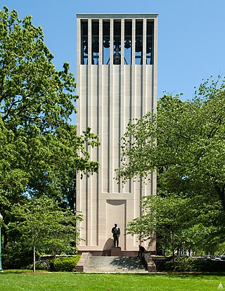
The Robert A. Taft Memorial and Carillon is a carillon in Washington, D.C. dedicated as a memorial to U.S. Senator Robert Alphonso Taft, son of President William Howard Taft.
Sight 10: Acacia Griffins
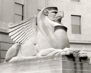
Acacia Griffins are public artworks by American sculptor Edmond Amateis, located at the Acacia Building at 51 Louisiana Avenue N.W., in Washington, D.C., United States.
Sight 11: Japanese American Memorial
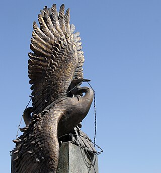
The Japanese American Memorial to Patriotism During World War II is a National Park Service site to commemorate the contributions of American citizens of Japanese ancestry and their parents who patriotically supported the United States despite unjust treatment during World War II.
Wikipedia: Japanese American Memorial to Patriotism During World War II (EN)
Sight 12: Washington Union Station
Washington Union Station, known locally as Union Station, is a major train station, transportation hub, and leisure destination in Washington, D.C. Designed by Daniel Burnham and opened in 1907, it is Amtrak's headquarters, the railroad's second-busiest station, and North America's 10th-busiest railroad station. The station is the southern terminus of the Northeast Corridor, an electrified rail line extending north through major cities including Baltimore, Philadelphia, New York City, and Boston, and the busiest passenger rail line in the nation. In 2015, it served just under five million passengers.
Sight 13: American Legion Freedom Bell
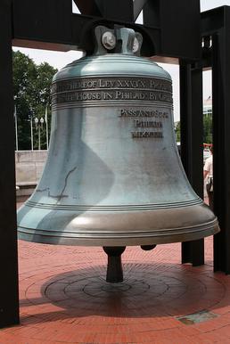
Freedom Bell, American Legion, is a public artwork located at Union Station in Washington, D.C., United States. A replica of the Liberty Bell, Freedom Bell, American Legion was surveyed as part of the Smithsonian's American Art Museum's Inventories of American Painting and Sculpture database in 1985.
Sight 14: Union Station Plaza
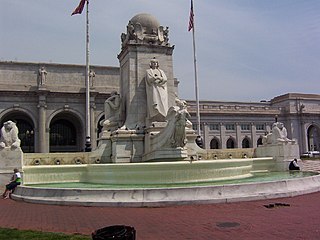
Columbus Circle, also known as Union Station Plaza or Columbus Plaza, is a traffic circle at the intersection of Delaware, Louisiana and Massachusetts Avenues and E and First Streets, Northeast in Washington, D.C. It is located in front of Union Station right next to the grounds of the United States Capitol. Union Station and its access roads interrupt this circle on one side, forming an arc.
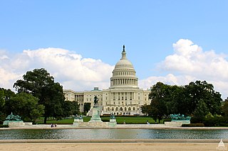
Sight 15: United States Capitol
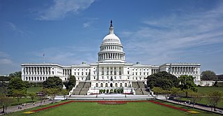
The United States Capitol, often called the Capitol or the Capitol Building, is the seat of the United States Congress, the legislative branch of the federal government. It is located on Capitol Hill at the eastern end of the National Mall in Washington, D.C. Although no longer at the geographic center of the national capital, the U.S. Capitol forms the origin point for the street-numbering system of the district as well as its four quadrants. Like the principal buildings of the executive and judicial branches, the Capitol is built in a neoclassical style and has a white exterior.
Sight 16: Statue of Freedom
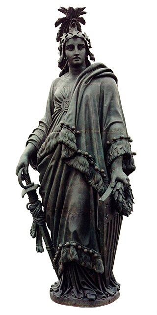
The Statue of Freedom, also known as Armed Freedom or simply Freedom, is a bronze statue designed by Thomas Crawford that, since 1863, has crowned the United States Capitol dome. Originally named Freedom Triumphant in War and Peace, a U.S. government publication now states that the statue "is officially known as the Statue of Freedom." The statue depicts a female figure bearing a military helmet and holding a sheathed sword in her right hand and a laurel wreath and shield in her left.
Sight 17: Emancipation Hall
The United States Capitol Visitor Center (CVC) is a large underground addition to the United States Capitol complex which serves as a gathering point for up to 4,000 tourists and an expansion space for the U.S. Congress. It is located below the landscaped tree-shaded grounds of the East Front of the Capitol and its plaza, topped by a thick plastic / glass skylight on the surface, between the Capitol building and 1st Street East, towards the east. The complex contains 580,000 square feet (54,000 m2) of space below ground on three levels. The overall project's budget was $621 million dollars.
Sight 18: Capitol Hill
Capitol Hill is a neighborhood in Washington, D.C., located in both Northeast D.C. and Southeast D.C.. Bounded by 14th Street SE & NE, F Street NE, Southeast Boulevard SE, South Capitol Street SE. Dominated by the United States Capitol, which sits on the highest point of Capitol Hill, it is one of the oldest historic districts in Washington. Home to around 35,000 people in just under 2 square miles (5 km2), Capitol Hill is also one of the most densely populated neighborhoods. The name "Capitol Hill" is frequently used as a metonym for the U.S. Congress.
Sight 19: Seward Square
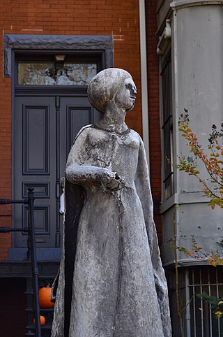
Seward Square is a square and park maintained by the National Park Service located at the intersection of Pennsylvania Avenue and North Carolina Avenue in the Capitol Hill neighborhood of Southeast Washington, D.C. The square is bounded by 4th Street to the west and 6th Street to the east. North and south of the park are the respective westbound and eastbound lanes of Seward Square, SE. Because Pennsylvania and North Carolina Avenues intersect in the middle of the square, it divides the square into four unique smaller parks. The park is named after William Henry Seward, the United States Secretary of State under Presidents Abraham Lincoln and Andrew Johnson. Seward is noted for his part in the American purchase of Alaska from the Russian Empire in 1867. The purchase was ridiculed at the time and was colloquially known as "Seward's Folly". There is no statue of William Seward on the site of the park, however there is a statue of his adopted daughter, Olive Risley Seward located at a private residence at the corner of 6th Street and North Carolina Avenue, SE. The statue was sculpted in 1971 by John Cavanaugh.
Sight 20: Olive Risley Seward Statue
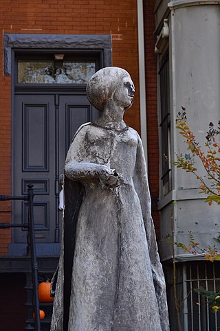
Olive Risley Seward is a lead on burlap statue by American sculptor John Cavanaugh, located at North Carolina Avenue and Sixth Street, Southeast, Washington, D.C., in the Capitol Hill neighborhood.
Sight 21: Lincoln Park
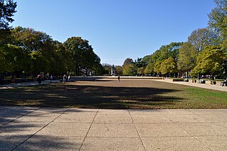
Lincoln Park is the largest urban park located in the Capitol Hill neighborhood of Washington, D.C. It was known historically as Lincoln Square. From 1862 to 1865, it was the site of the largest hospital in Washington, DC: Lincoln Hospital.
Share
Disclaimer Please be aware of your surroundings and do not enter private property. We are not liable for any damages that occur during the tours.
GPX-Download For navigation apps and GPS devices you can download the tour as a GPX file.
